Monthly deployment history
Show information about this page ↓ | View the deployment history as a simple table
Latest monthly deployment movies: May 2025
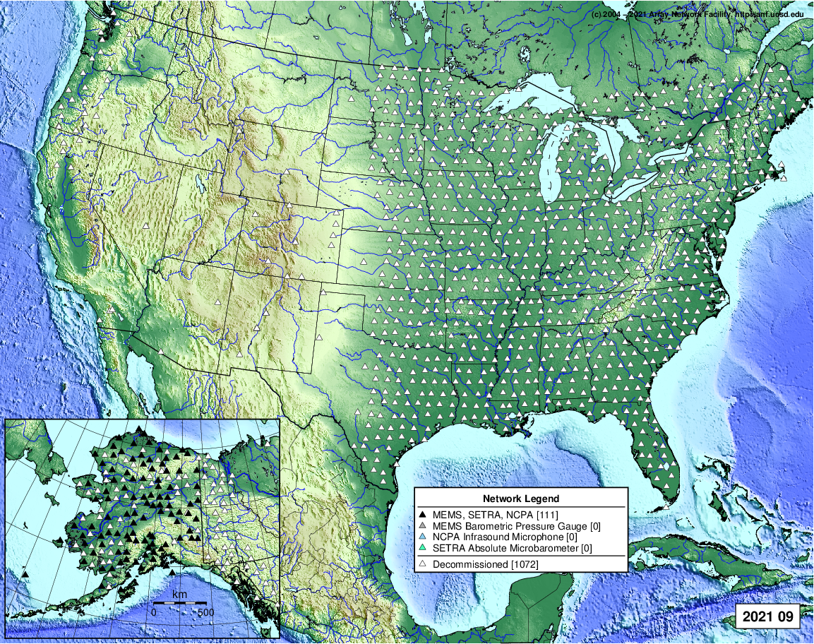
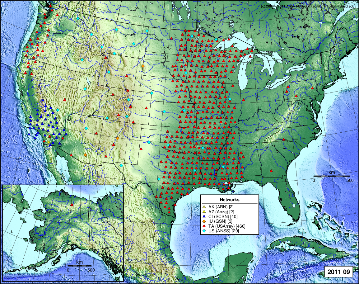
Latest monthly deployment image: September 2021 (seismic rolling)
")
Monthly archive
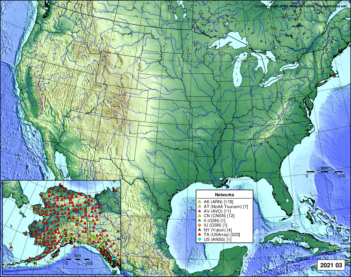
2021
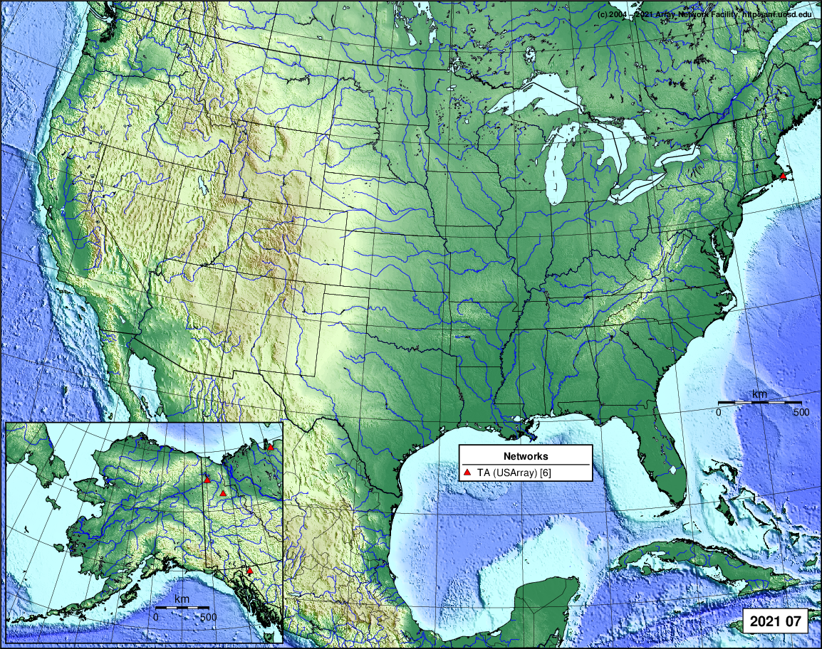
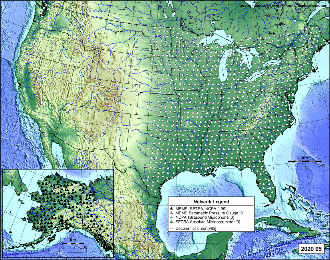
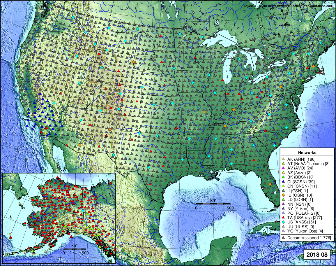
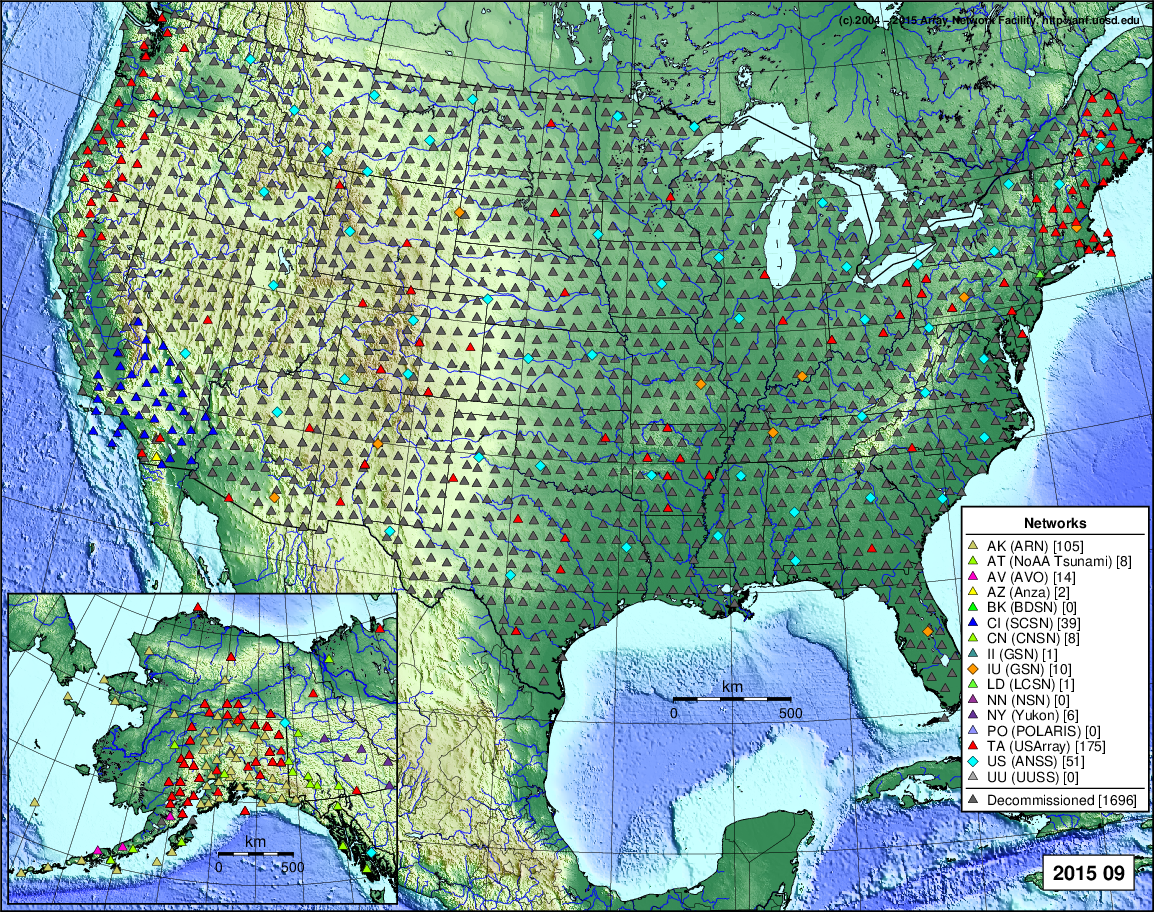
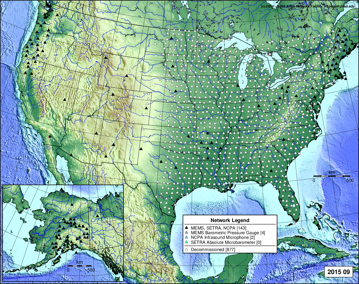
- 2021 September: Seismic [ cumulative | rolling ] Inframet [ cumulative | rolling ]
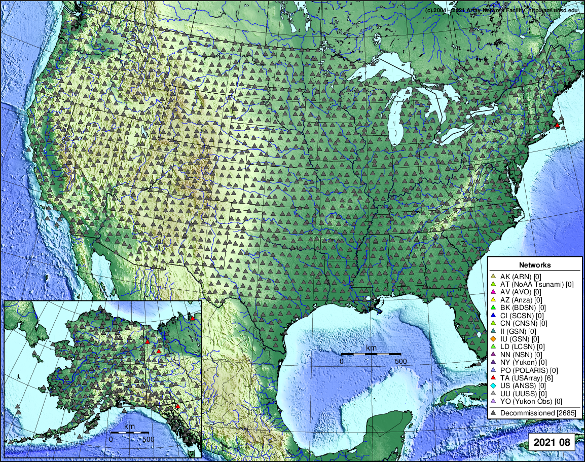
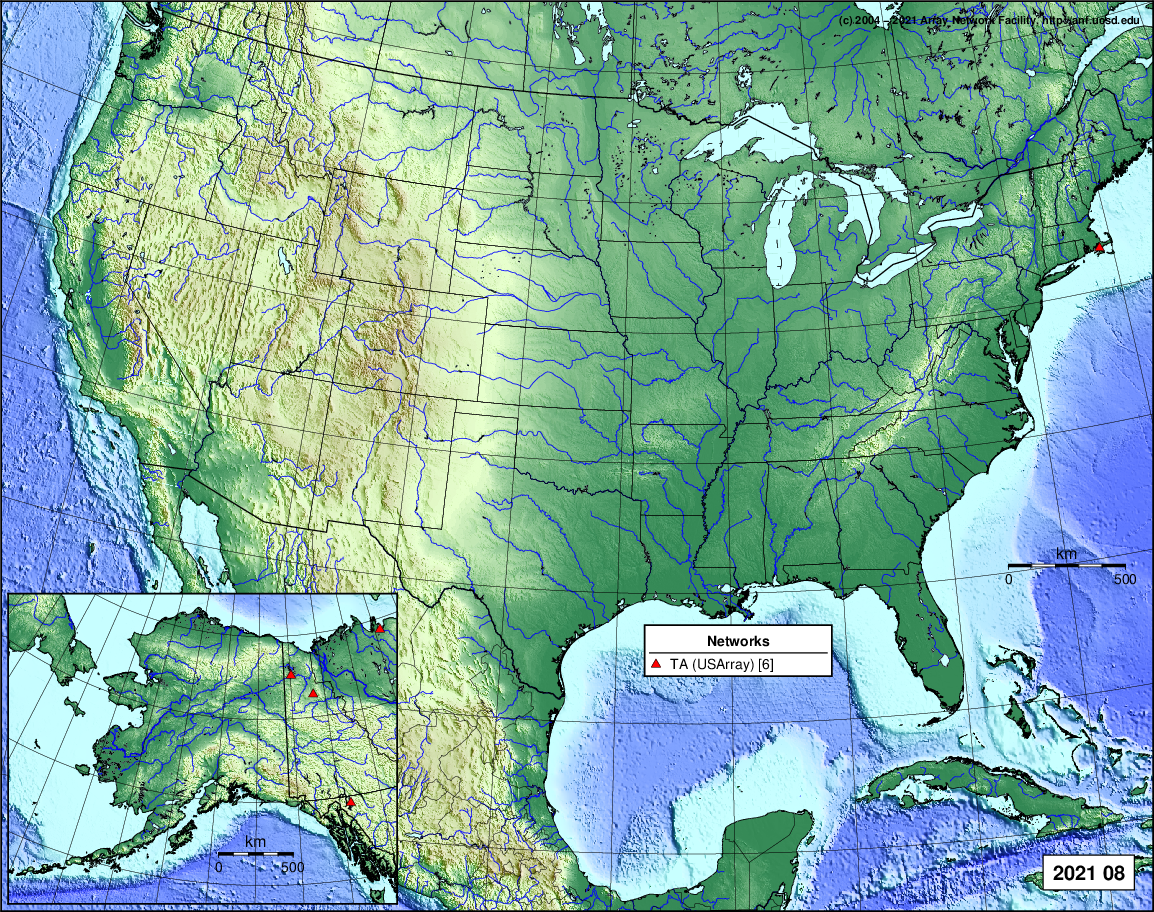
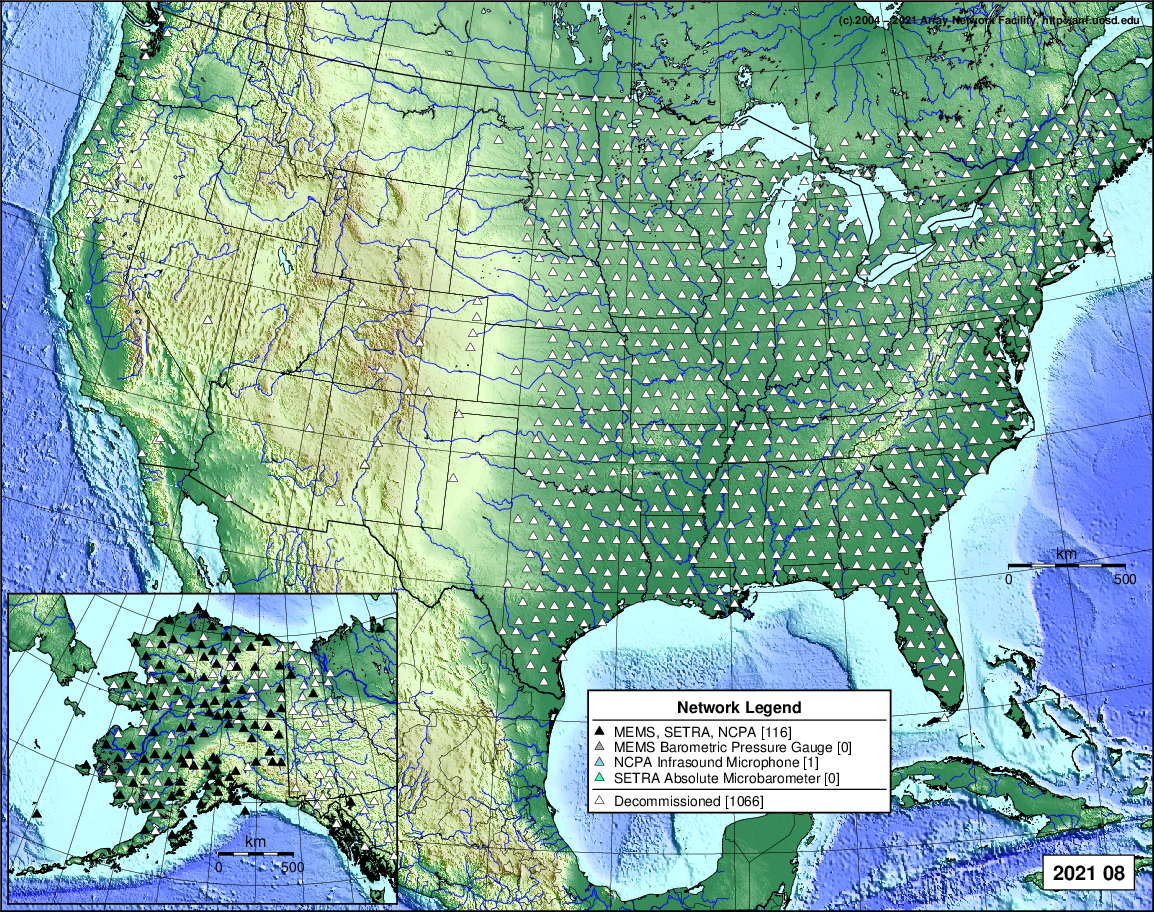
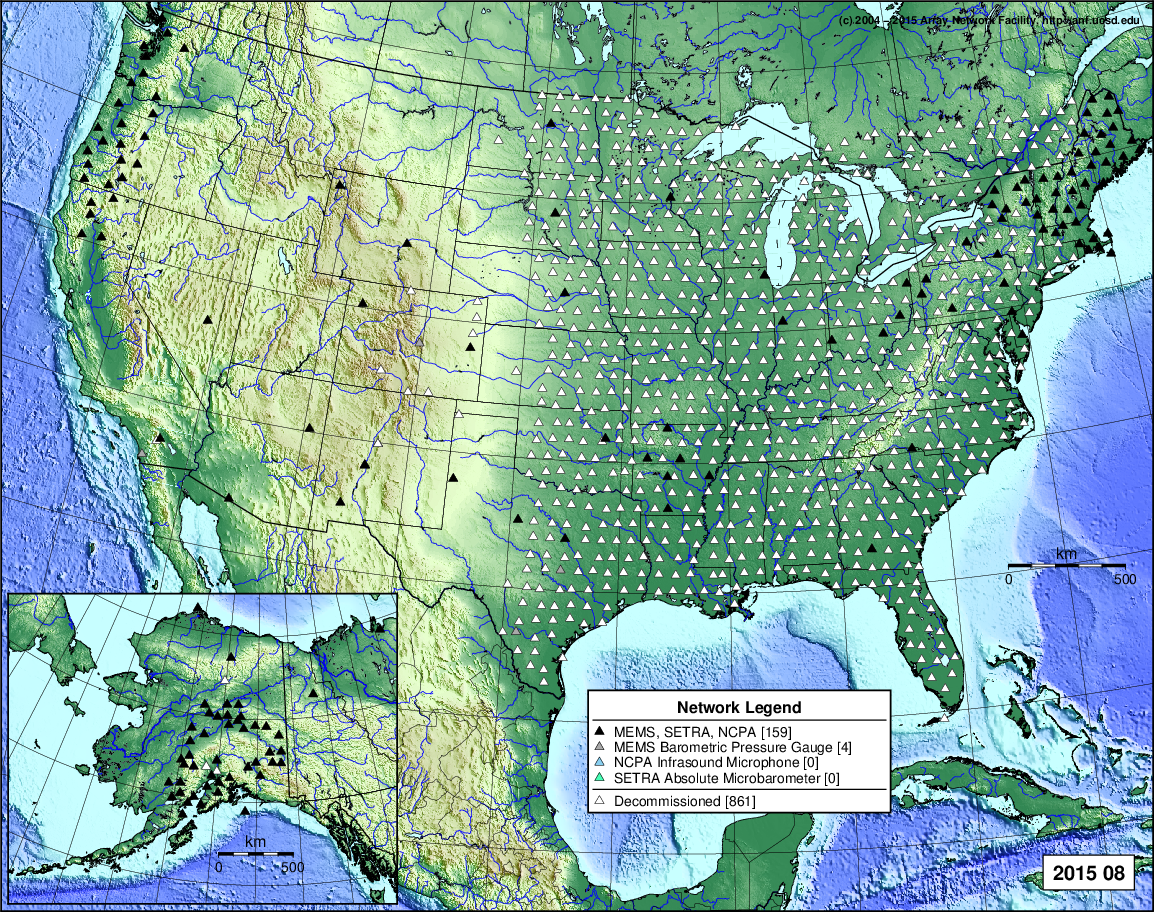
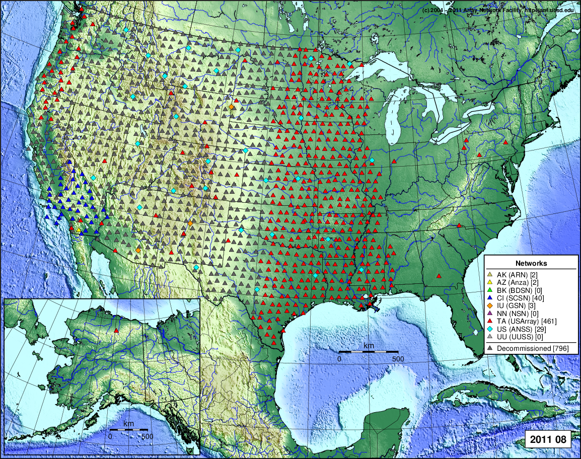
- 2021 August: Seismic [ cumulative | rolling ] Inframet [ cumulative | rolling ]
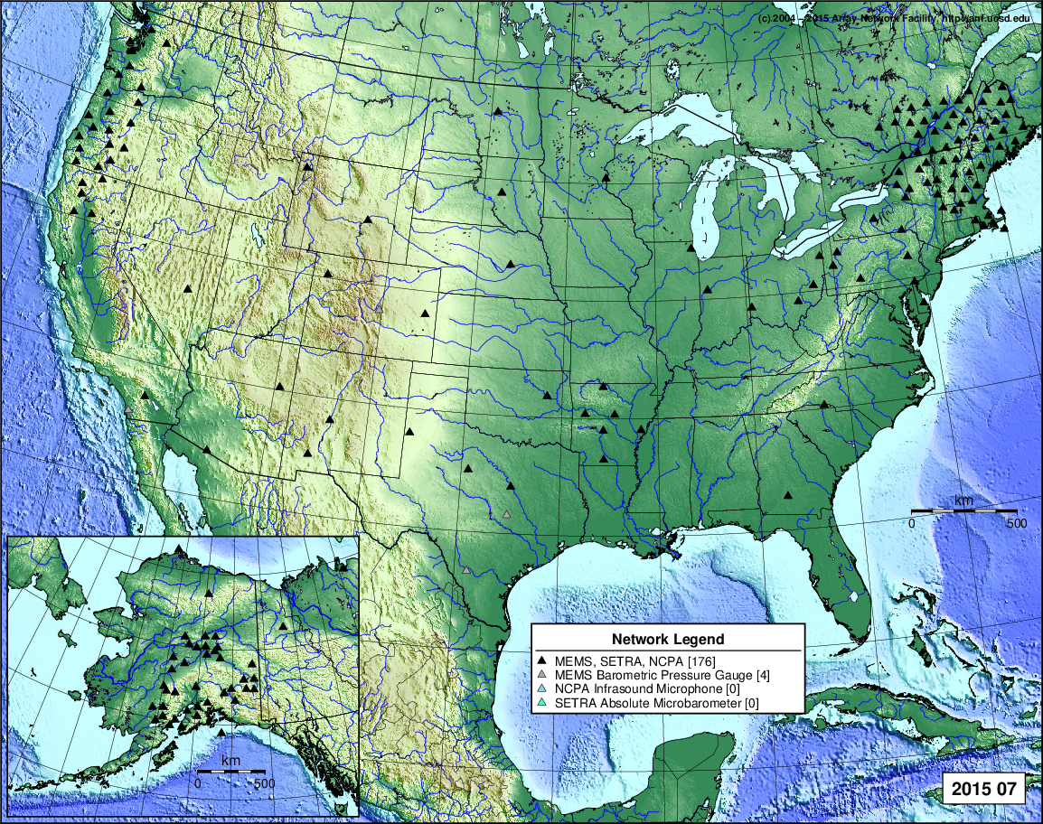
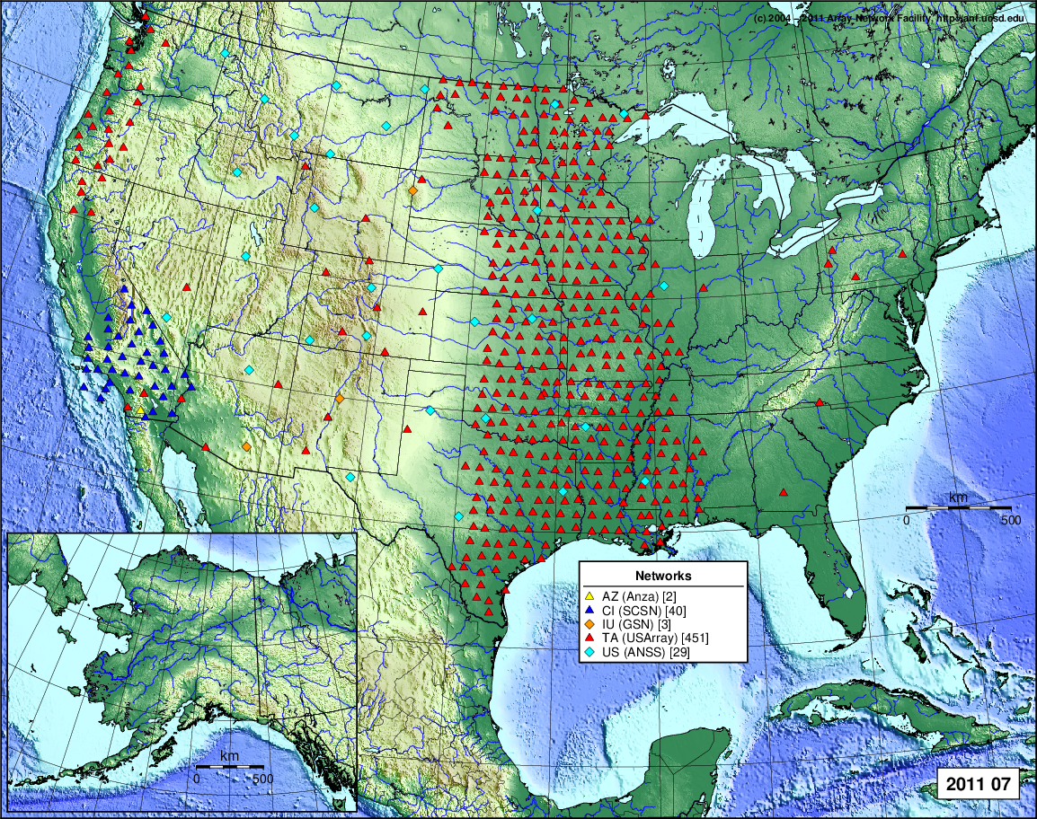
- 2021 July: Seismic [ cumulative | rolling ] Inframet [ cumulative | rolling ]
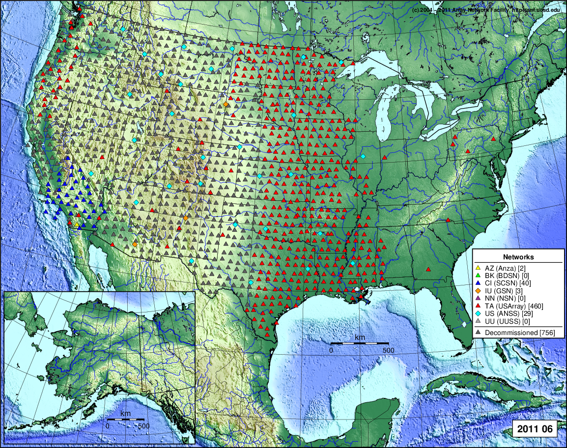
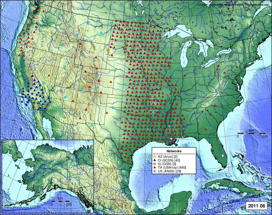
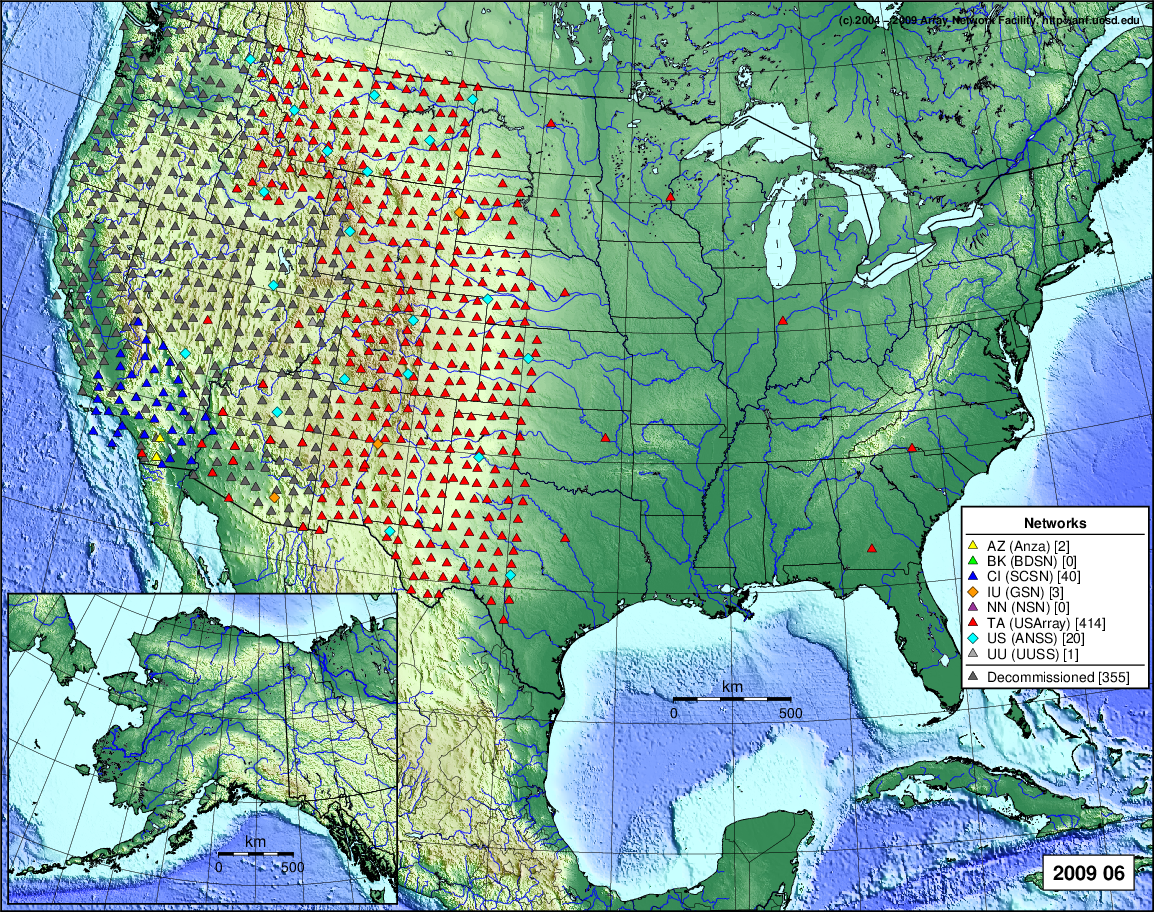
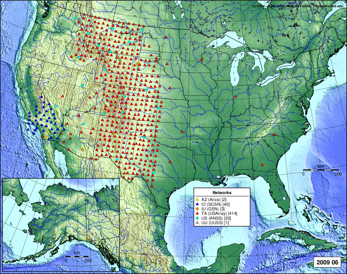
- 2021 June: Seismic [ cumulative | rolling ] Inframet [ cumulative | rolling ]
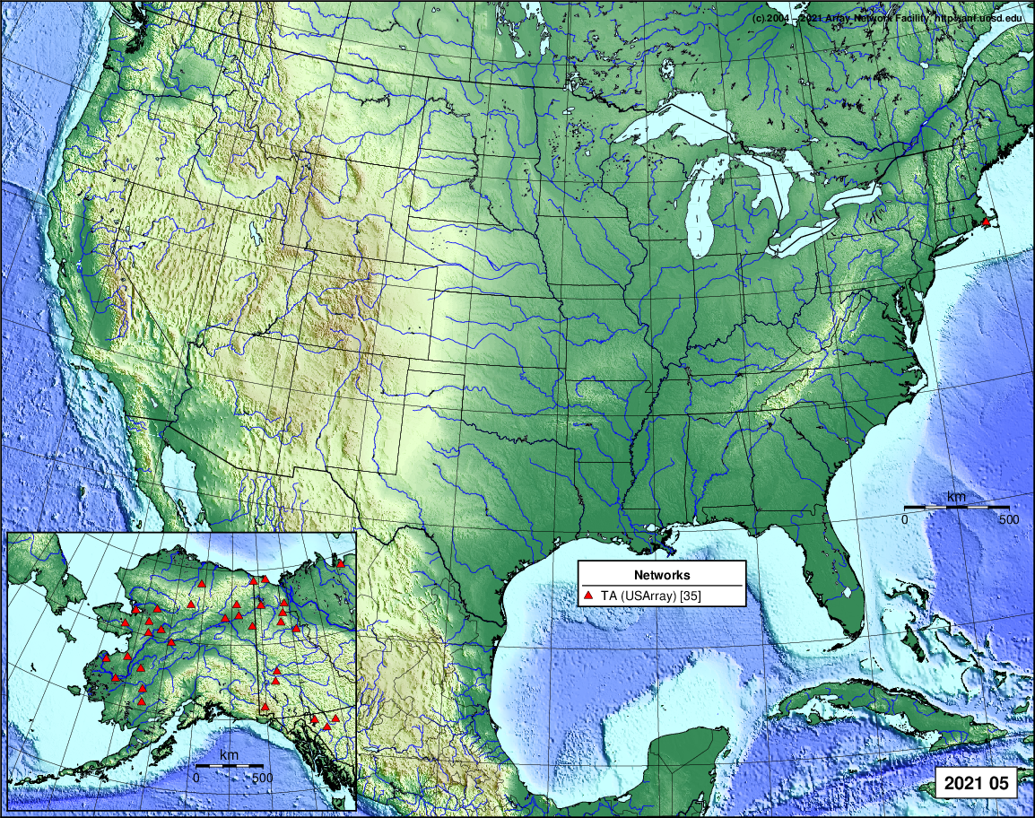
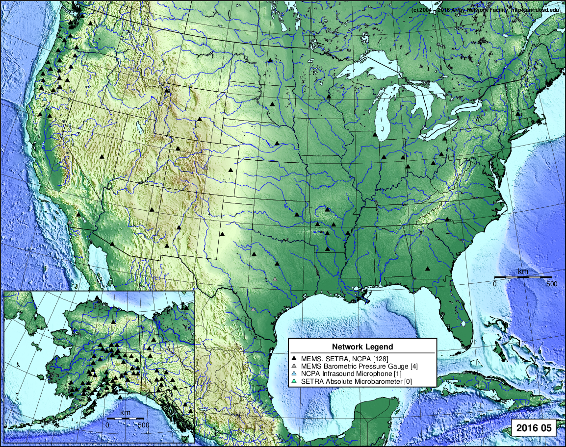
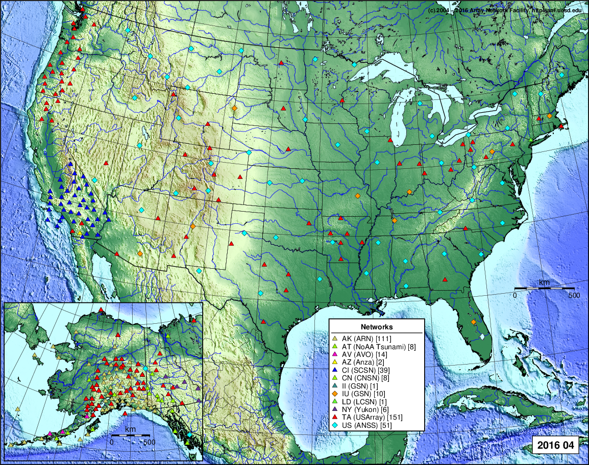
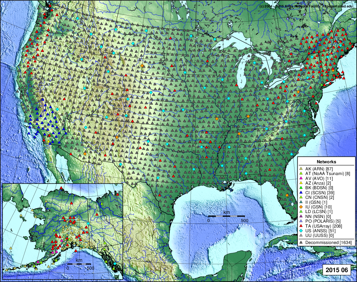
- 2021 May: Seismic [ cumulative | rolling ] Inframet [ cumulative | rolling ]
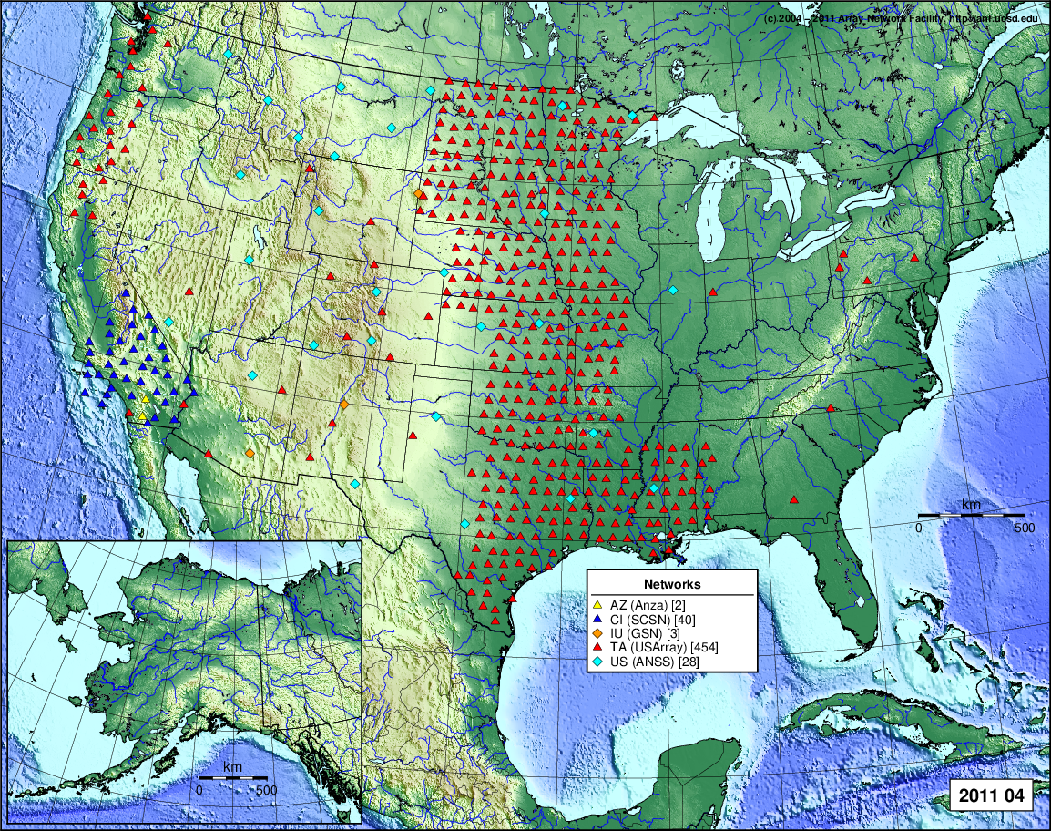
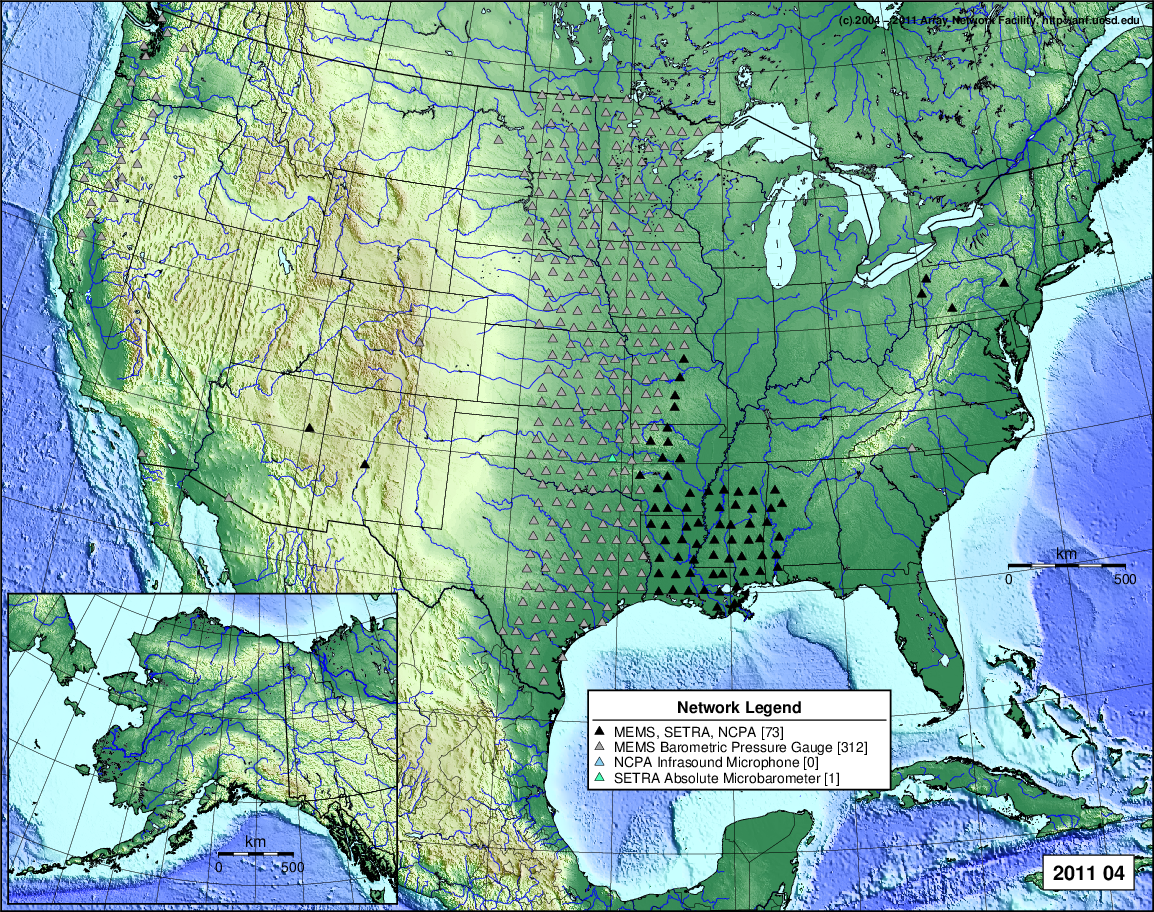
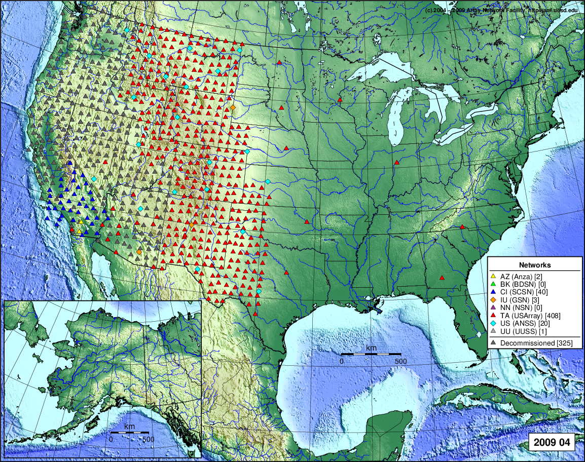
- 2021 April: Seismic [ cumulative | rolling ] Inframet [ cumulative | rolling ]
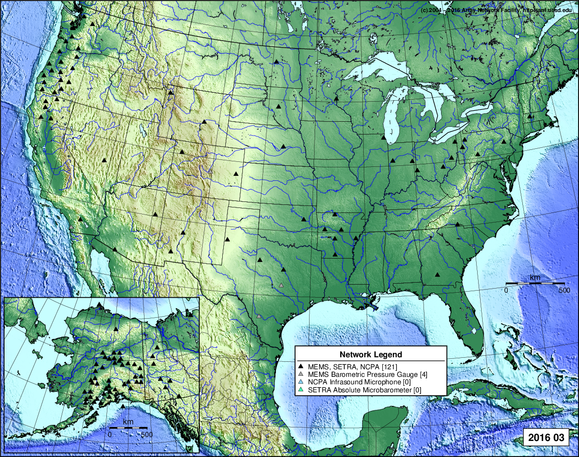
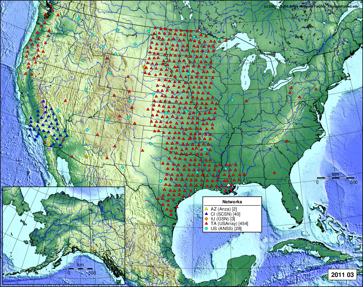
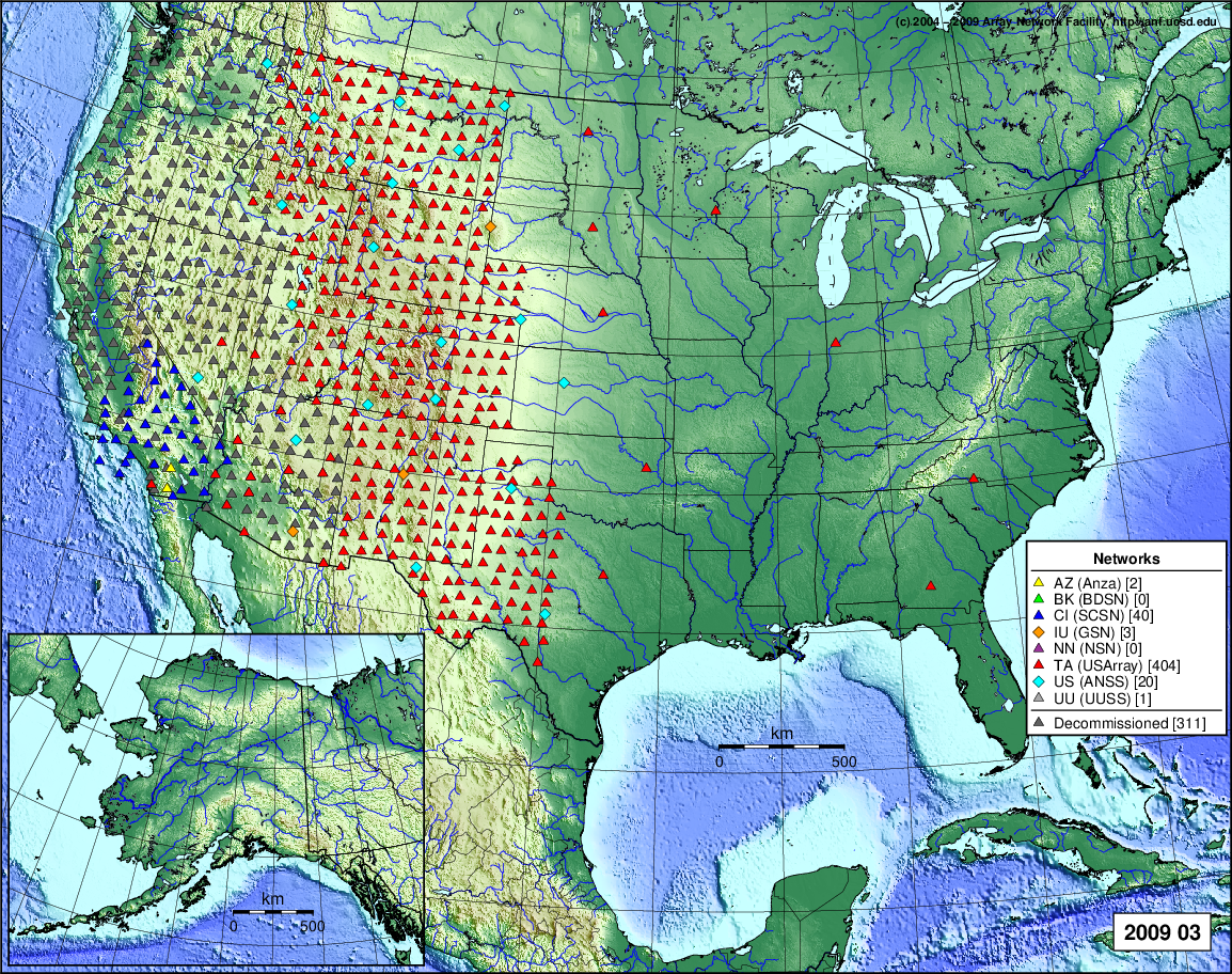
- 2021 March: Seismic [ cumulative | rolling ] Inframet [ cumulative | rolling ]
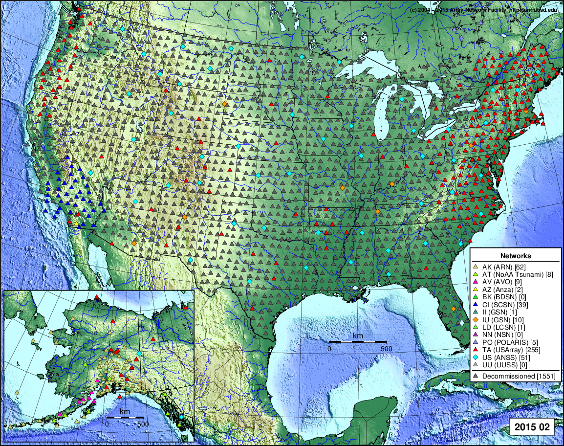
- 2021 February: Seismic [ cumulative | rolling ] Inframet [ cumulative | rolling ]
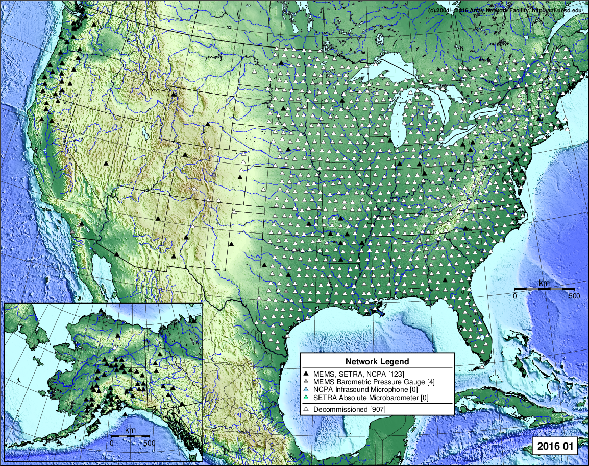
- 2021 January: Seismic [ cumulative | rolling ] Inframet [ cumulative | rolling ]
2020
- 2020 December: Seismic [ cumulative | rolling ] Inframet [ cumulative | rolling ]
- 2020 November: Seismic [ cumulative | rolling ] Inframet [ cumulative | rolling ]
- 2020 October: Seismic [ cumulative | rolling ] Inframet [ cumulative | rolling ]
- 2020 September: Seismic [ cumulative | rolling ] Inframet [ cumulative | rolling ]
- 2020 August: Seismic [ cumulative | rolling ] Inframet [ cumulative | rolling ]
- 2020 July: Seismic [ cumulative | rolling ] Inframet [ cumulative | rolling ]
- 2020 June: Seismic [ cumulative | rolling ] Inframet [ cumulative | rolling ]
- 2020 May: Seismic [ cumulative | rolling ] Inframet [ cumulative | rolling ]
- 2020 April: Seismic [ cumulative | rolling ] Inframet [ cumulative | rolling ]
- 2020 March: Seismic [ cumulative | rolling ] Inframet [ cumulative | rolling ]
- 2020 February: Seismic [ cumulative | rolling ] Inframet [ cumulative | rolling ]
- 2020 January: Seismic [ cumulative | rolling ] Inframet [ cumulative | rolling ]
2019
- 2019 December: Seismic [ cumulative | rolling ] Inframet [ cumulative | rolling ]
- 2019 November: Seismic [ cumulative | rolling ] Inframet [ cumulative | rolling ]
- 2019 October: Seismic [ cumulative | rolling ] Inframet [ cumulative | rolling ]
- 2019 September: Seismic [ cumulative | rolling ] Inframet [ cumulative | rolling ]
- 2019 August: Seismic [ cumulative | rolling ] Inframet [ cumulative | rolling ]
- 2019 July: Seismic [ cumulative | rolling ] Inframet [ cumulative | rolling ]
- 2019 June: Seismic [ cumulative | rolling ] Inframet [ cumulative | rolling ]
- 2019 May: Seismic [ cumulative | rolling ] Inframet [ cumulative | rolling ]
- 2019 April: Seismic [ cumulative | rolling ] Inframet [ cumulative | rolling ]
- 2019 March: Seismic [ cumulative | rolling ] Inframet [ cumulative | rolling ]
- 2019 February: Seismic [ cumulative | rolling ] Inframet [ cumulative | rolling ]
- 2019 January: Seismic [ cumulative | rolling ] Inframet [ cumulative | rolling ]
2018
- 2018 December: Seismic [ cumulative | rolling ] Inframet [ cumulative | rolling ]
- 2018 November: Seismic [ cumulative | rolling ] Inframet [ cumulative | rolling ]
- 2018 October: Seismic [ cumulative | rolling ] Inframet [ cumulative | rolling ]
- 2018 September: Seismic [ cumulative | rolling ] Inframet [ cumulative | rolling ]
- 2018 August: Seismic [ cumulative | rolling ] Inframet [ cumulative | rolling ]
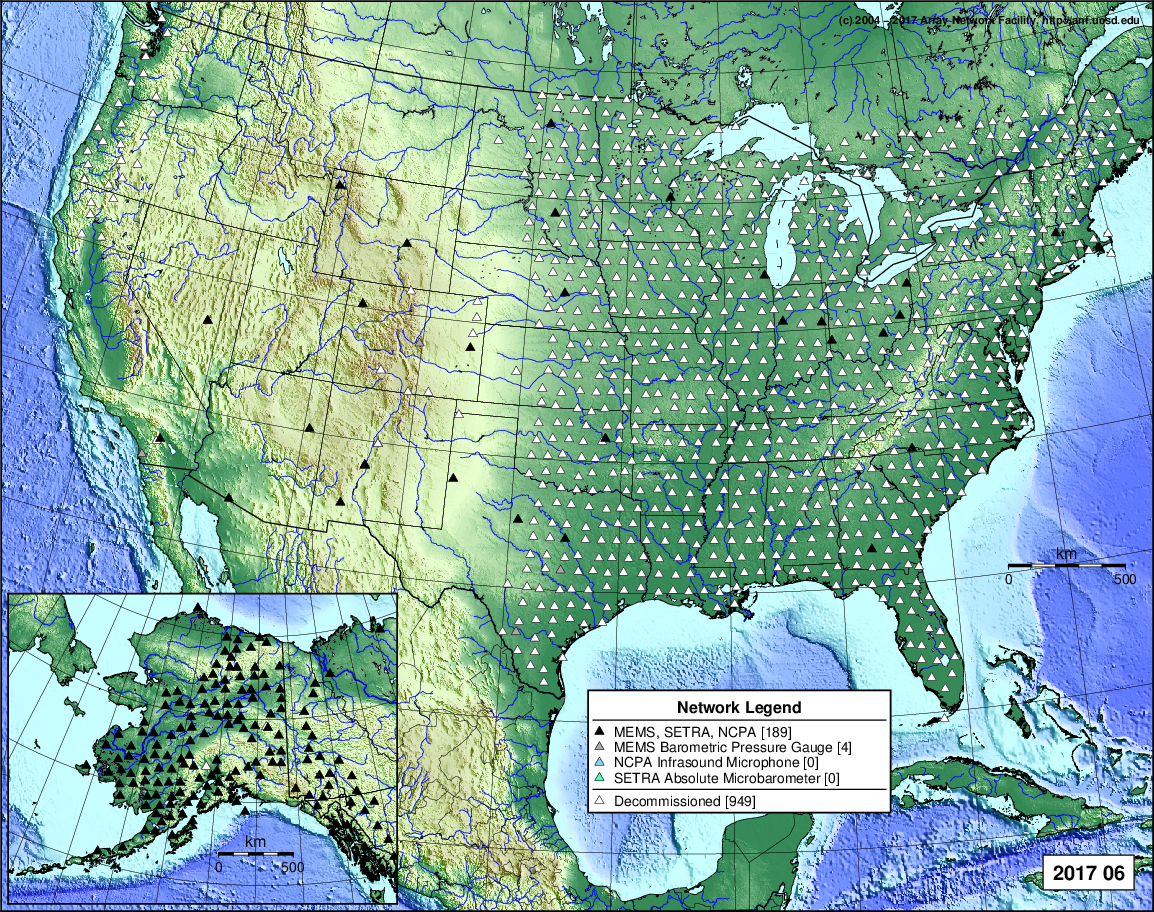
- 2018 July: Seismic [ cumulative | rolling ] Inframet [ cumulative | rolling ]
- 2018 June: Seismic [ cumulative | rolling ] Inframet [ cumulative | rolling ]
- 2018 May: Seismic [ cumulative | rolling ] Inframet [ cumulative | rolling ]
- 2018 April: Seismic [ cumulative | rolling ] Inframet [ cumulative | rolling ]
- 2018 March: Seismic [ cumulative | rolling ] Inframet [ cumulative | rolling ]
- 2018 February: Seismic [ cumulative | rolling ] Inframet [ cumulative | rolling ]
- 2018 January: Seismic [ cumulative | rolling ] Inframet [ cumulative | rolling ]
2017
- 2017 December: Seismic [ cumulative | rolling ] Inframet [ cumulative | rolling ]
- 2017 November: Seismic [ cumulative | rolling ] Inframet [ cumulative | rolling ]
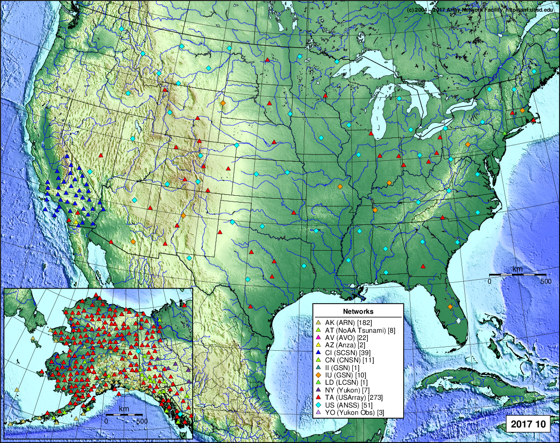
- 2017 October: Seismic [ cumulative | rolling ] Inframet [ cumulative | rolling ]
- 2017 September: Seismic [ cumulative | rolling ] Inframet [ cumulative | rolling ]
- 2017 August: Seismic [ cumulative | rolling ] Inframet [ cumulative | rolling ]
- 2017 July: Seismic [ cumulative | rolling ] Inframet [ cumulative | rolling ]
- 2017 June: Seismic [ cumulative | rolling ] Inframet [ cumulative | rolling ]
- 2017 May: Seismic [ cumulative | rolling ] Inframet [ cumulative | rolling ]
- 2017 April: Seismic [ cumulative | rolling ] Inframet [ cumulative | rolling ]
- 2017 March: Seismic [ cumulative | rolling ] Inframet [ cumulative | rolling ]
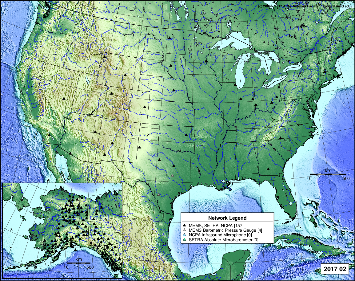
- 2017 February: Seismic [ cumulative | rolling ] Inframet [ cumulative | rolling ]
- 2017 January: Seismic [ cumulative | rolling ] Inframet [ cumulative | rolling ]
2016
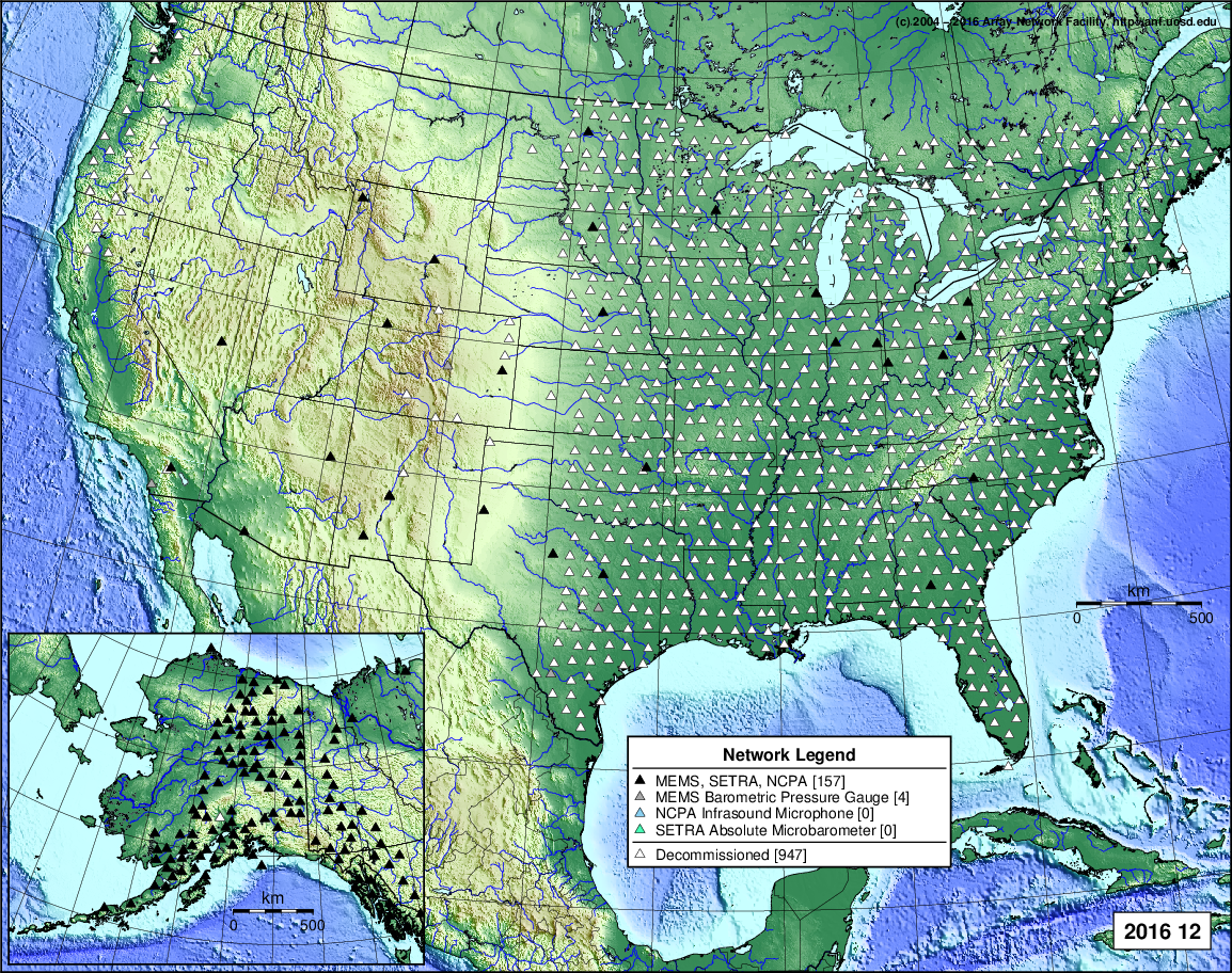
- 2016 December: Seismic [ cumulative | rolling ] Inframet [ cumulative | rolling ]
- 2016 November: Seismic [ cumulative | rolling ] Inframet [ cumulative | rolling ]
- 2016 October: Seismic [ cumulative | rolling ] Inframet [ cumulative | rolling ]
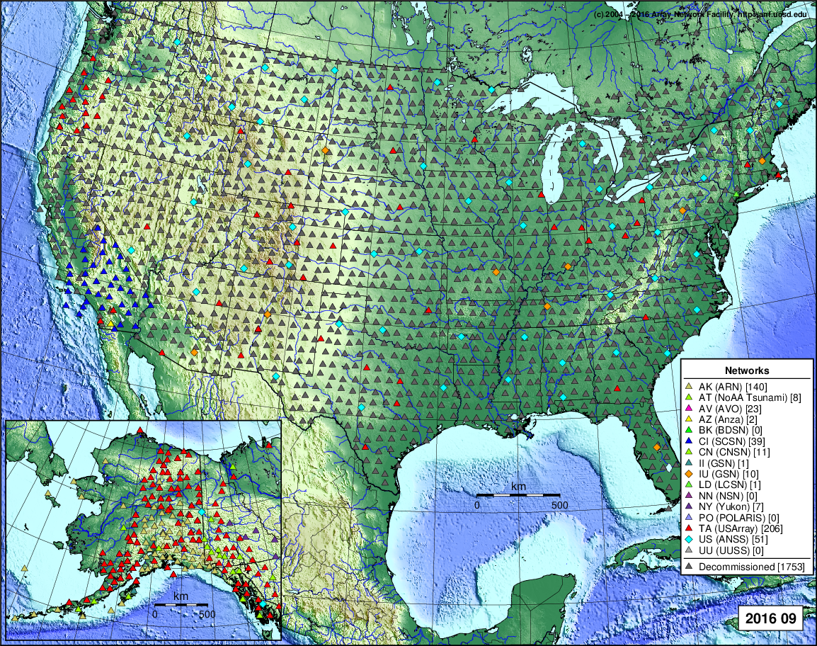
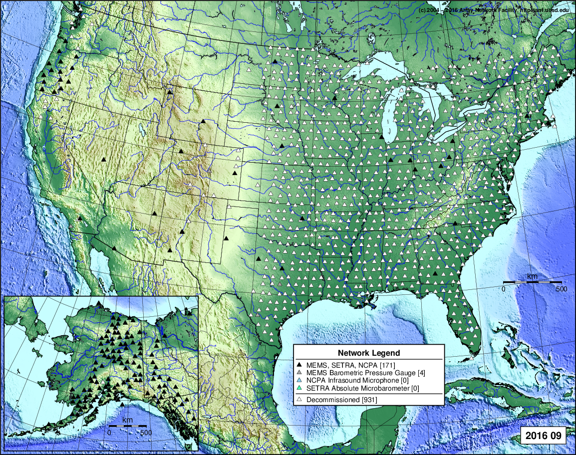
- 2016 September: Seismic [ cumulative | rolling ] Inframet [ cumulative | rolling ]
- 2016 August: Seismic [ cumulative | rolling ] Inframet [ cumulative | rolling ]
- 2016 July: Seismic [ cumulative | rolling ] Inframet [ cumulative | rolling ]
- 2016 June: Seismic [ cumulative | rolling ] Inframet [ cumulative | rolling ]
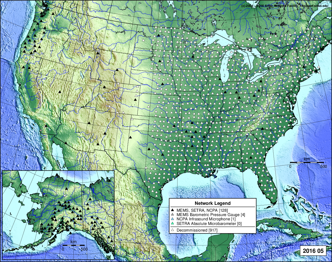
- 2016 May: Seismic [ cumulative | rolling ] Inframet [ cumulative | rolling ]
- 2016 April: Seismic [ cumulative | rolling ] Inframet [ cumulative | rolling ]
- 2016 March: Seismic [ cumulative | rolling ] Inframet [ cumulative | rolling ]
- 2016 February: Seismic [ cumulative | rolling ] Inframet [ cumulative | rolling ]
- 2016 January: Seismic [ cumulative | rolling ] Inframet [ cumulative | rolling ]
2015
- 2015 December: Seismic [ cumulative | rolling ] Inframet [ cumulative | rolling ]
- 2015 November: Seismic [ cumulative | rolling ] Inframet [ cumulative | rolling ]
- 2015 October: Seismic [ cumulative | rolling ] Inframet [ cumulative | rolling ]
- 2015 September: Seismic [ cumulative | rolling ] Inframet [ cumulative | rolling ]
- 2015 August: Seismic [ cumulative | rolling ] Inframet [ cumulative | rolling ]
- 2015 July: Seismic [ cumulative | rolling ] Inframet [ cumulative | rolling ]
- 2015 June: Seismic [ cumulative | rolling ] Inframet [ cumulative | rolling ]
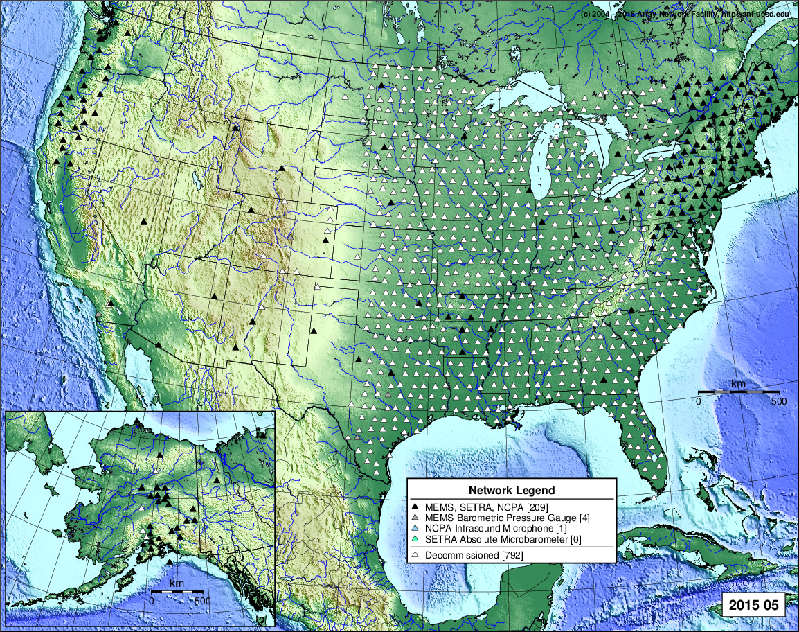
- 2015 May: Seismic [ cumulative | rolling ] Inframet [ cumulative | rolling ]
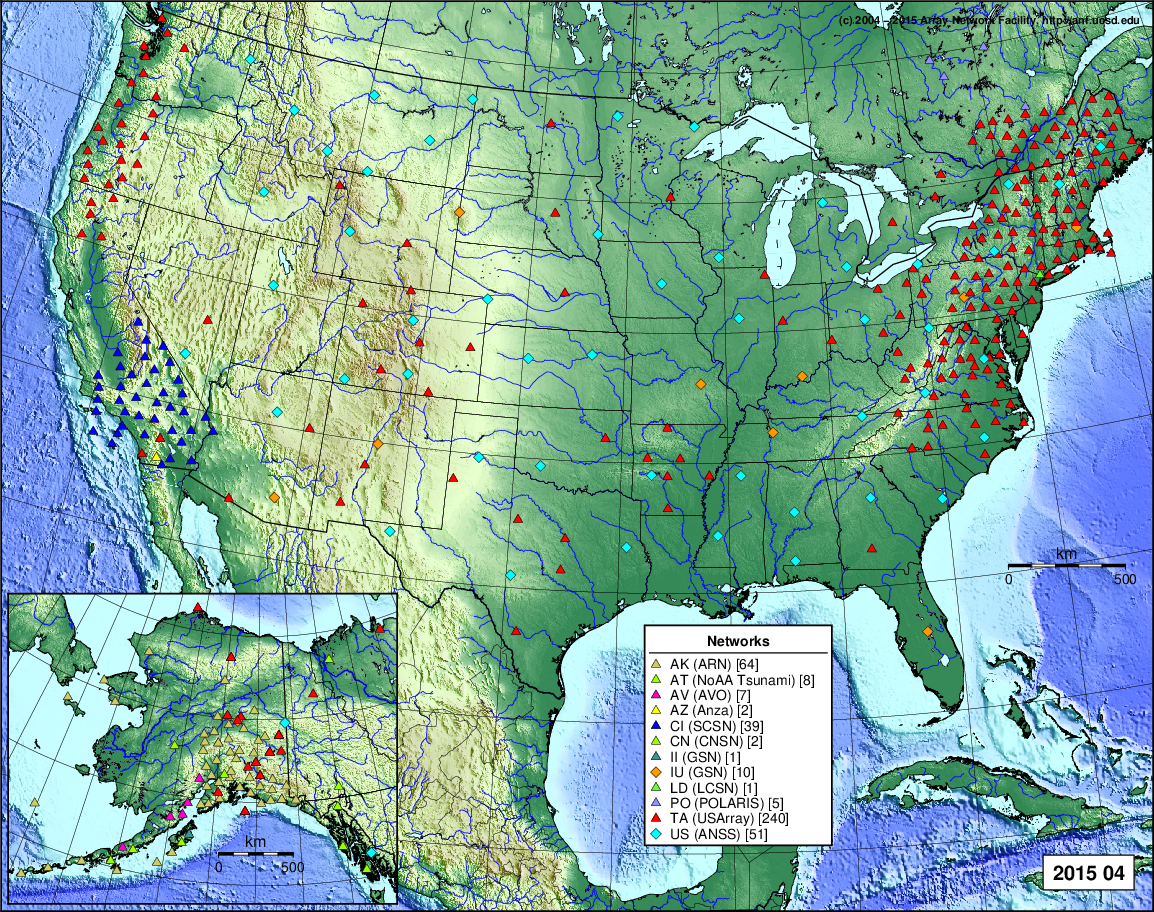
- 2015 April: Seismic [ cumulative | rolling ] Inframet [ cumulative | rolling ]
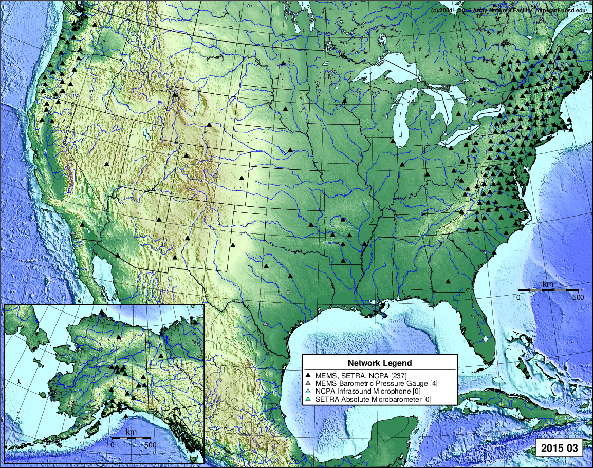
- 2015 March: Seismic [ cumulative | rolling ] Inframet [ cumulative | rolling ]
- 2015 February: Seismic [ cumulative | rolling ] Inframet [ cumulative | rolling ]
- 2015 January: Seismic [ cumulative | rolling ] Inframet [ cumulative | rolling ]
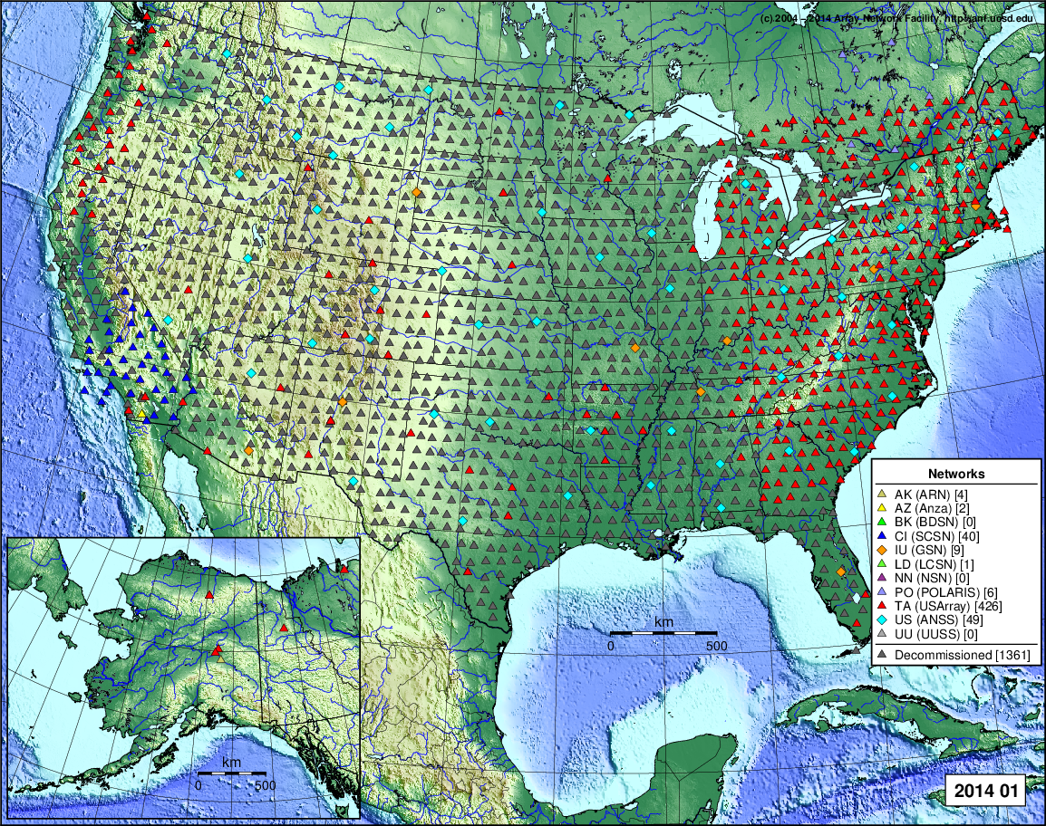
2014
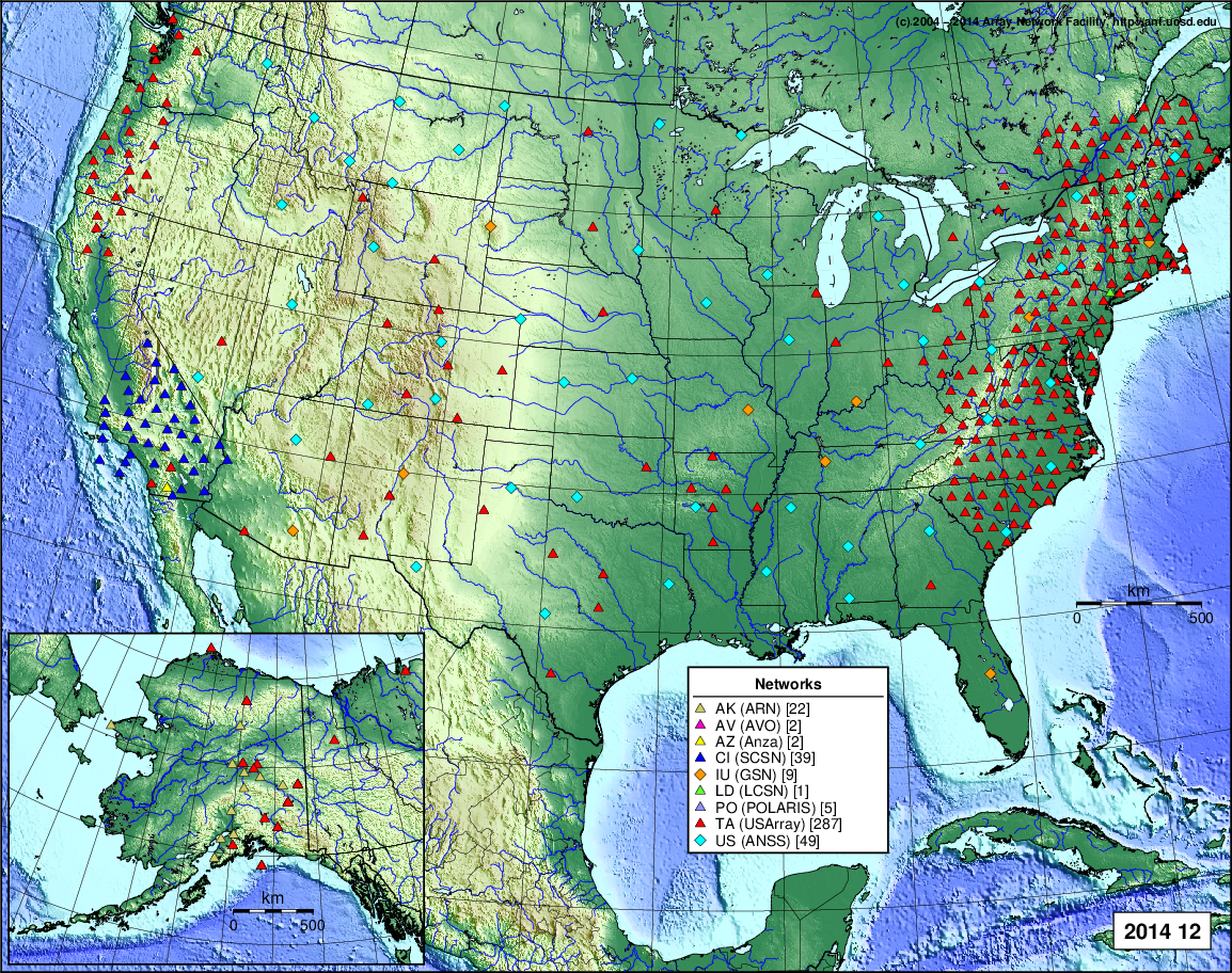
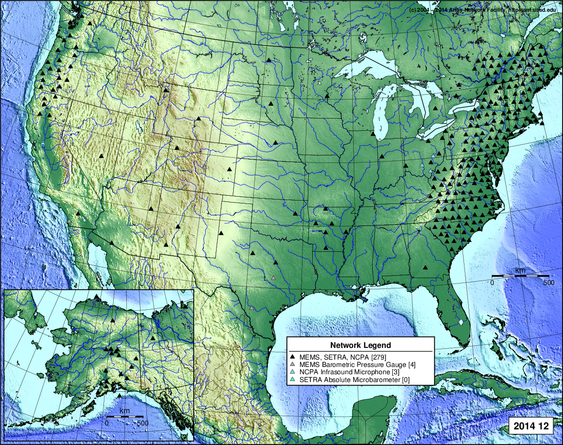
- 2014 December: Seismic [ cumulative | rolling ] Inframet [ cumulative | rolling ]
- 2014 November: Seismic [ cumulative | rolling ] Inframet [ cumulative | rolling ]
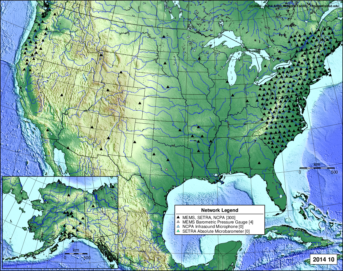
- 2014 October: Seismic [ cumulative | rolling ] Inframet [ cumulative | rolling ]
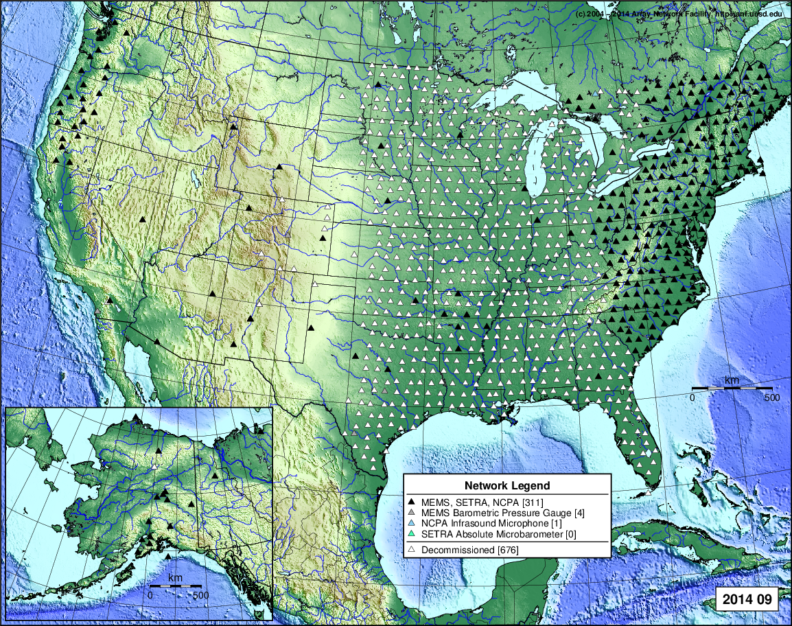
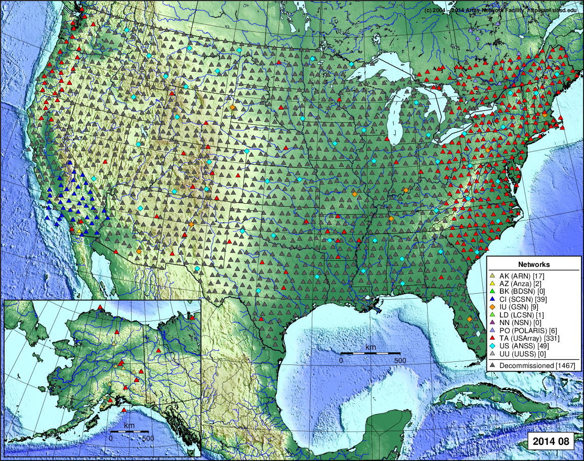
- 2014 September: Seismic [ cumulative | rolling ] Inframet [ cumulative | rolling ]
- 2014 August: Seismic [ cumulative | rolling ] Inframet [ cumulative | rolling ]
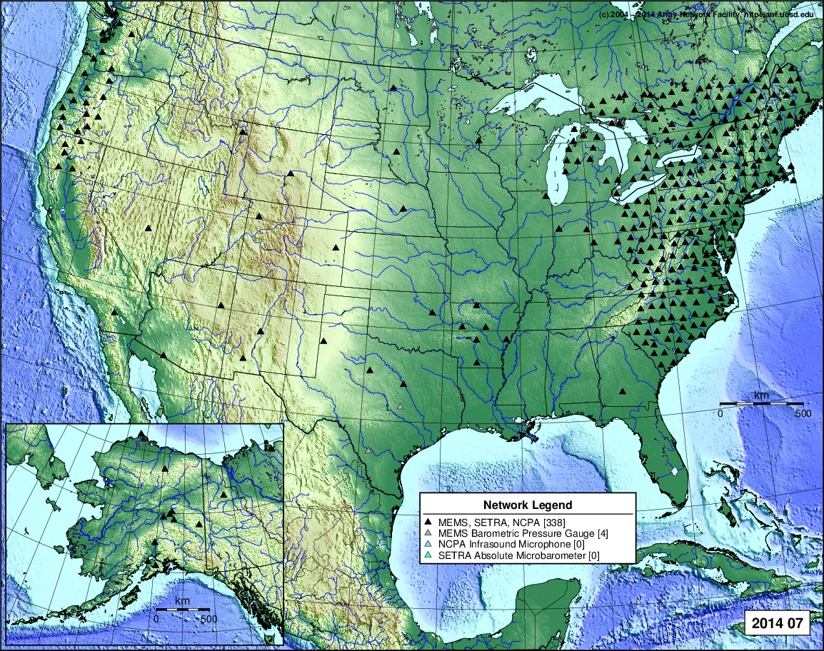
- 2014 July: Seismic [ cumulative | rolling ] Inframet [ cumulative | rolling ]
- 2014 June: Seismic [ cumulative | rolling ] Inframet [ cumulative | rolling ]
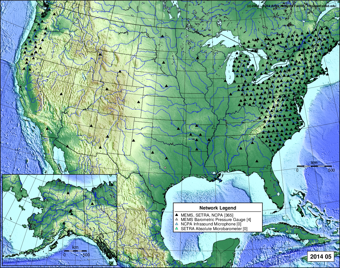
- 2014 May: Seismic [ cumulative | rolling ] Inframet [ cumulative | rolling ]
- 2014 April: Seismic [ cumulative | rolling ] Inframet [ cumulative | rolling ]
- 2014 March: Seismic [ cumulative | rolling ] Inframet [ cumulative | rolling ]
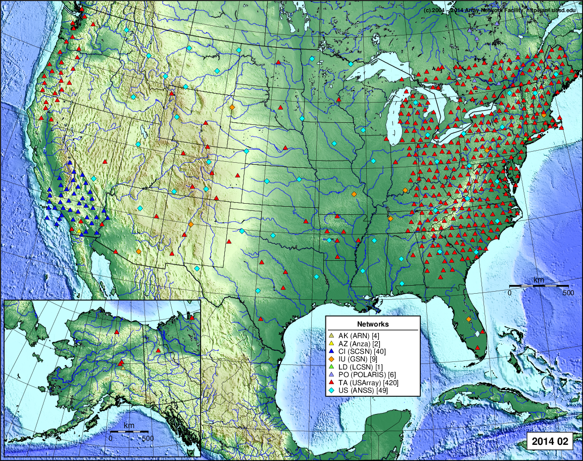
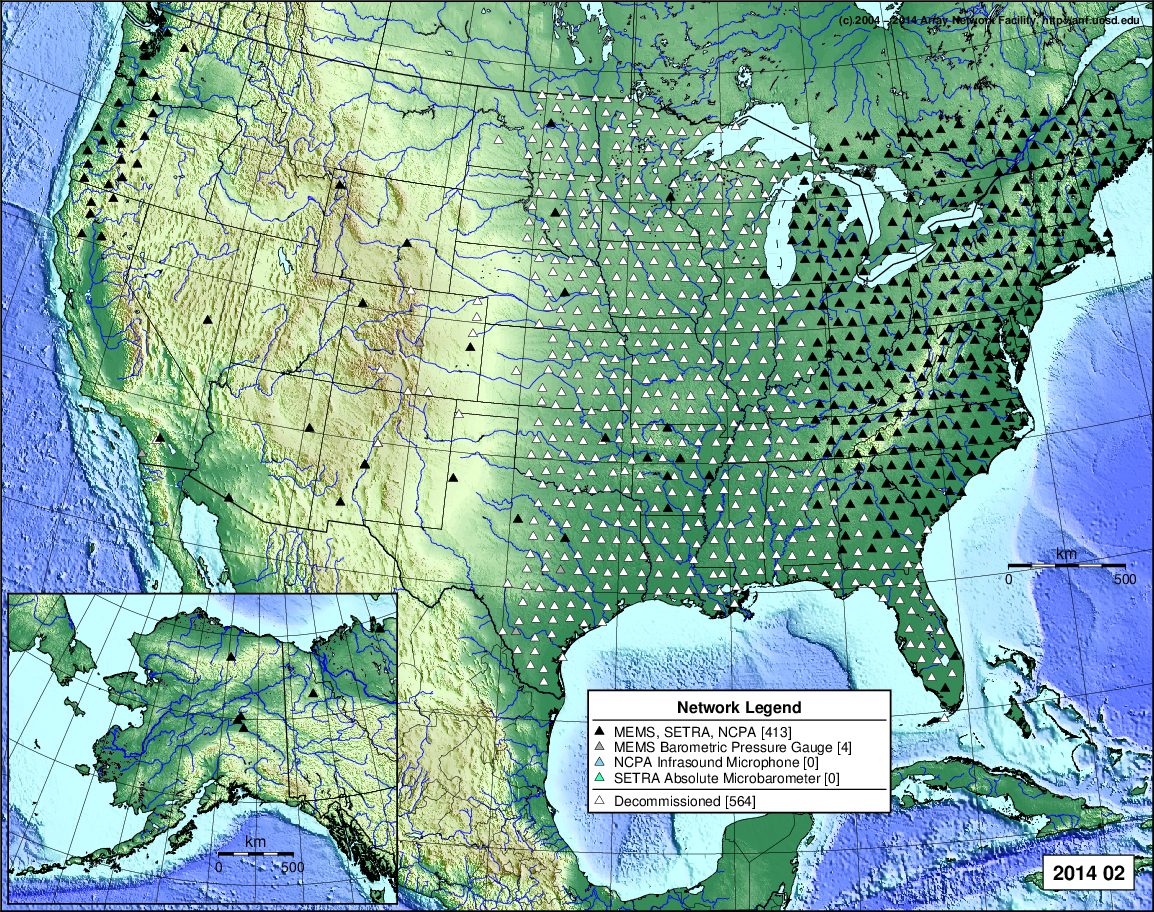
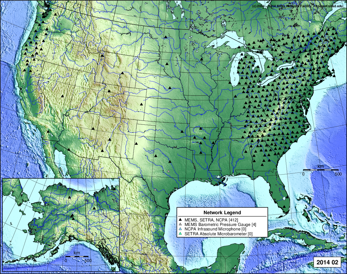
- 2014 February: Seismic [ cumulative | rolling ] Inframet [ cumulative | rolling ]
- 2014 January: Seismic [ cumulative | rolling ] Inframet [ cumulative | rolling ]
2013
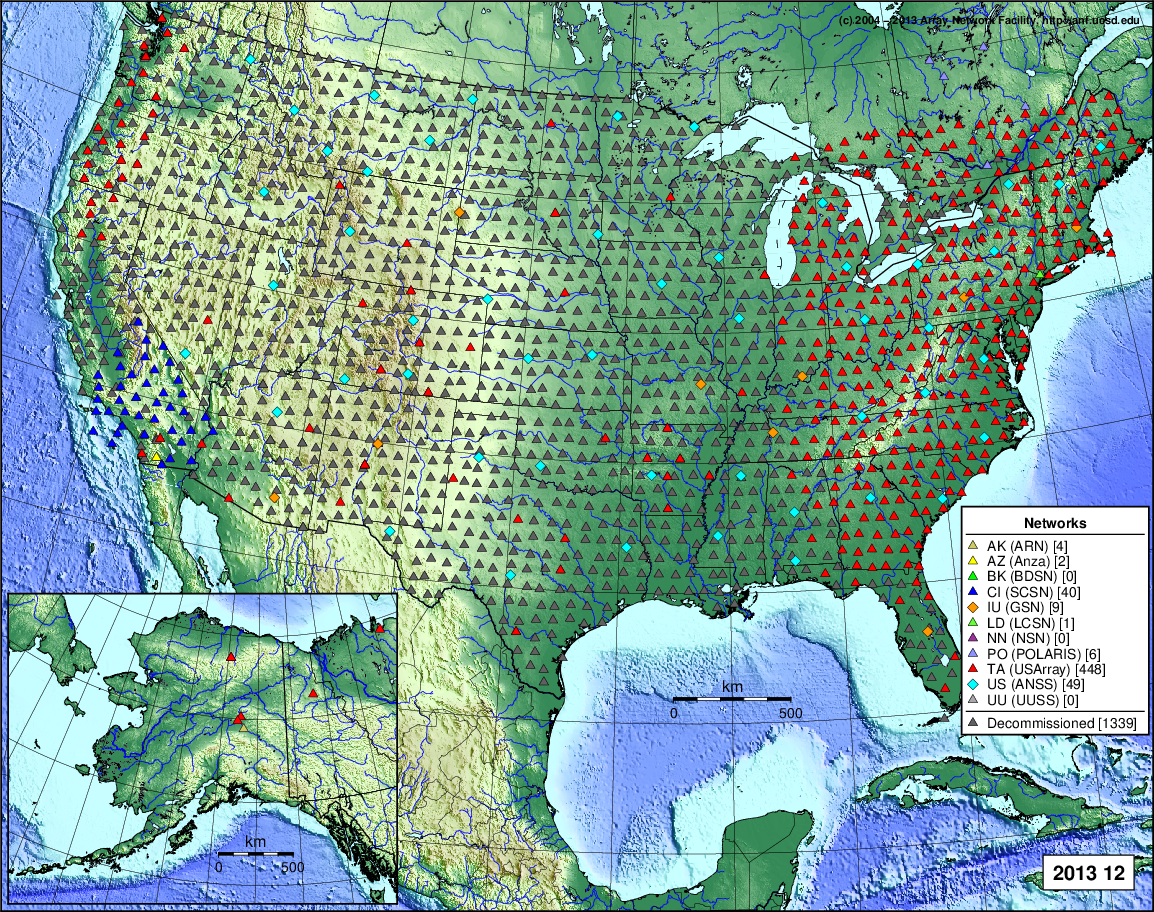
- 2013 December: Seismic [ cumulative | rolling ] Inframet [ cumulative | rolling ]
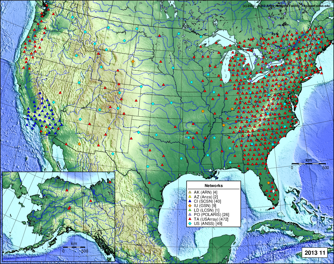
- 2013 November: Seismic [ cumulative | rolling ] Inframet [ cumulative | rolling ]
- 2013 October: Seismic [ cumulative | rolling ] Inframet [ cumulative | rolling ]
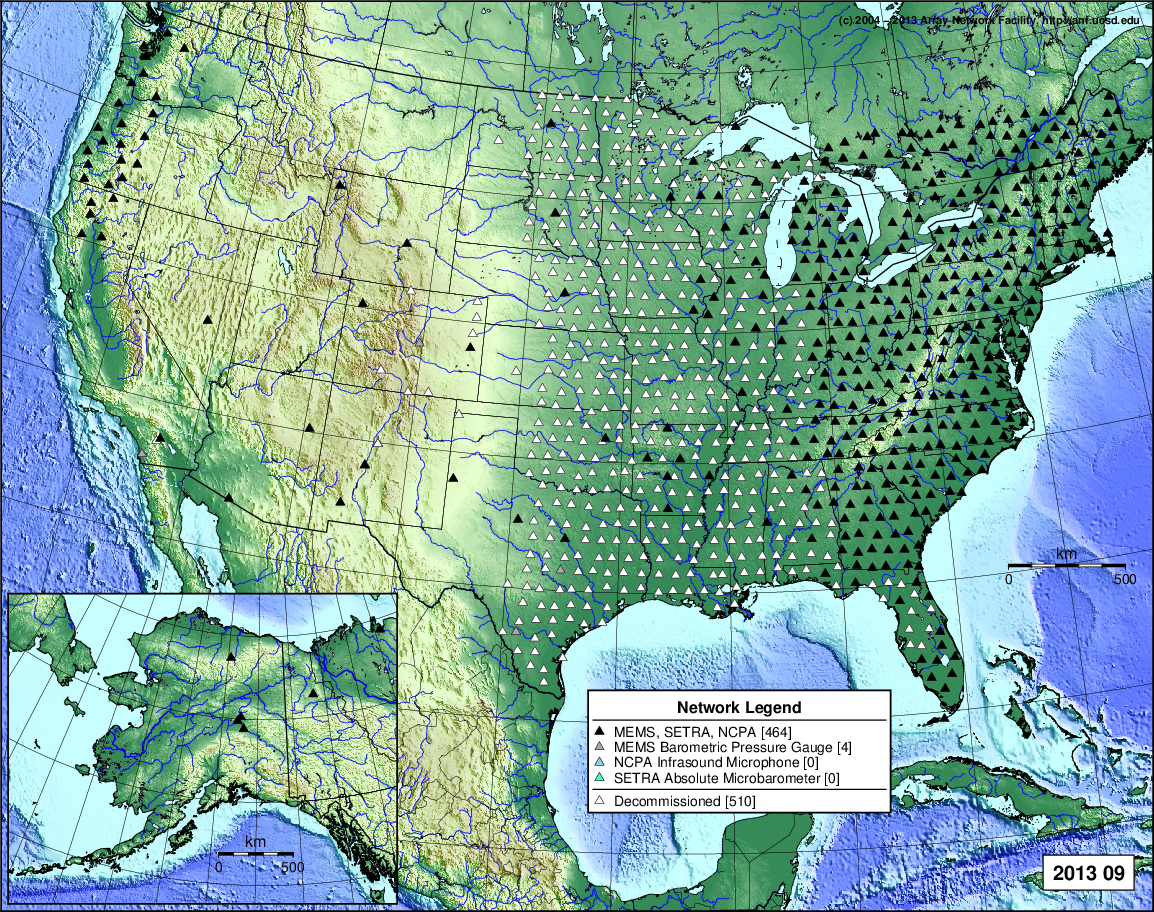
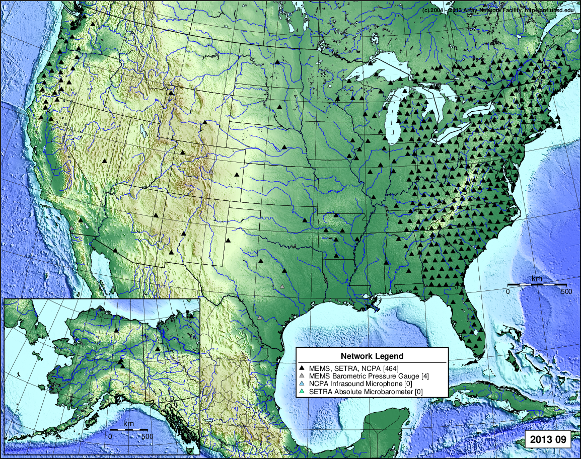
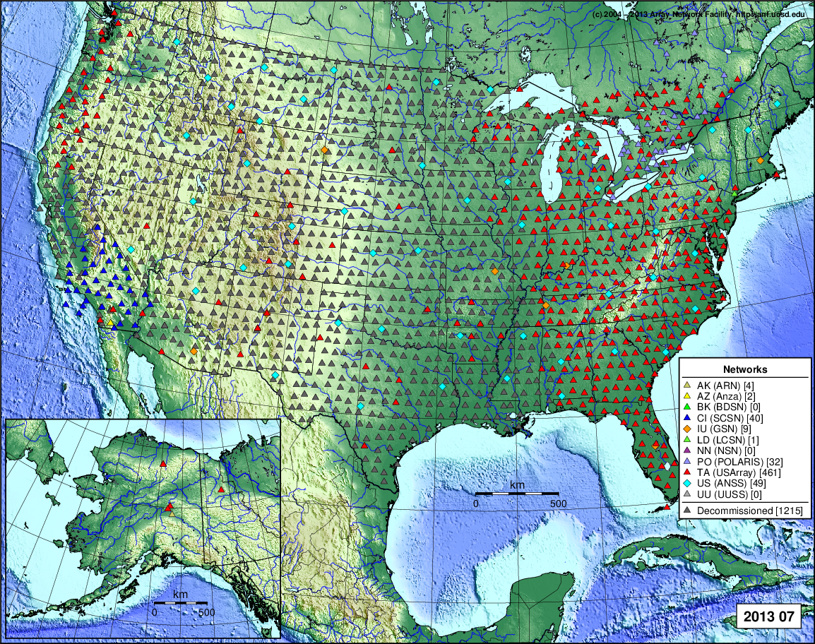
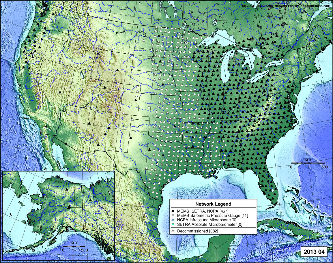
- 2013 September: Seismic [ cumulative | rolling ] Inframet [ cumulative | rolling ]
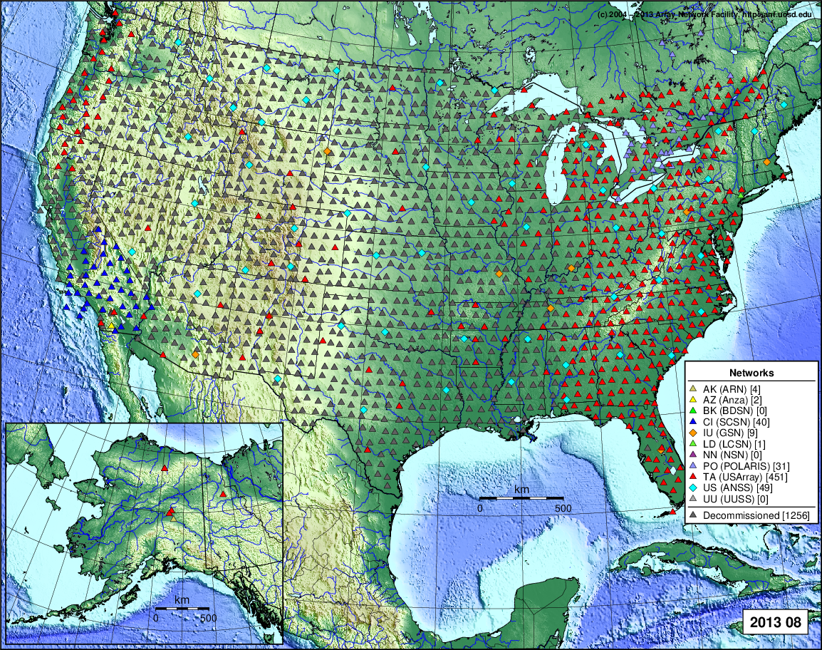
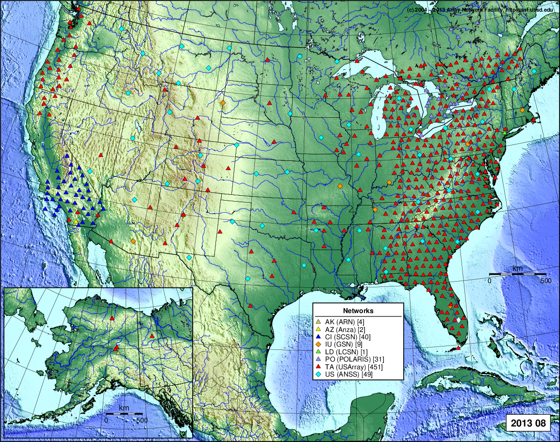
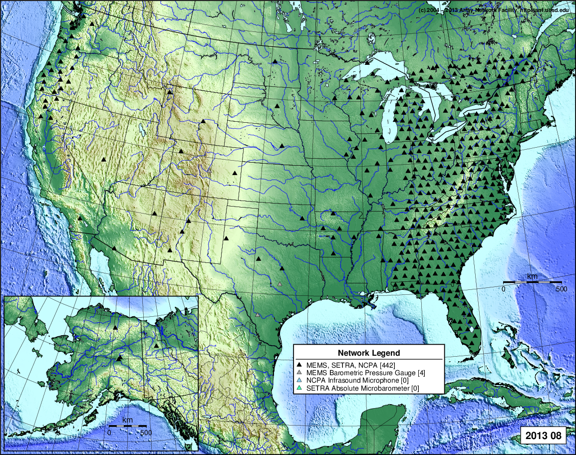
- 2013 August: Seismic [ cumulative | rolling ] Inframet [ cumulative | rolling ]
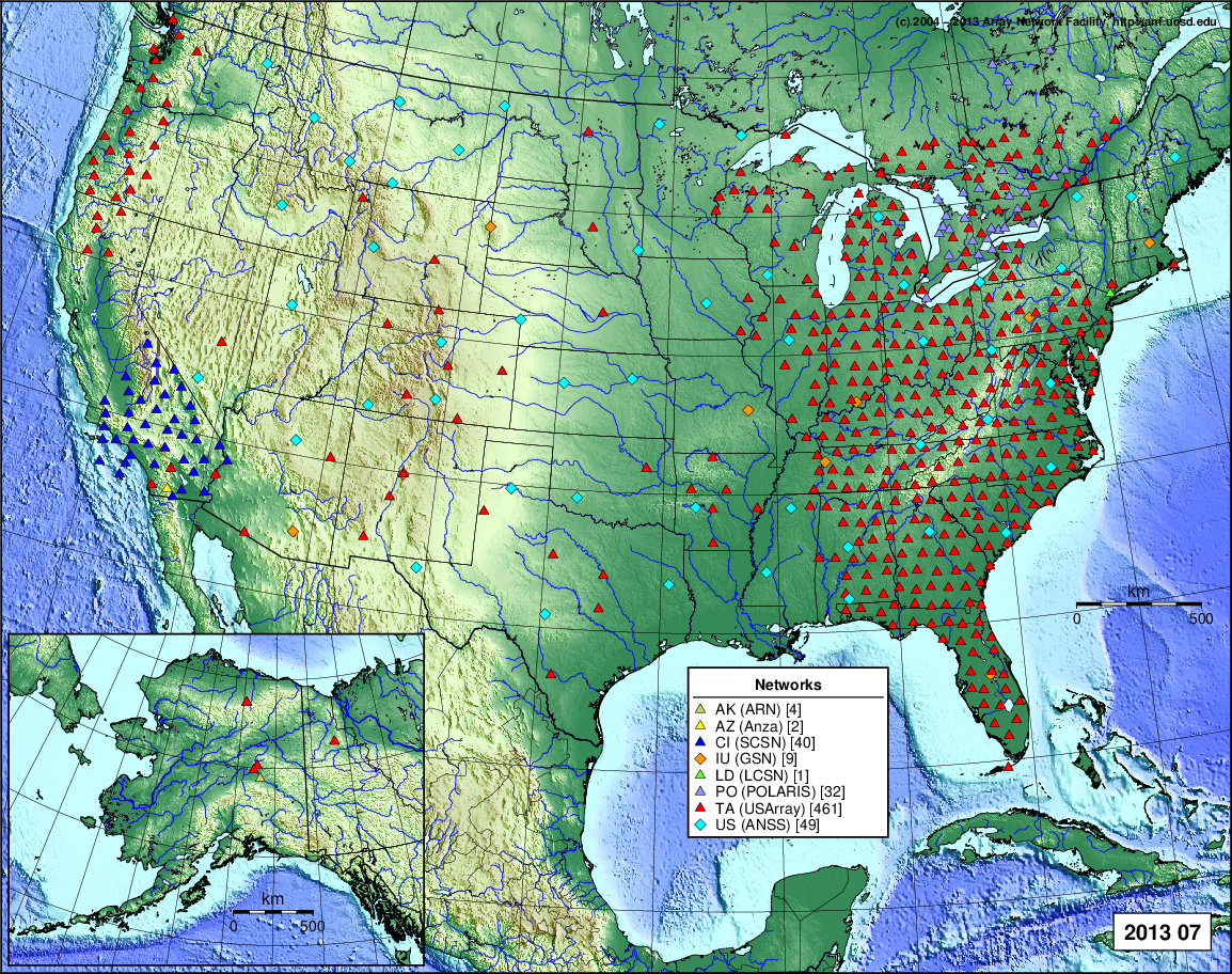
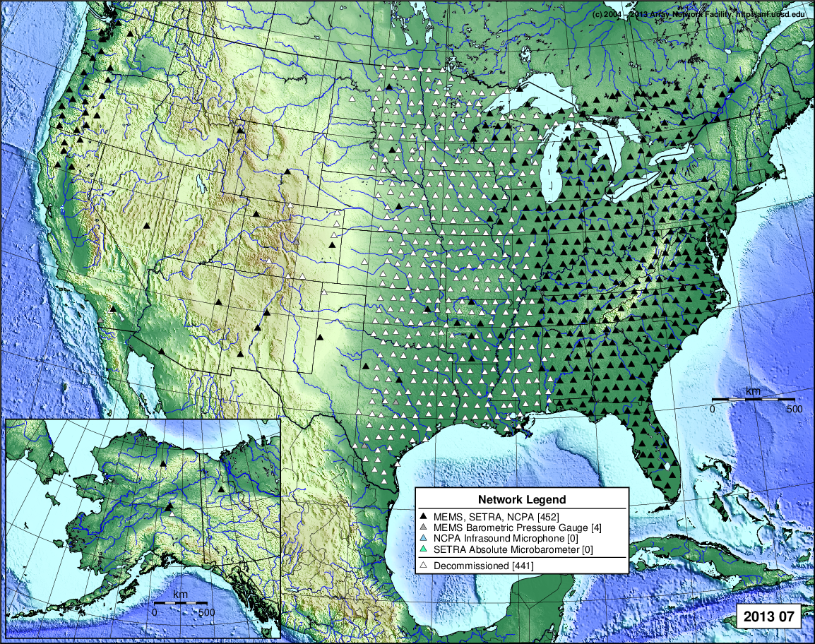
- 2013 July: Seismic [ cumulative | rolling ] Inframet [ cumulative | rolling ]
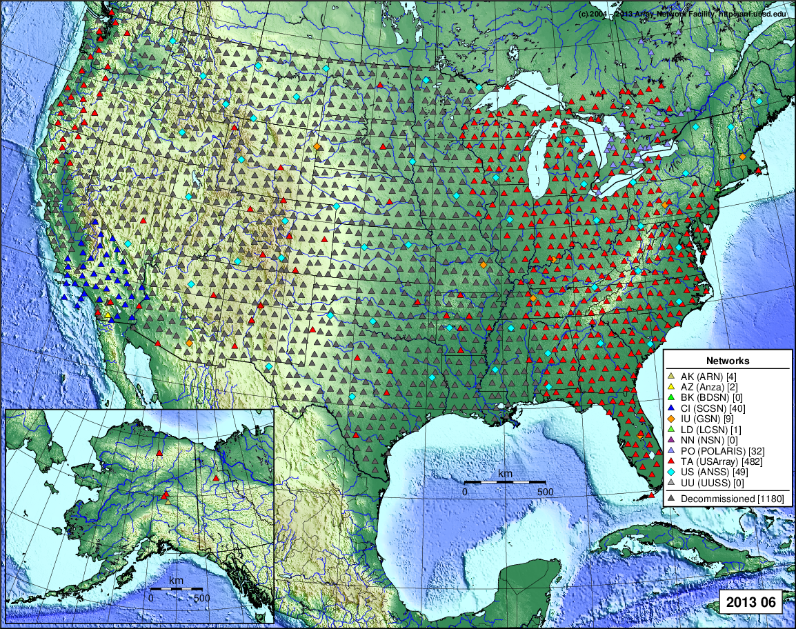
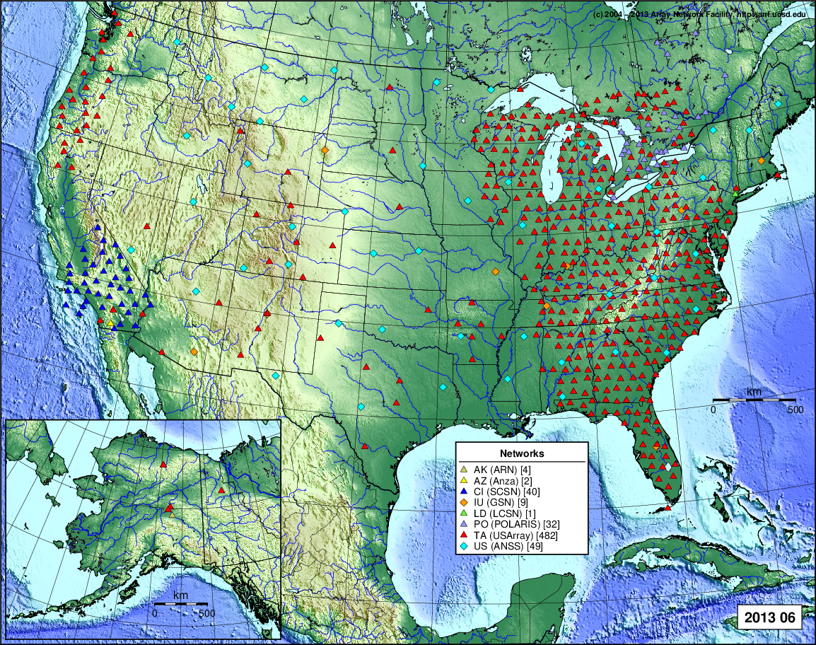
- 2013 June: Seismic [ cumulative | rolling ] Inframet [ cumulative | rolling ]
- 2013 May: Seismic [ cumulative | rolling ] Inframet [ cumulative | rolling ]
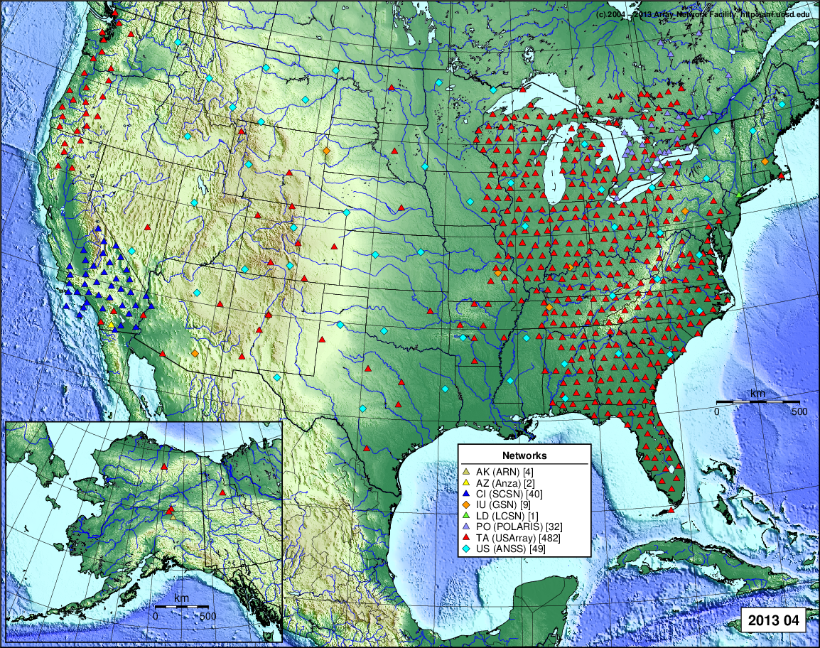
- 2013 April: Seismic [ cumulative | rolling ] Inframet [ cumulative | rolling ]
- 2013 March: Seismic [ cumulative | rolling ] Inframet [ cumulative | rolling ]
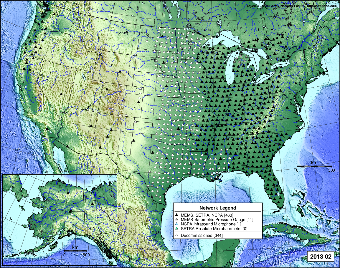
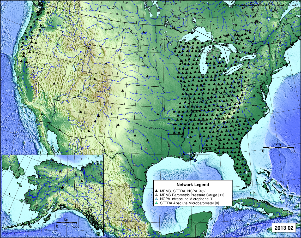
- 2013 February: Seismic [ cumulative | rolling ] Inframet [ cumulative | rolling ]
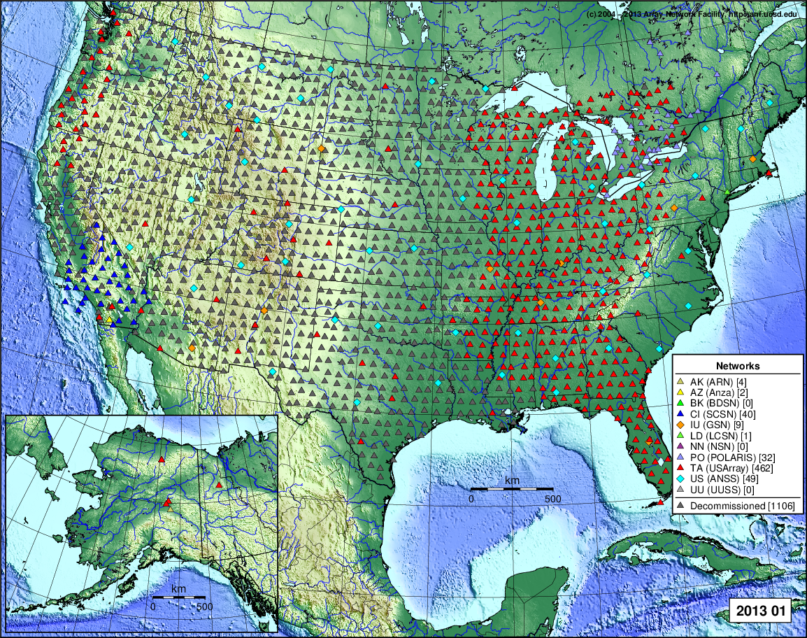
- 2013 January: Seismic [ cumulative | rolling ] Inframet [ cumulative | rolling ]
2012
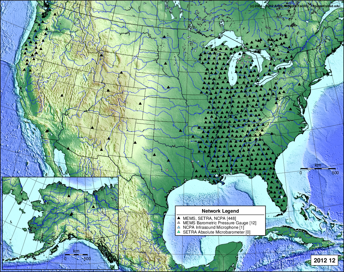
- 2012 December: Seismic [ cumulative | rolling ] Inframet [ cumulative | rolling ]
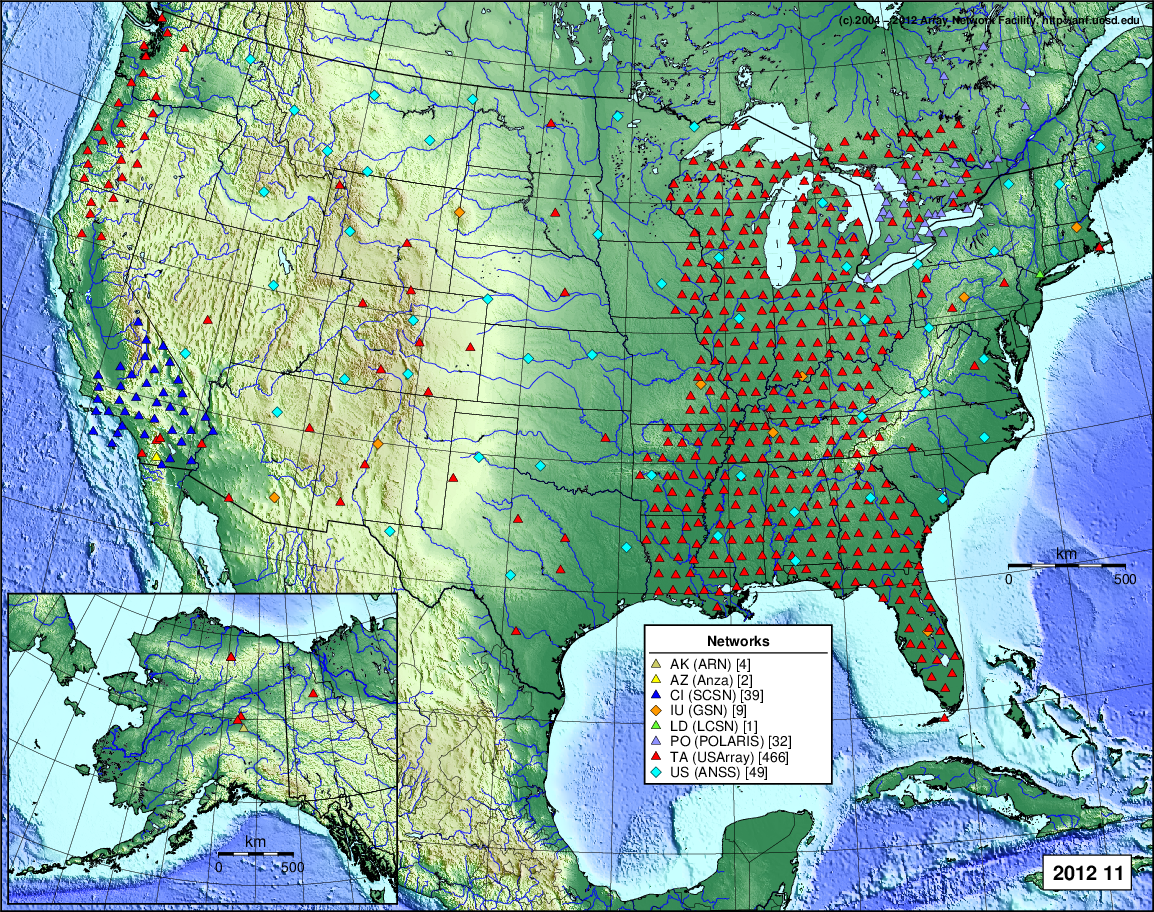
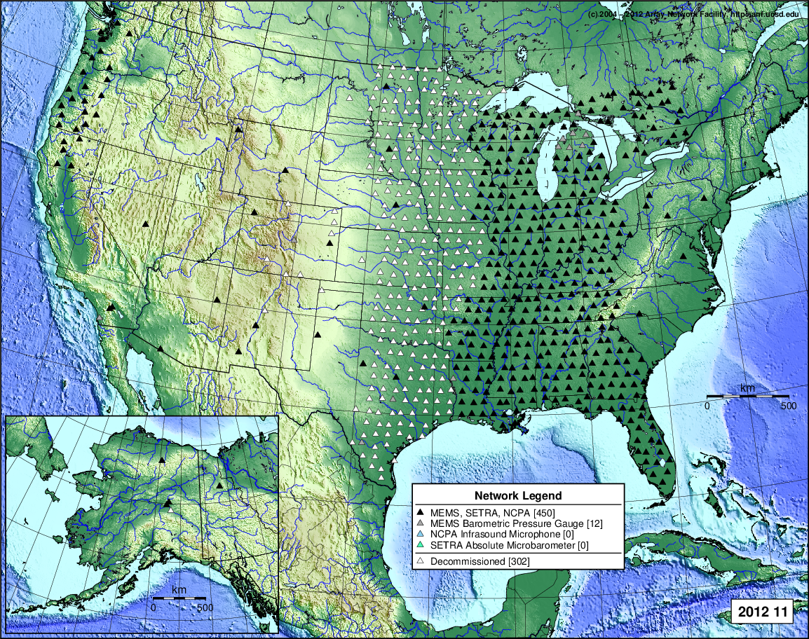
- 2012 November: Seismic [ cumulative | rolling ] Inframet [ cumulative | rolling ]
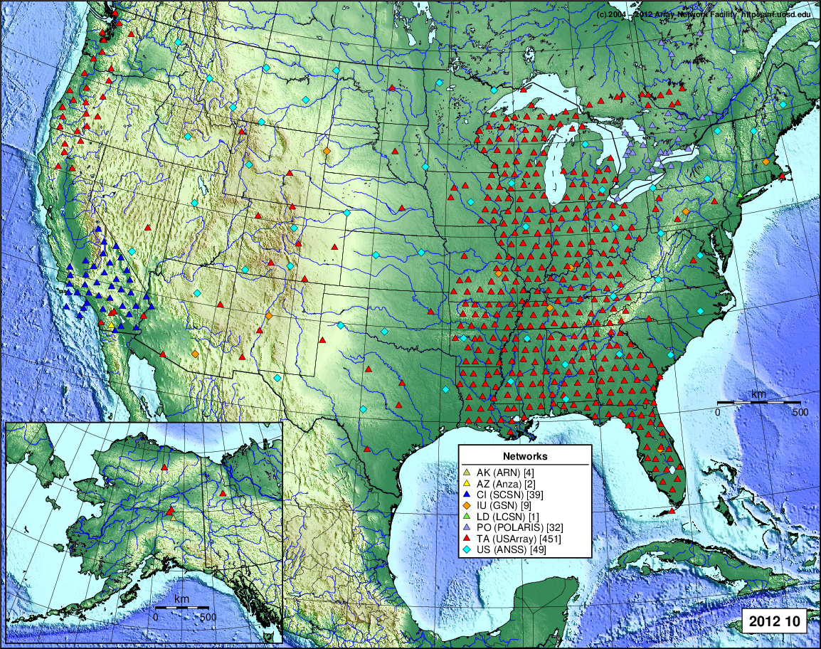
- 2012 October: Seismic [ cumulative | rolling ] Inframet [ cumulative | rolling ]
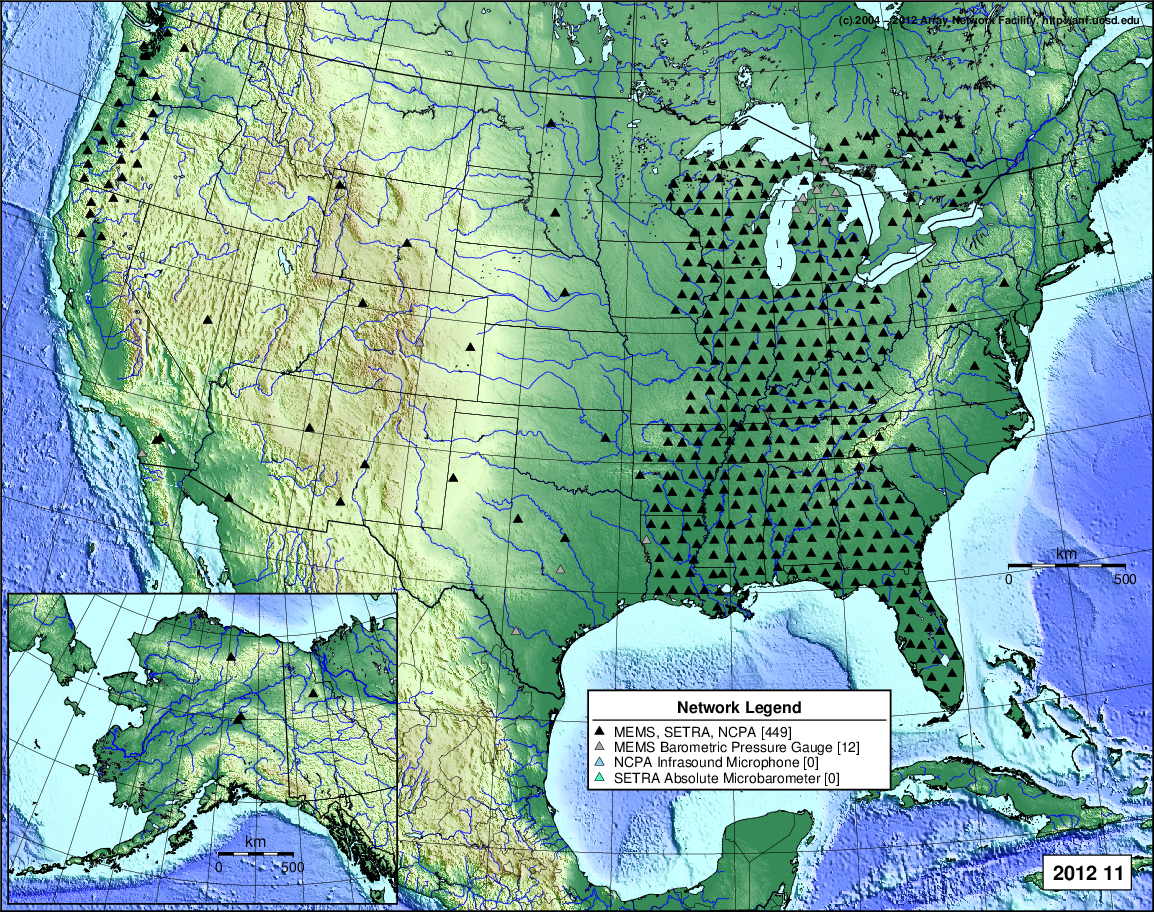
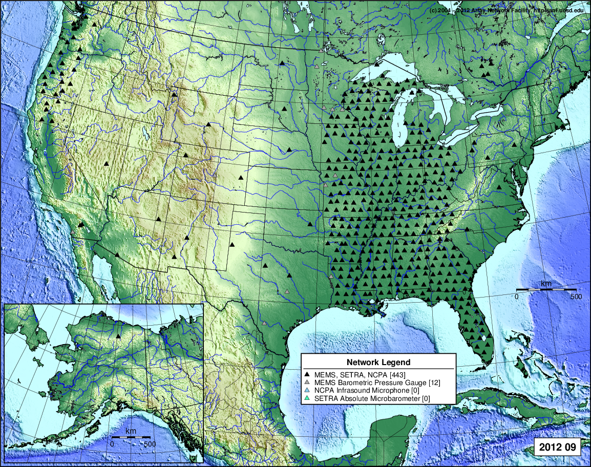
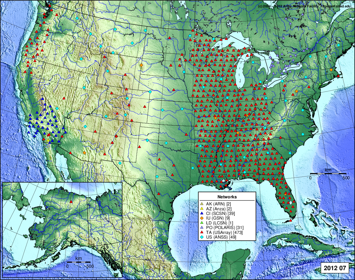
- 2012 September: Seismic [ cumulative | rolling ] Inframet [ cumulative | rolling ]
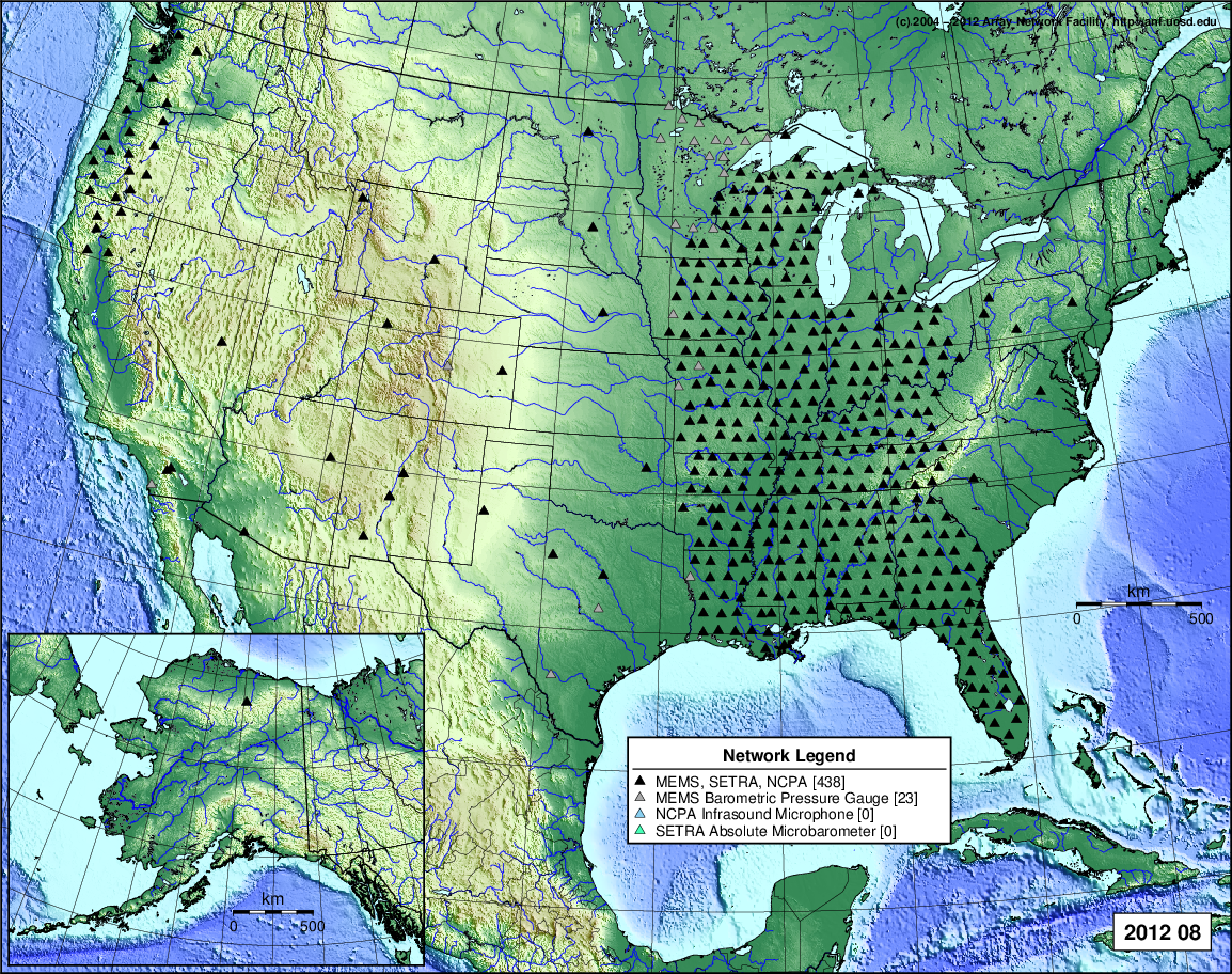
- 2012 August: Seismic [ cumulative | rolling ] Inframet [ cumulative | rolling ]
- 2012 July: Seismic [ cumulative | rolling ] Inframet [ cumulative | rolling ]
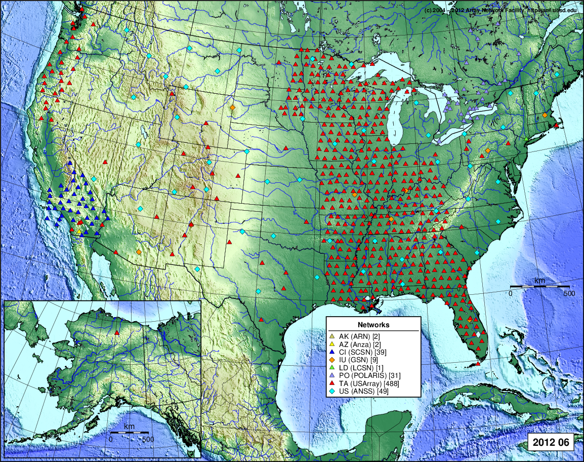
- 2012 June: Seismic [ cumulative | rolling ] Inframet [ cumulative | rolling ]
- 2012 May: Seismic [ cumulative | rolling ] Inframet [ cumulative | rolling ]
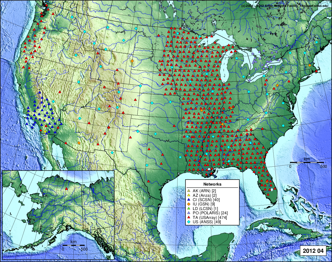
- 2012 April: Seismic [ cumulative | rolling ] Inframet [ cumulative | rolling ]
- 2012 March: Seismic [ cumulative | rolling ] Inframet [ cumulative | rolling ]
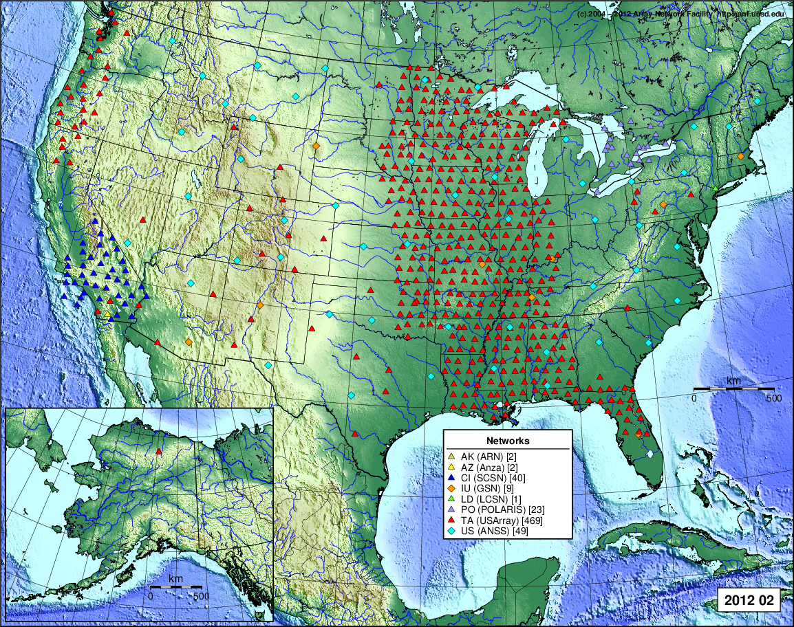
- 2012 February: Seismic [ cumulative | rolling ] Inframet [ cumulative | rolling ]
- 2012 January: Seismic [ cumulative | rolling ] Inframet [ cumulative | rolling ]
2011
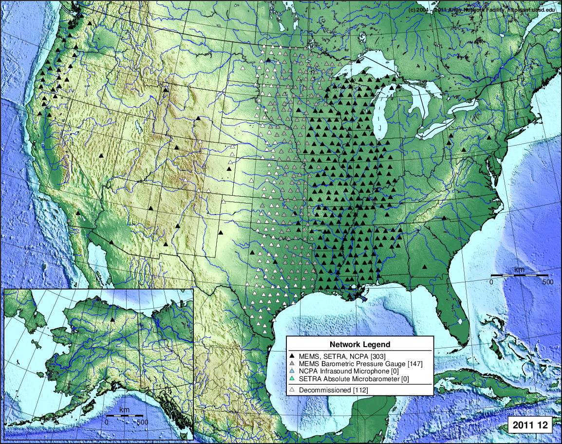
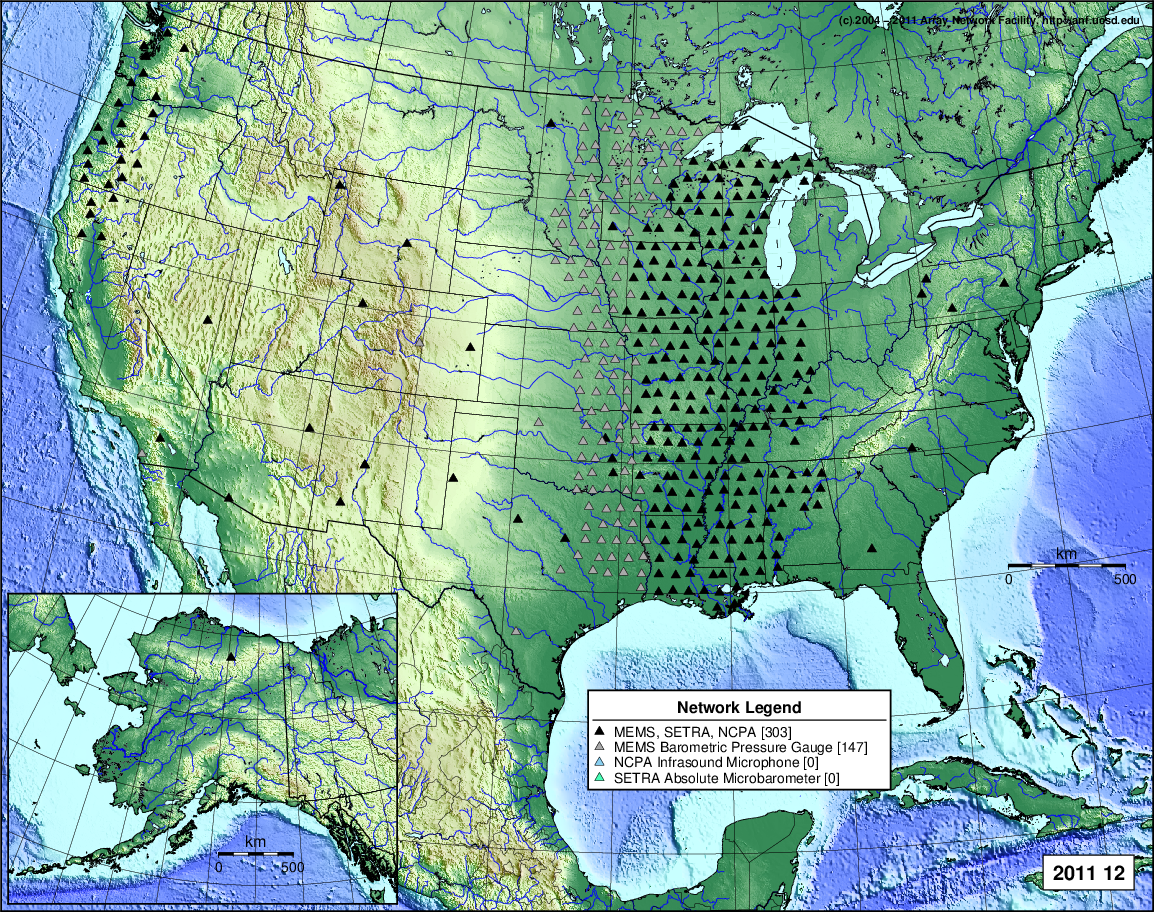
- 2011 December: Seismic [ cumulative | rolling ] Inframet [ cumulative | rolling ]
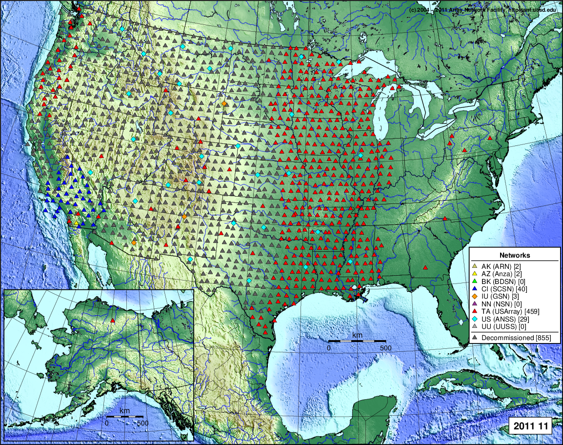
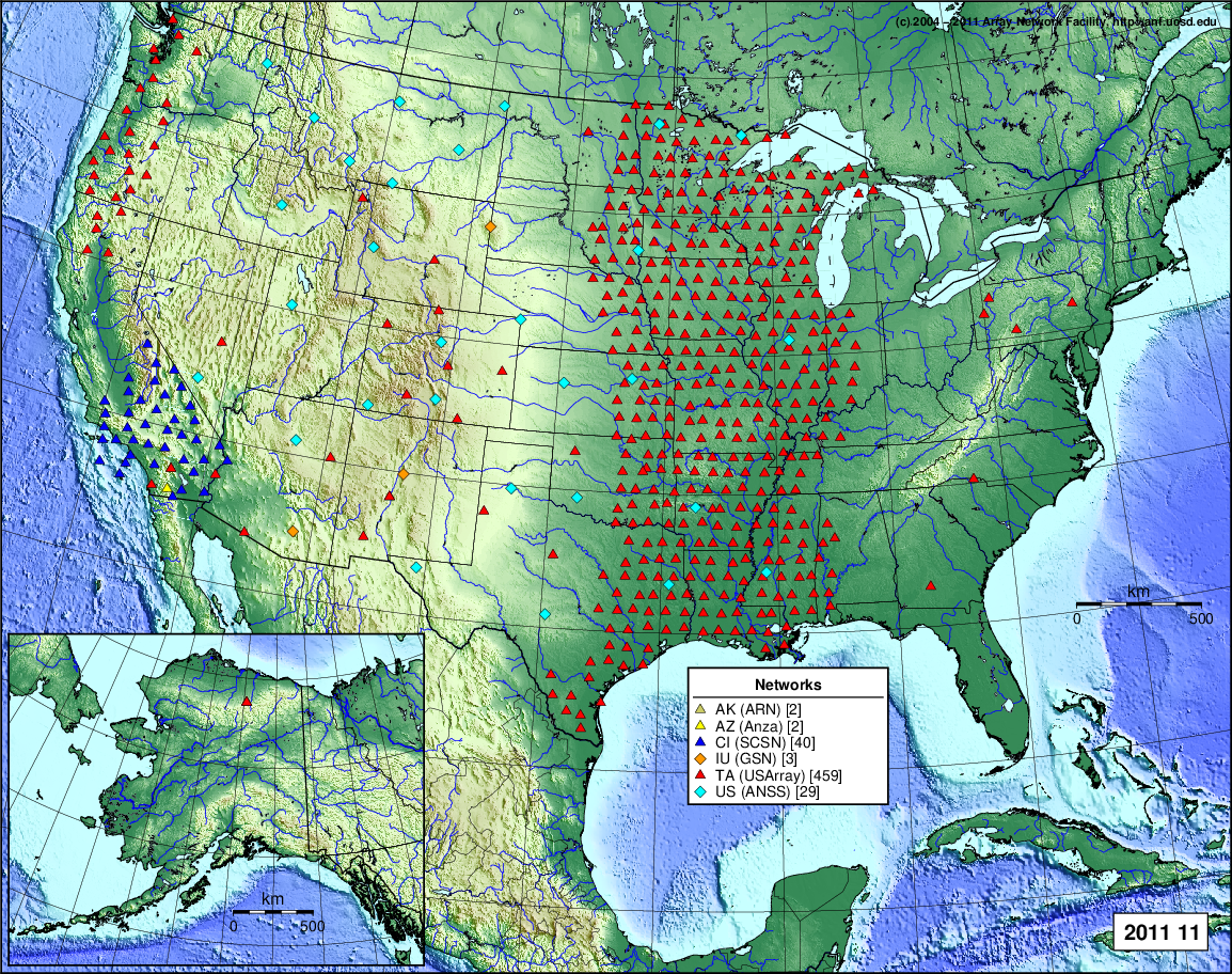
- 2011 November: Seismic [ cumulative | rolling ] Inframet [ cumulative | rolling ]
- 2011 October: Seismic [ cumulative | rolling ] Inframet [ cumulative | rolling ]
- 2011 September: Seismic [ cumulative | rolling ] Inframet [ cumulative | rolling ]
- 2011 August: Seismic [ cumulative | rolling ] Inframet [ cumulative | rolling ]
- 2011 July: Seismic [ cumulative | rolling ] Inframet [ cumulative | rolling ]
- 2011 June: Seismic [ cumulative | rolling ] Inframet [ cumulative | rolling ]
- 2011 May: Seismic [ cumulative | rolling ] Inframet [ cumulative | rolling ]
- 2011 April: Seismic [ cumulative | rolling ] Inframet [ cumulative | rolling ]
- 2011 March: Seismic [ cumulative | rolling ] Inframet [ cumulative | rolling ]
- 2011 February: Seismic [ cumulative | rolling ] Inframet [ cumulative | rolling ]
- 2011 January: Seismic [ cumulative | rolling ] Inframet [ cumulative | rolling ]
2010
- 2010 December: Seismic [ cumulative | rolling ] Inframet [ cumulative | rolling ]
- 2010 November: Seismic [ cumulative | rolling ] Inframet [ cumulative | rolling ]
- 2010 October: Seismic [ cumulative | rolling ] Inframet [ cumulative | rolling ]
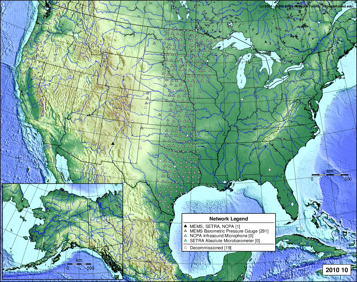
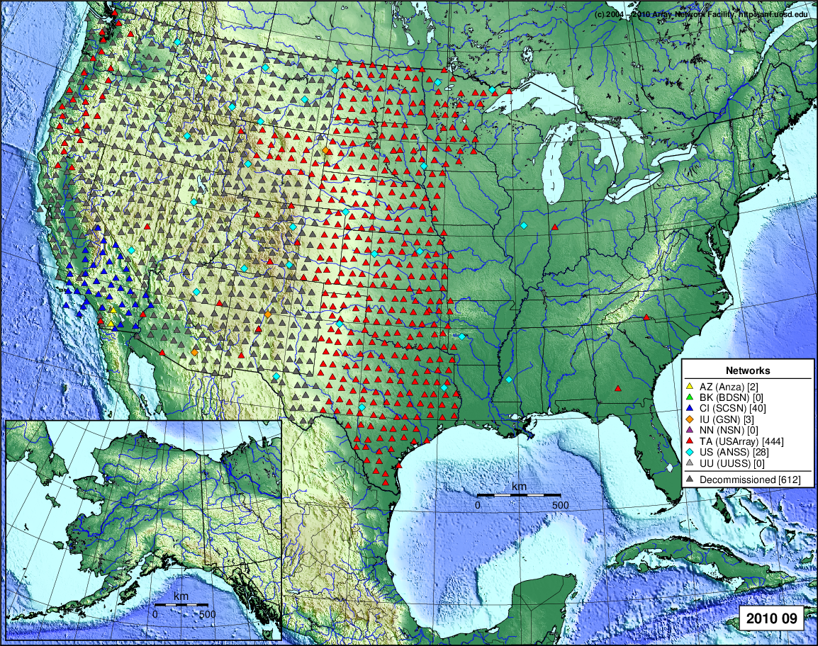
- 2010 September: Seismic [ cumulative | rolling ] Inframet [ cumulative | rolling ]
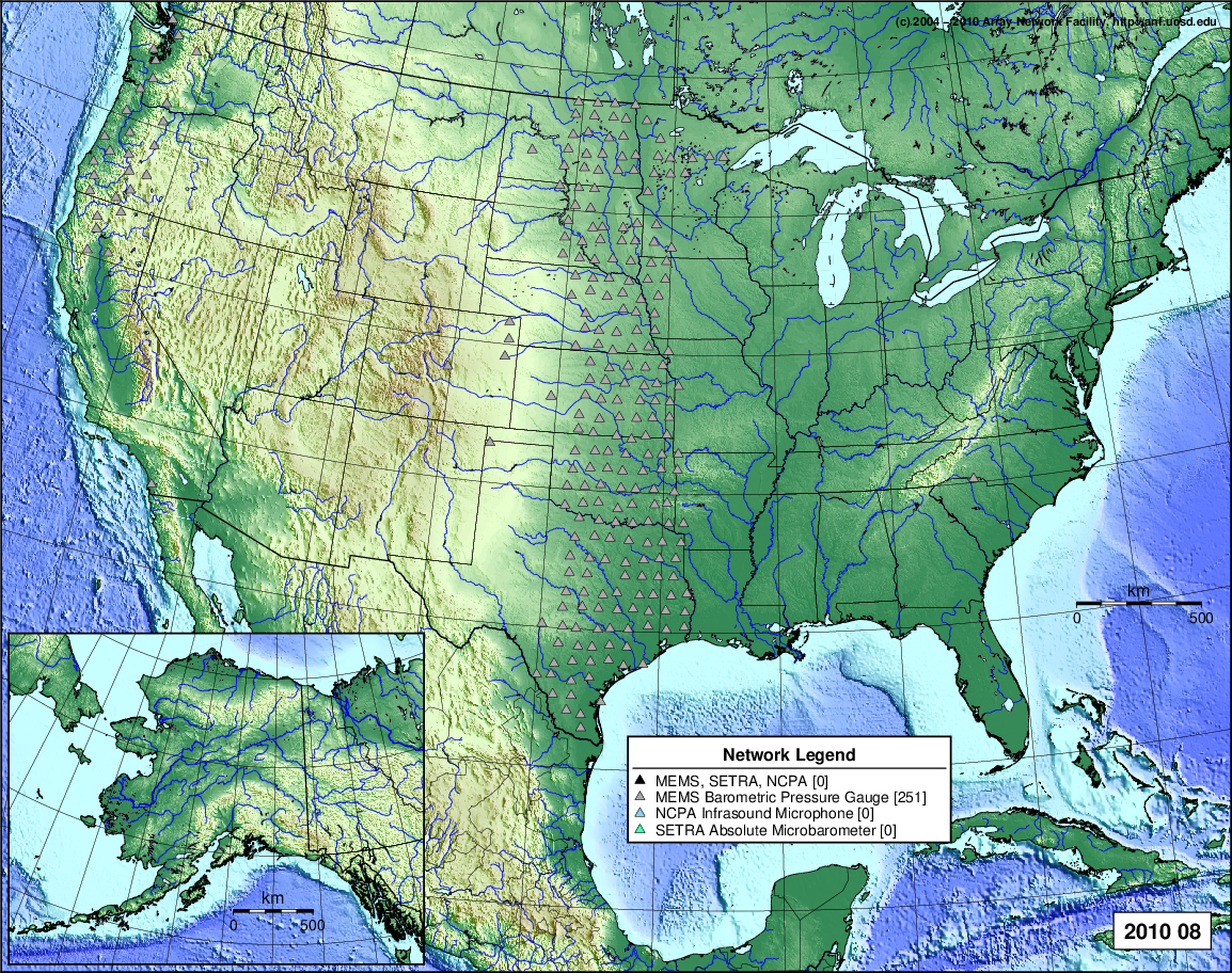
- 2010 August: Seismic [ cumulative | rolling ] Inframet [ cumulative | rolling ]
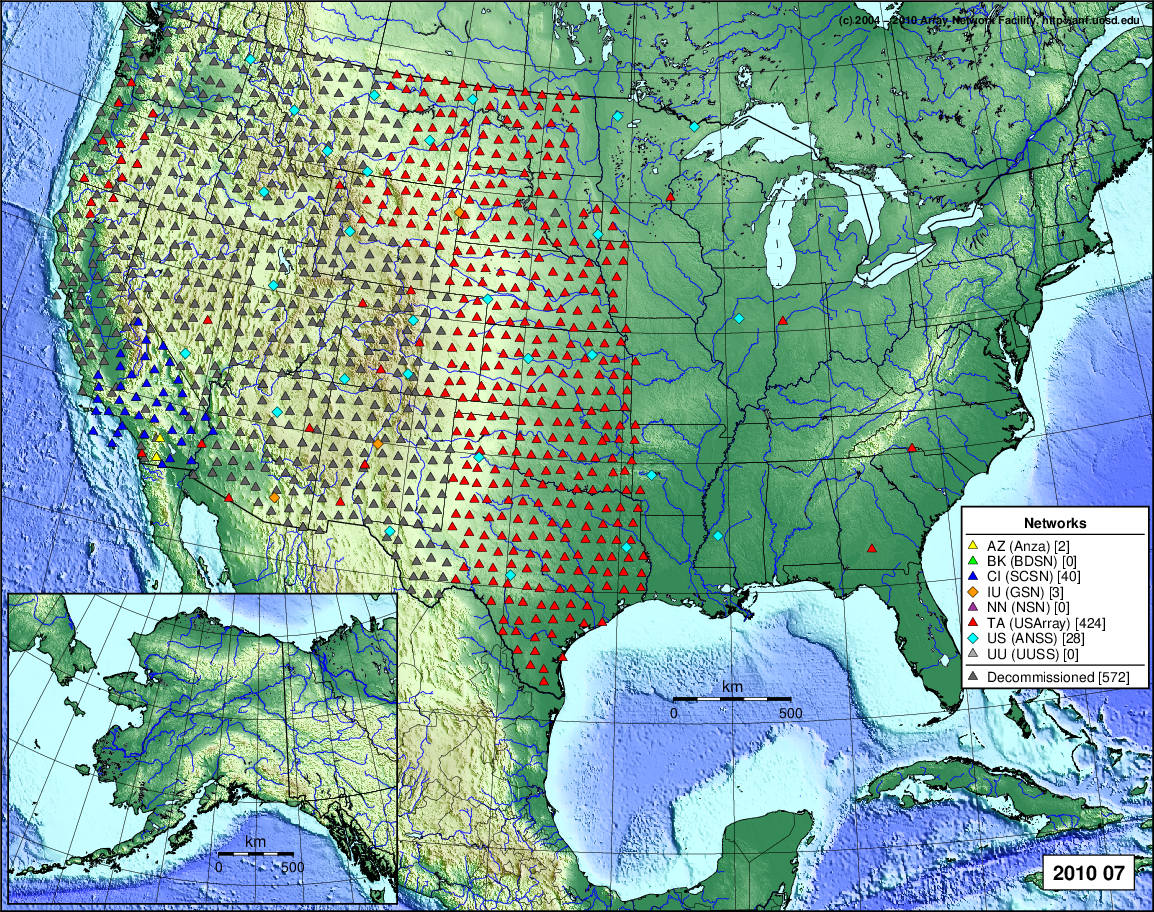
- 2010 July: Seismic [ cumulative | rolling ] Inframet [ cumulative | rolling ]
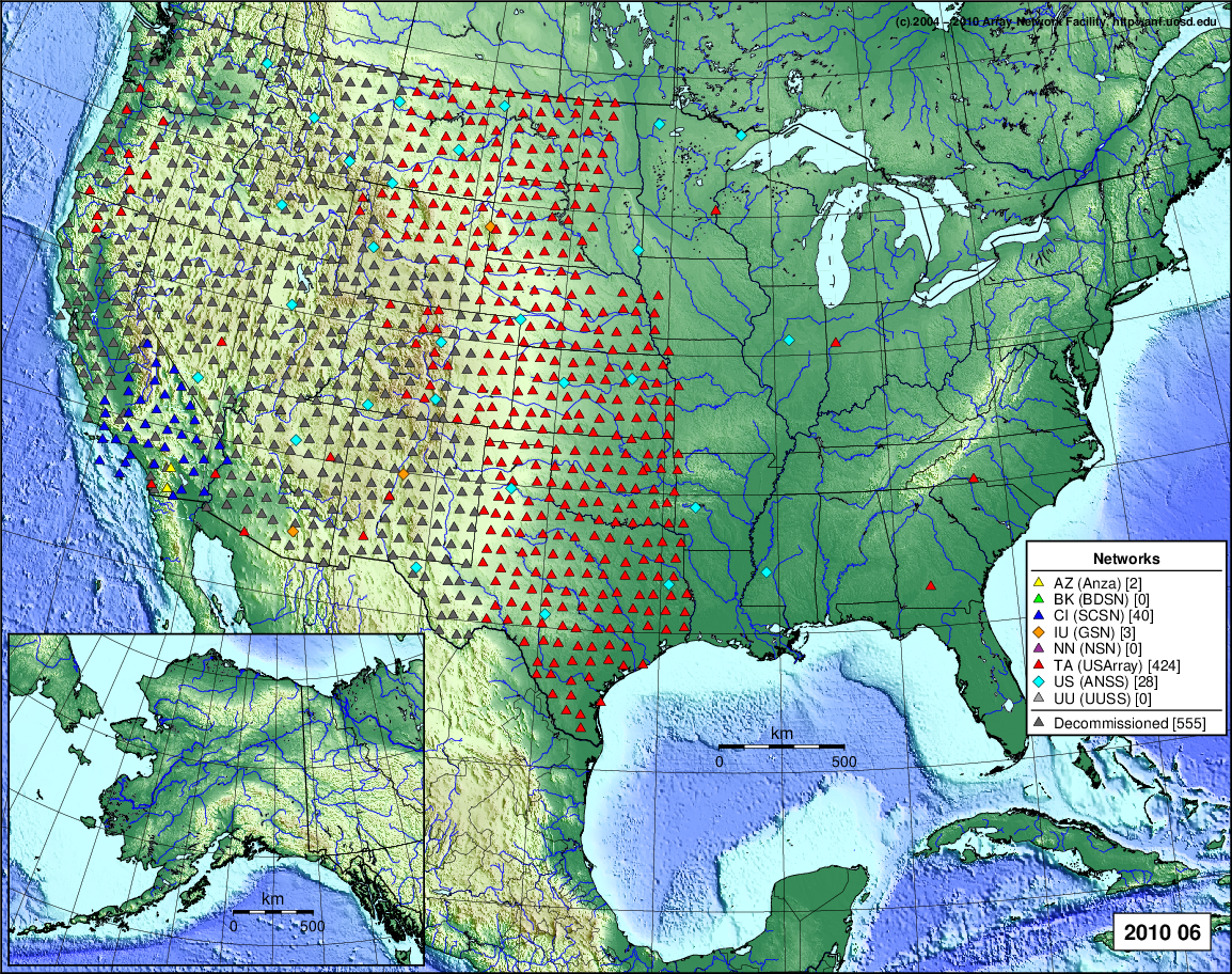
- 2010 June: Seismic [ cumulative | rolling ] Inframet [ cumulative | rolling ]
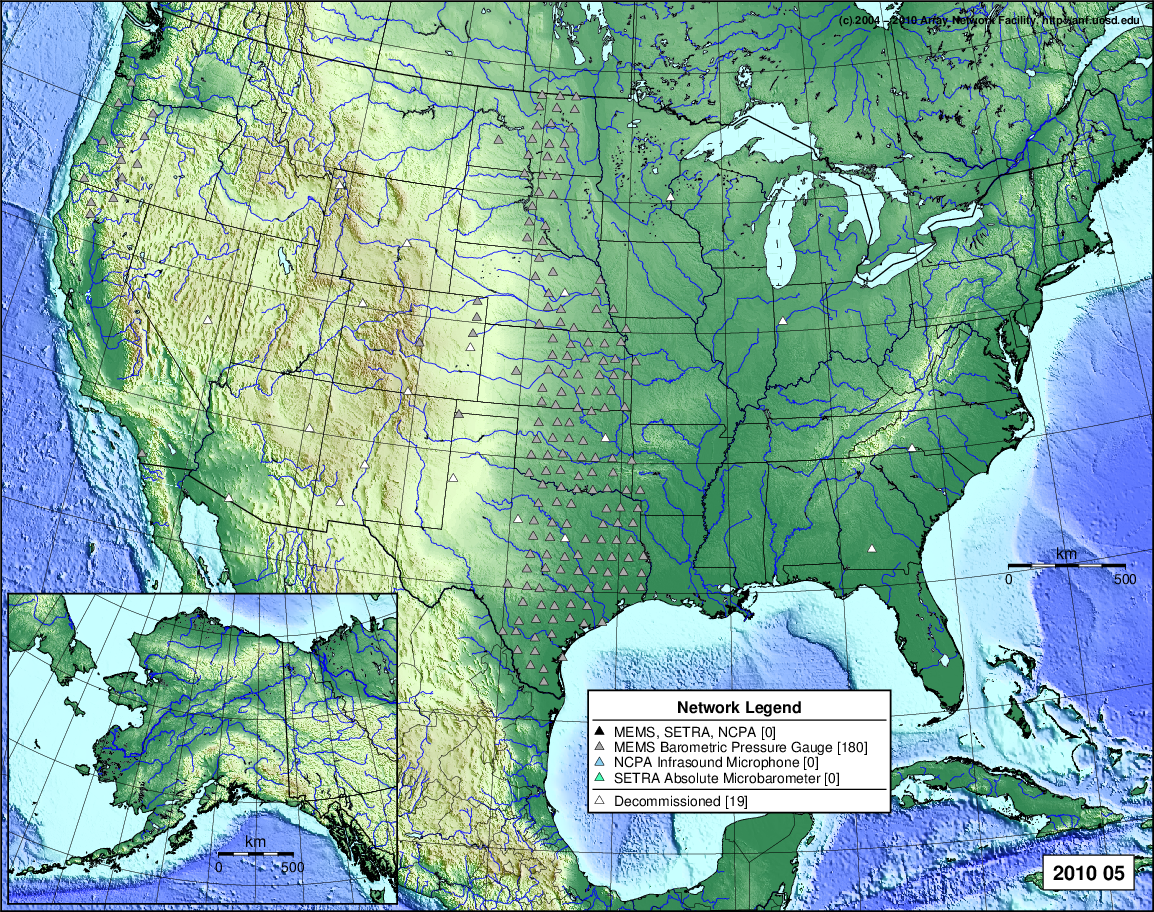
- 2010 May: Seismic [ cumulative | rolling ] Inframet [ cumulative | rolling ]
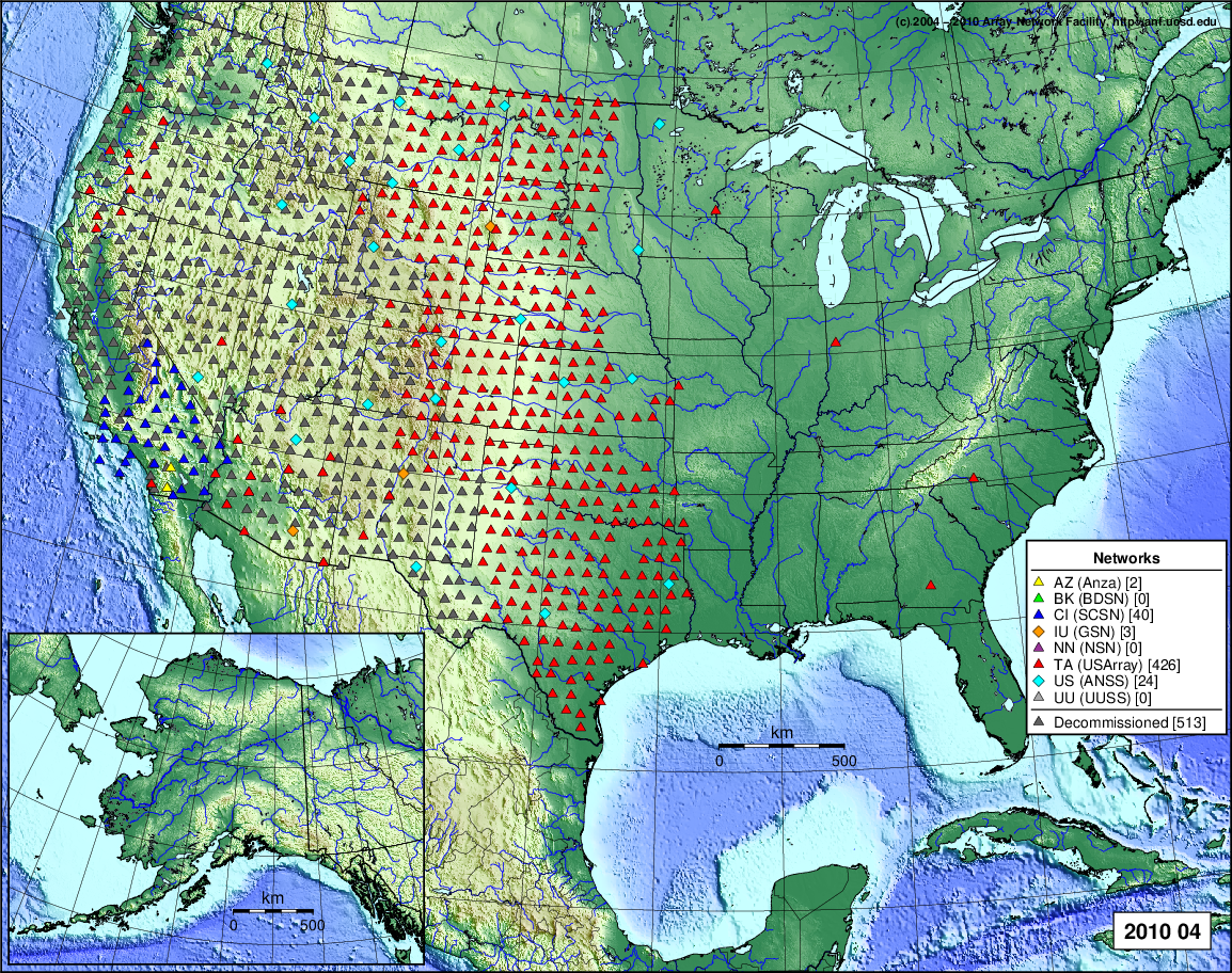
- 2010 April: Seismic [ cumulative | rolling ] Inframet [ cumulative | rolling ]
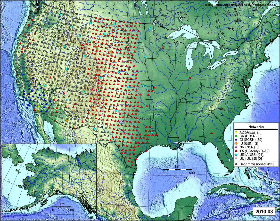
- 2010 March: Seismic [ cumulative | rolling ] Inframet [ cumulative | rolling ]
- 2010 February: Seismic [ cumulative | rolling ] Inframet [ cumulative | rolling ]
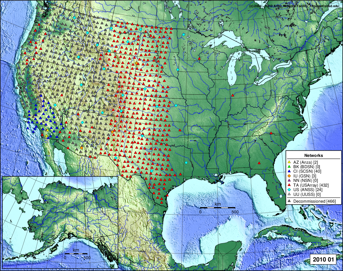
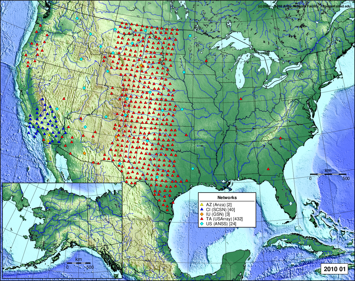
- 2010 January: Seismic [ cumulative | rolling ] Inframet [ cumulative | rolling ]
2009
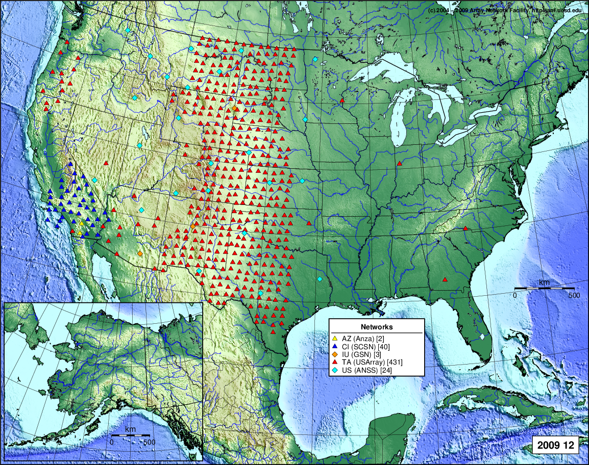
- 2009 December: Seismic [ cumulative | rolling ] Inframet [ cumulative | rolling ]
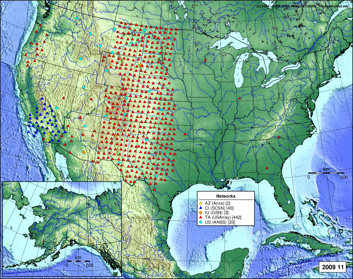
- 2009 November: Seismic [ cumulative | rolling ] Inframet [ cumulative | rolling ]
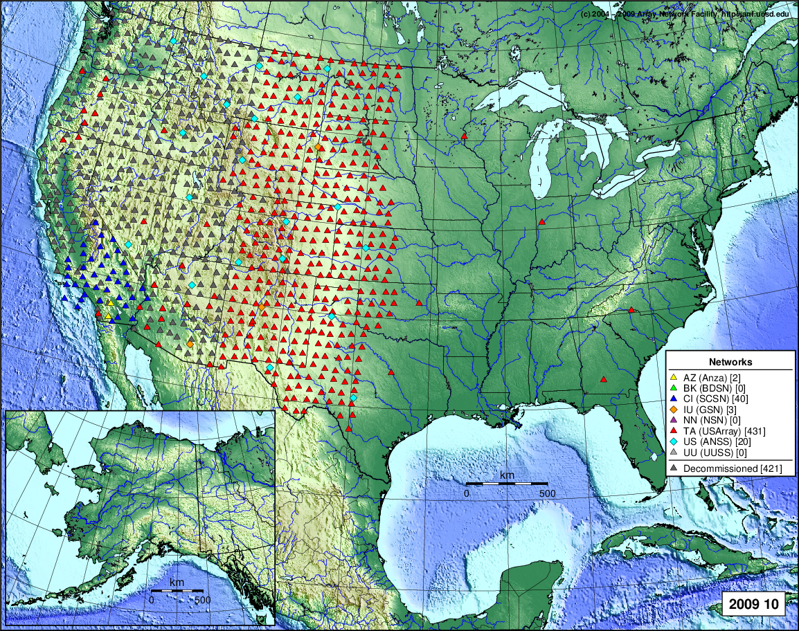
- 2009 October: Seismic [ cumulative | rolling ] Inframet [ cumulative | rolling ]
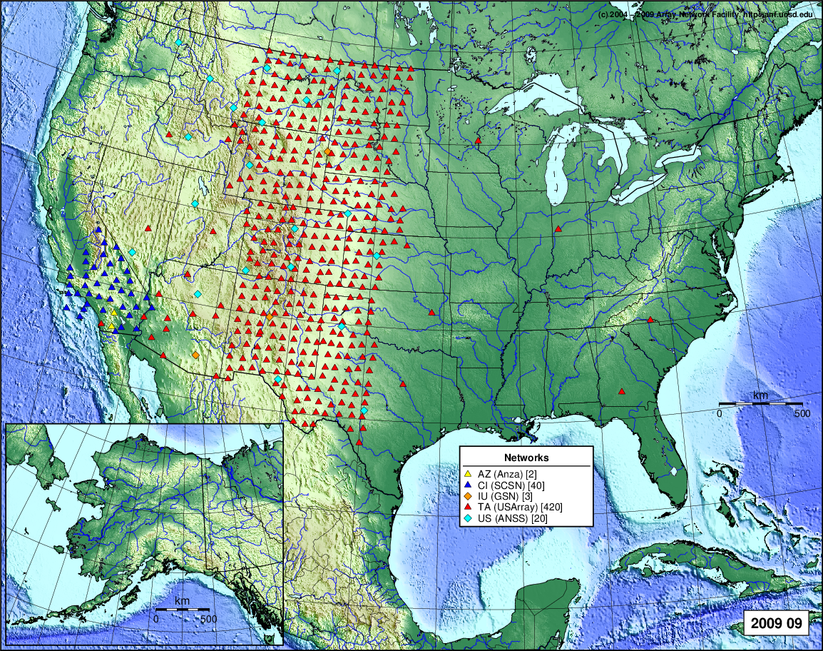
- 2009 September: Seismic [ cumulative | rolling ] Inframet [ cumulative | rolling ]
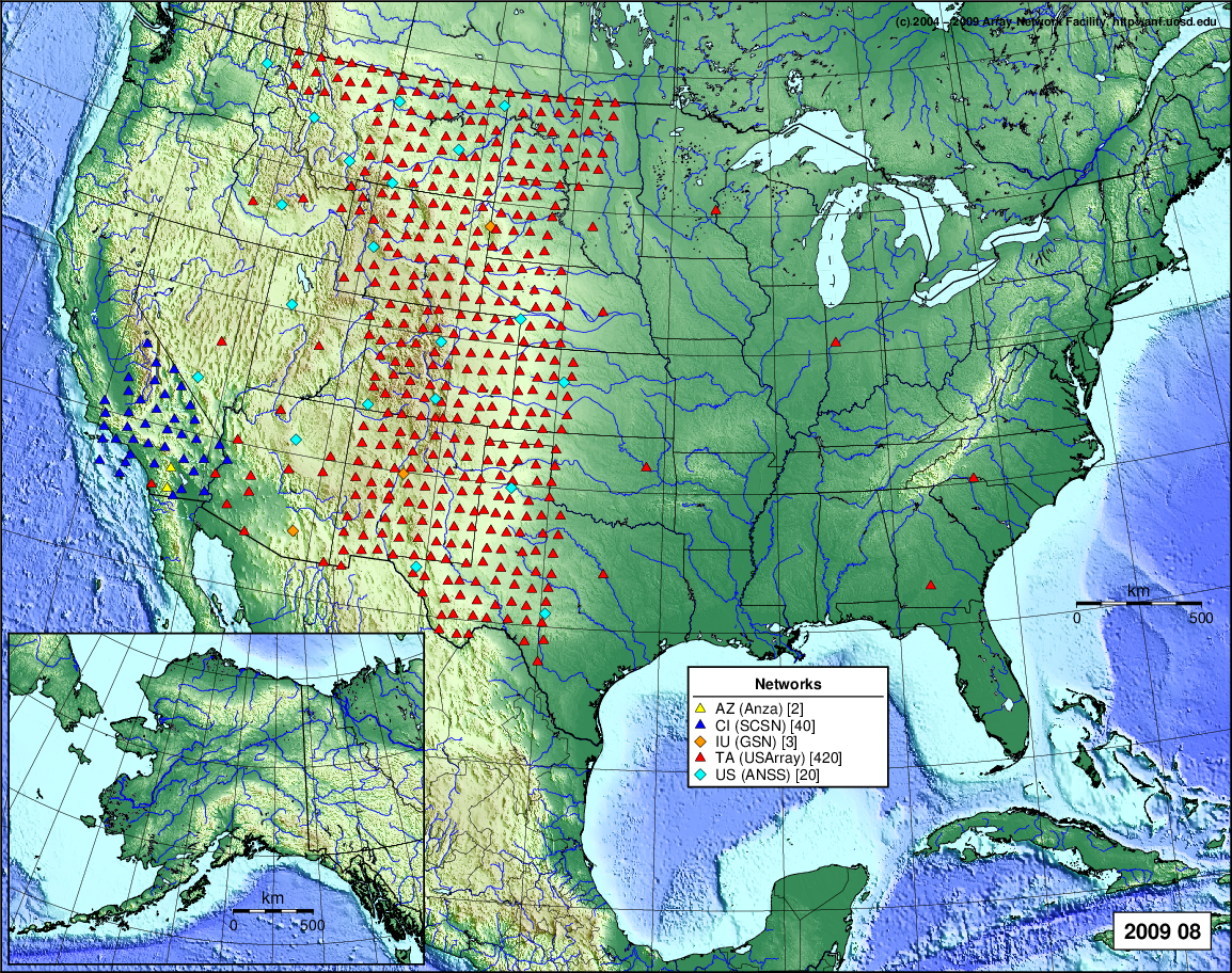
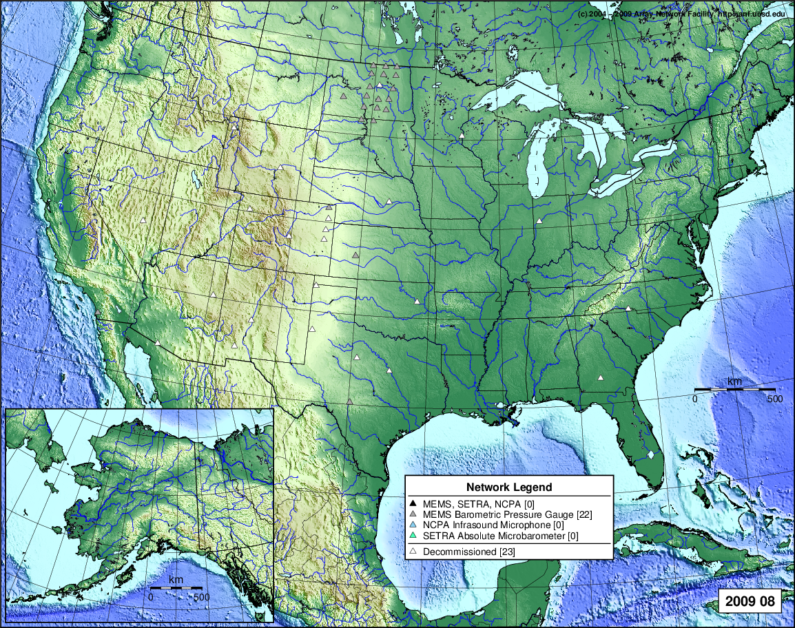
- 2009 August: Seismic [ cumulative | rolling ] Inframet [ cumulative | rolling ]
- 2009 July: Seismic [ cumulative | rolling ] Inframet [ cumulative | rolling ]
- 2009 June: Seismic [ cumulative | rolling ] Inframet [ cumulative | rolling ]
- 2009 May: Seismic [ cumulative | rolling ] Inframet [ cumulative | rolling ]
- 2009 April: Seismic [ cumulative | rolling ] Inframet [ cumulative | rolling ]
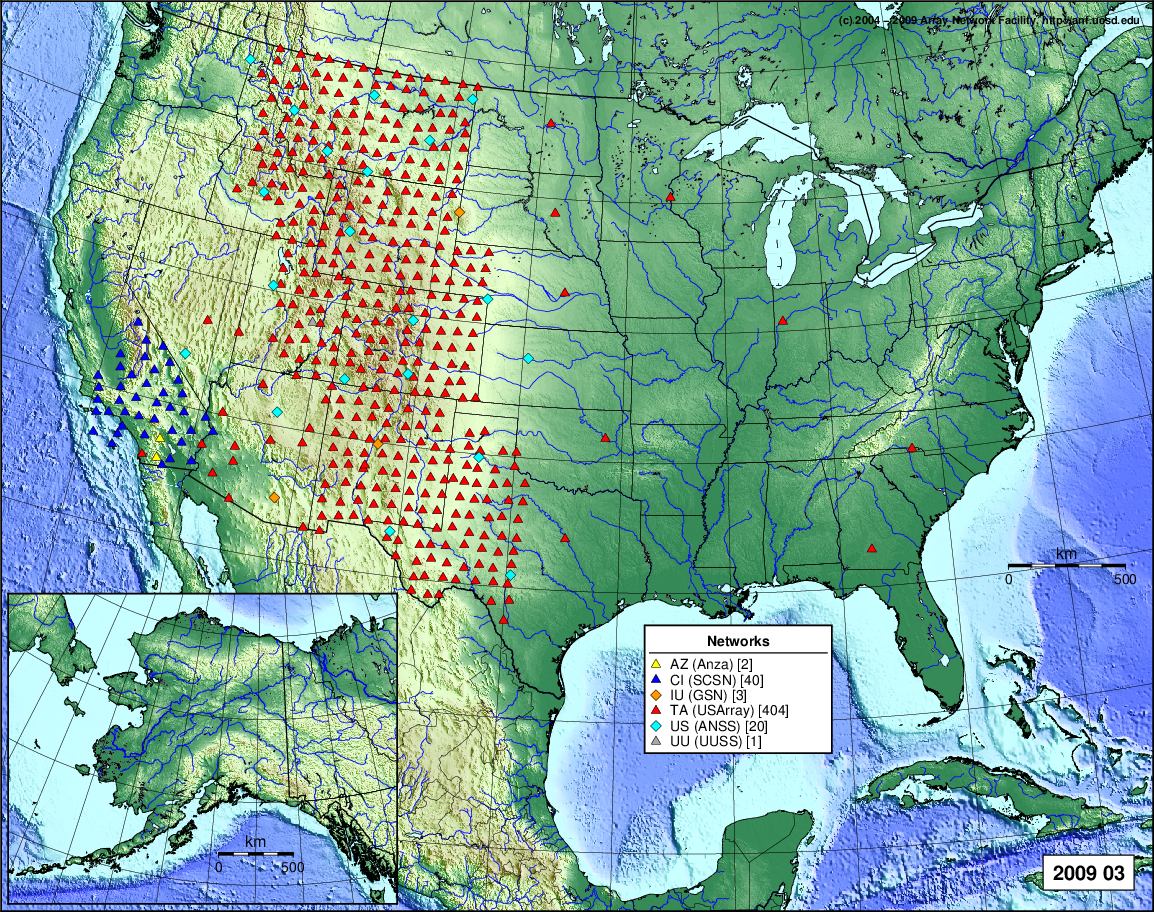
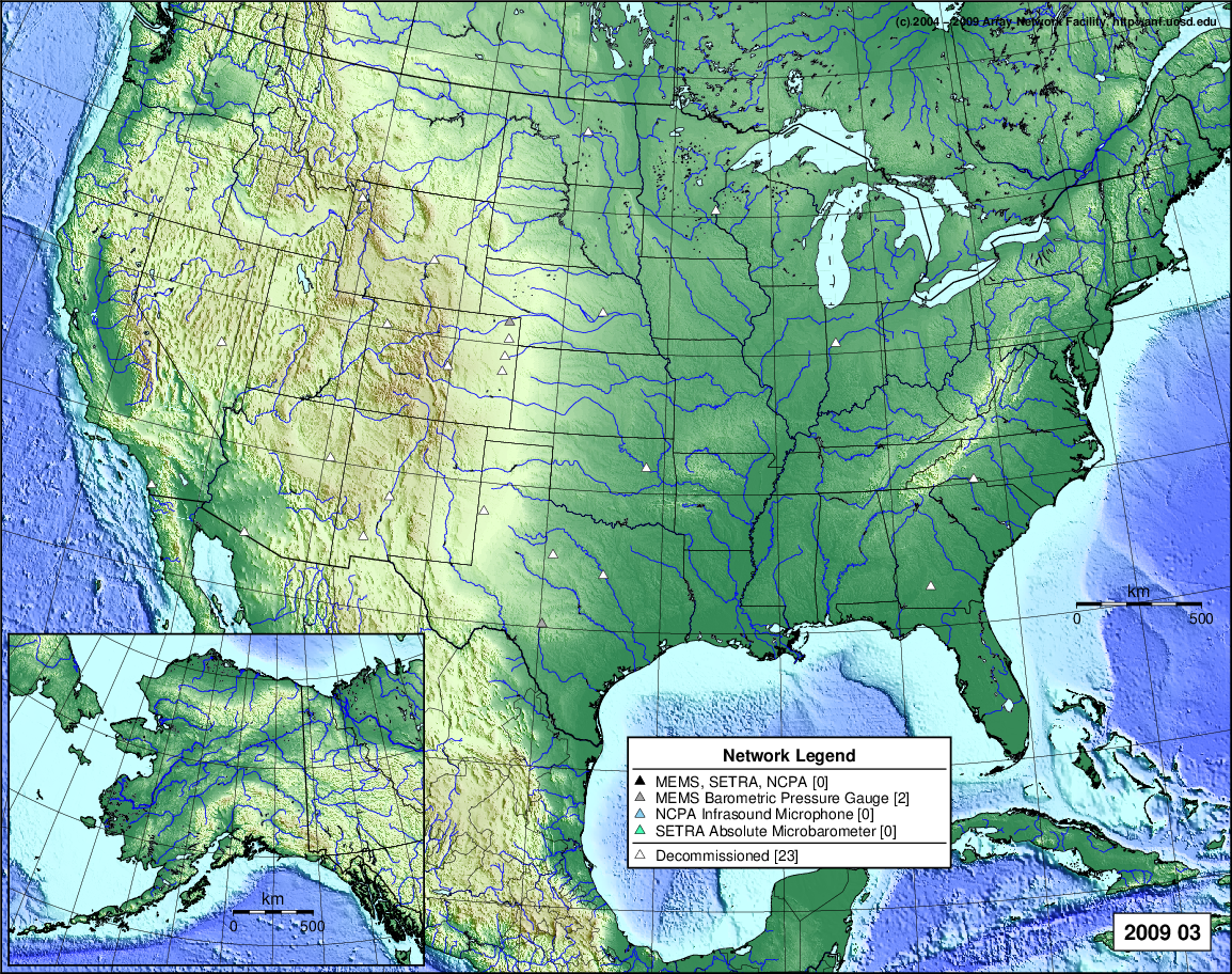
- 2009 March: Seismic [ cumulative | rolling ] Inframet [ cumulative | rolling ]
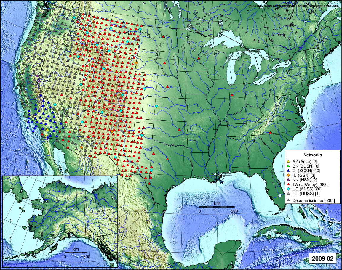
- 2009 February: Seismic [ cumulative | rolling ] Inframet [ cumulative | rolling ]
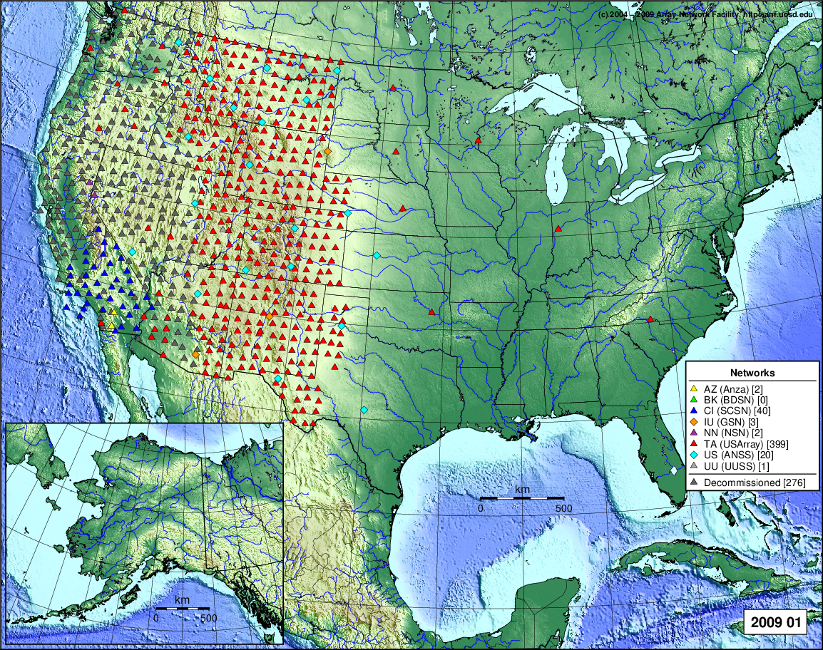
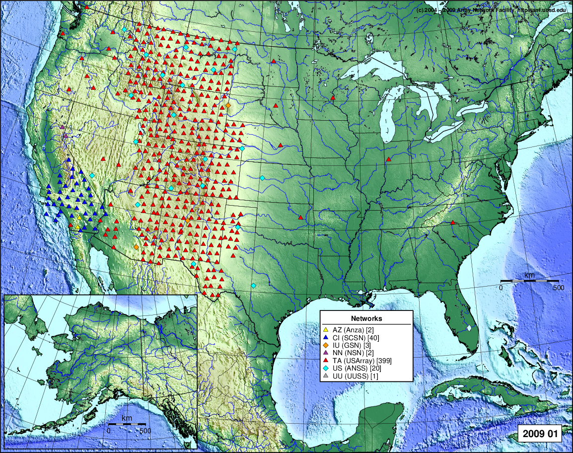
- 2009 January: Seismic [ cumulative | rolling ] Inframet [ cumulative | rolling ]
2008
- 2008 December: Seismic [ cumulative | rolling ] Inframet [ cumulative | rolling ]
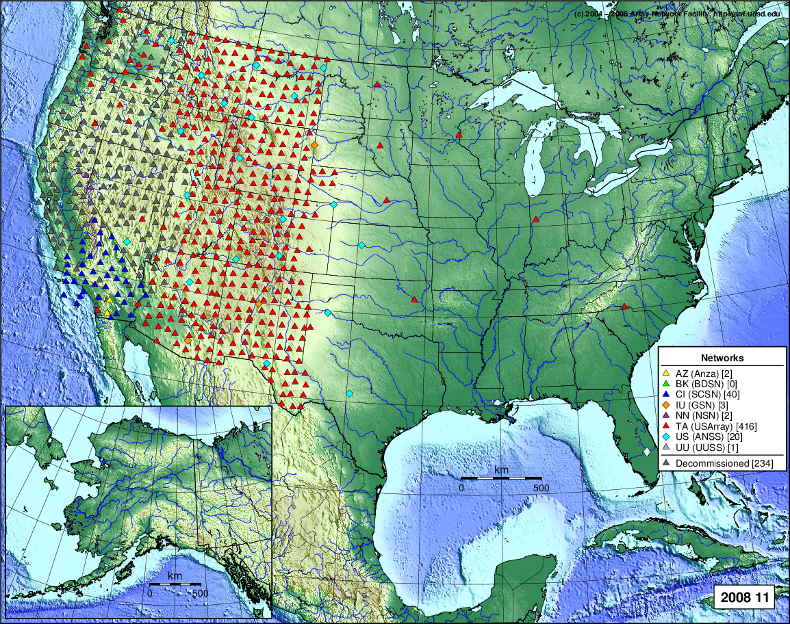
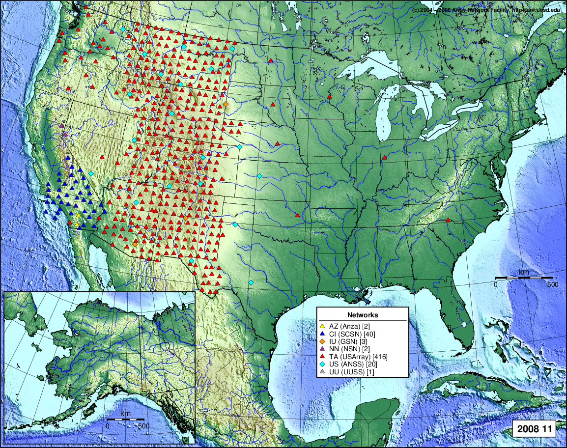
- 2008 November: Seismic [ cumulative | rolling ] Inframet [ cumulative | rolling ]
- 2008 October: Seismic [ cumulative | rolling ] Inframet [ cumulative | rolling ]
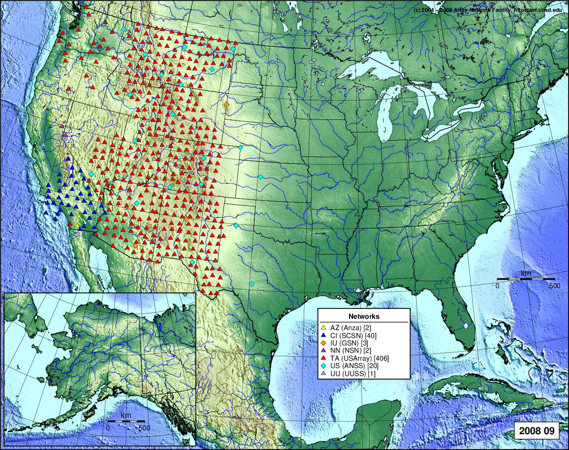
- 2008 September: Seismic [ cumulative | rolling ] Inframet [ cumulative | rolling ]
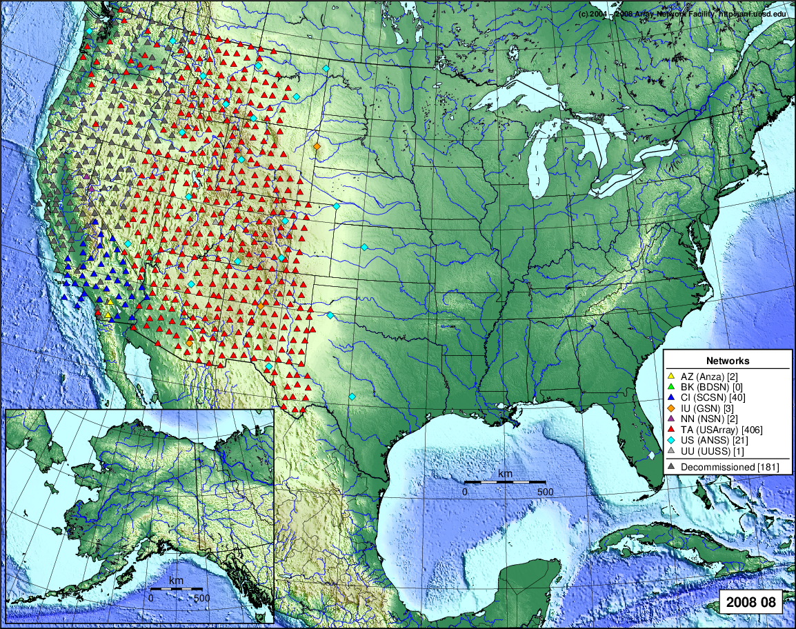
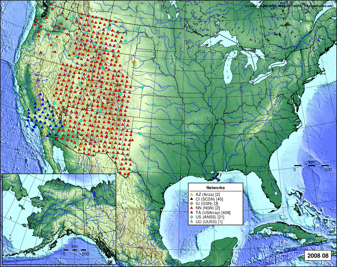
- 2008 August: Seismic [ cumulative | rolling ] Inframet [ cumulative | rolling ]
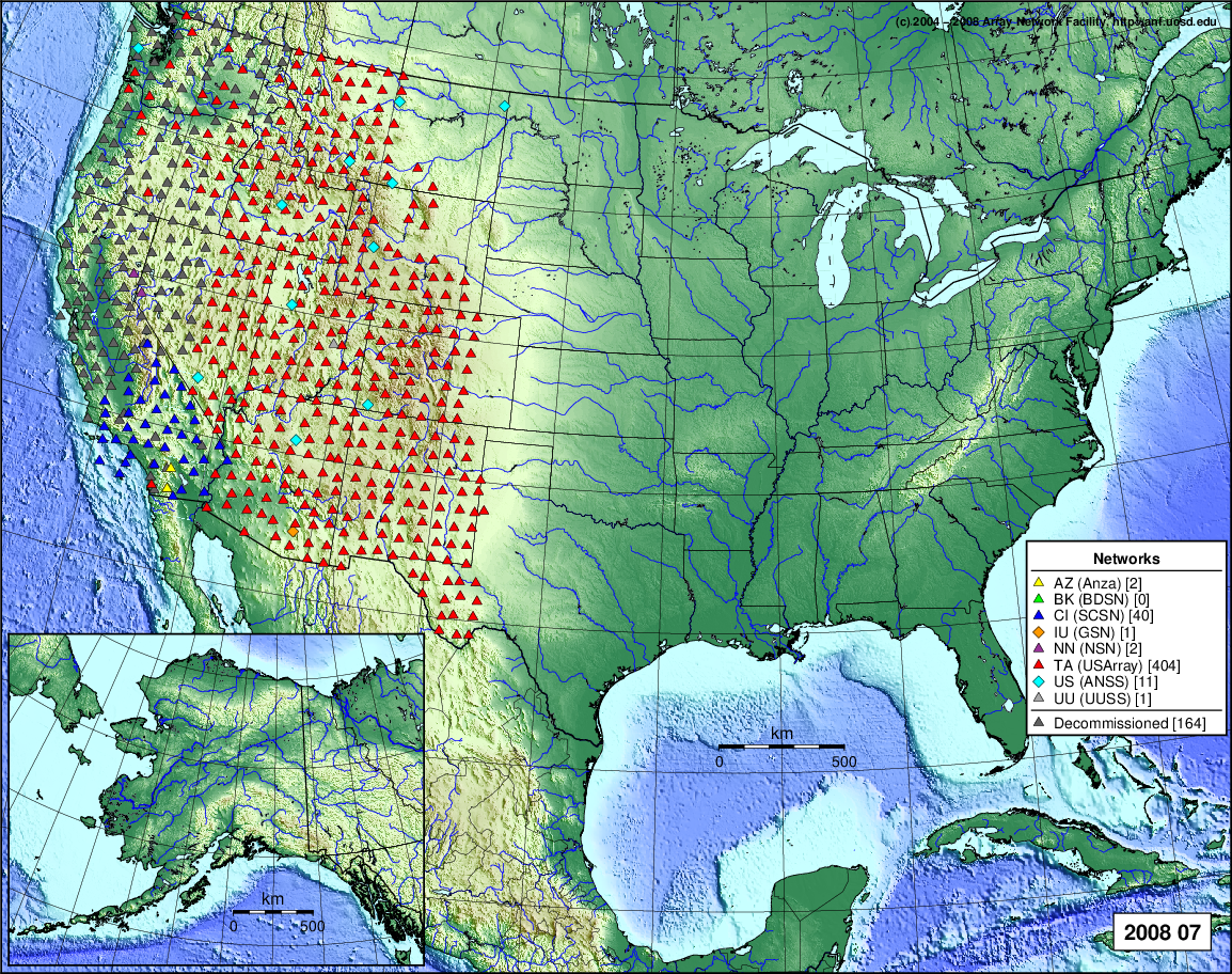
- 2008 July: Seismic [ cumulative | rolling ] Inframet [ cumulative | rolling ]
- 2008 June: Seismic [ cumulative | rolling ] Inframet [ cumulative | rolling ]
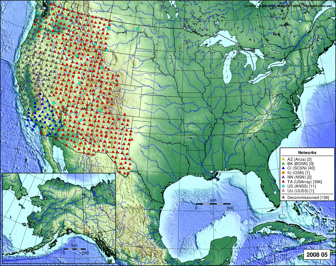
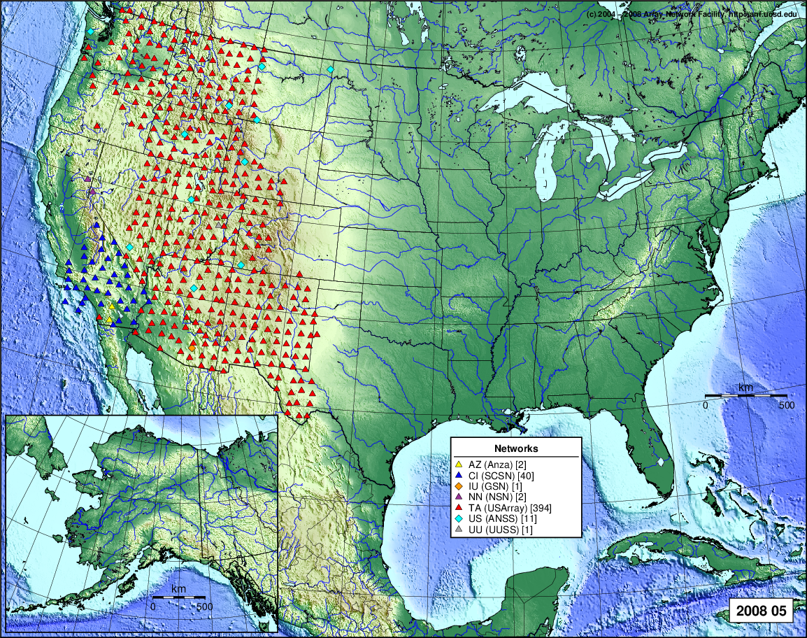
- 2008 May: Seismic [ cumulative | rolling ] Inframet [ cumulative | rolling ]
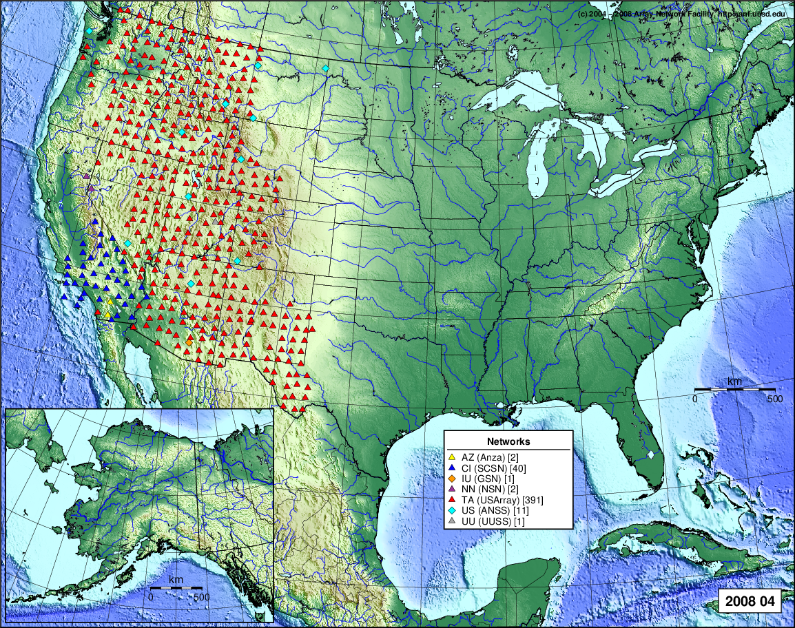
- 2008 April: Seismic [ cumulative | rolling ] Inframet [ cumulative | rolling ]
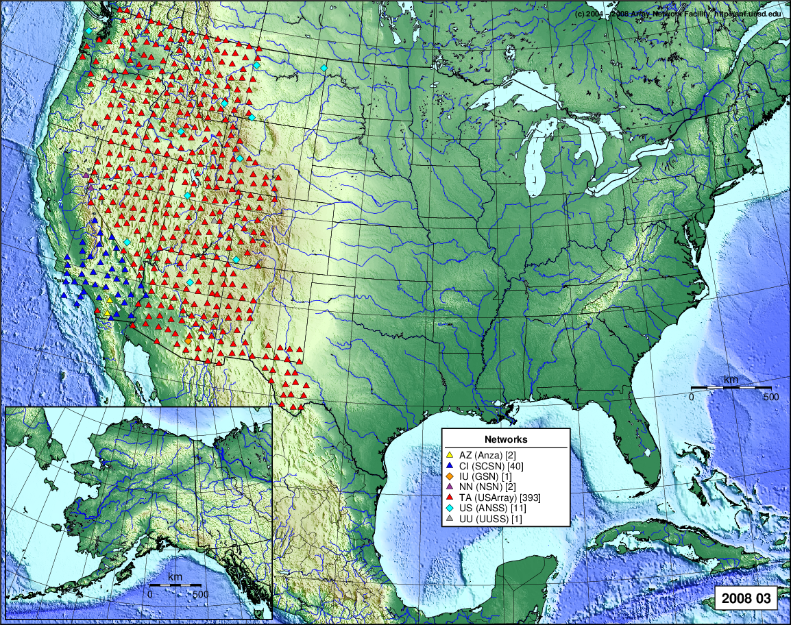
- 2008 March: Seismic [ cumulative | rolling ] Inframet [ cumulative | rolling ]
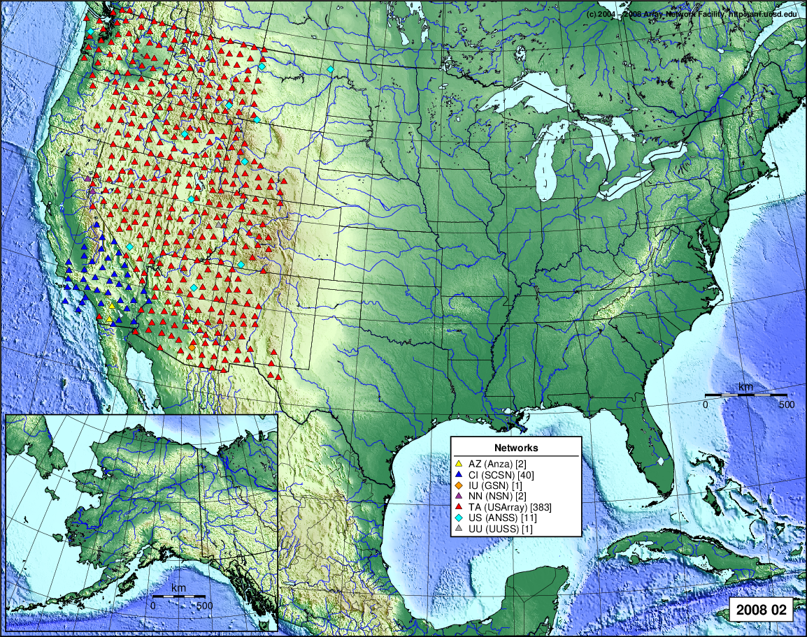
- 2008 February: Seismic [ cumulative | rolling ] Inframet [ cumulative | rolling ]
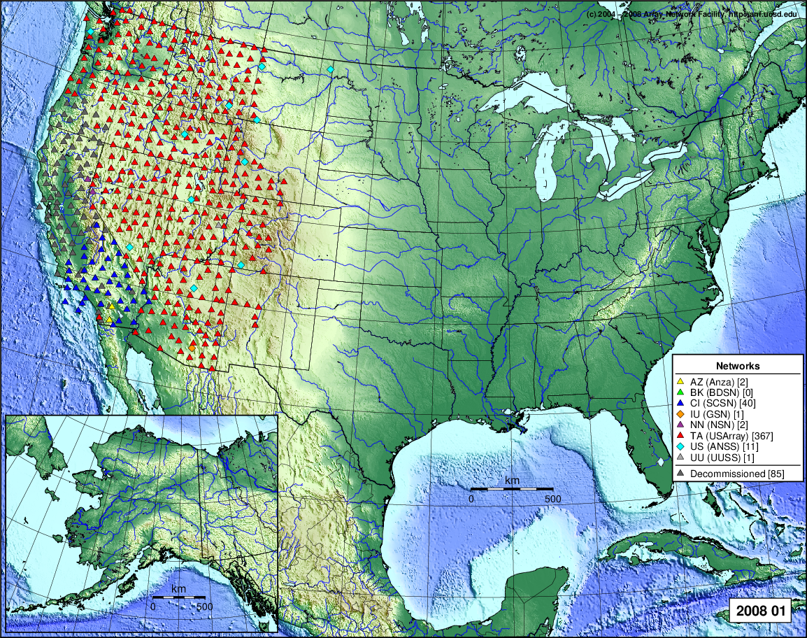
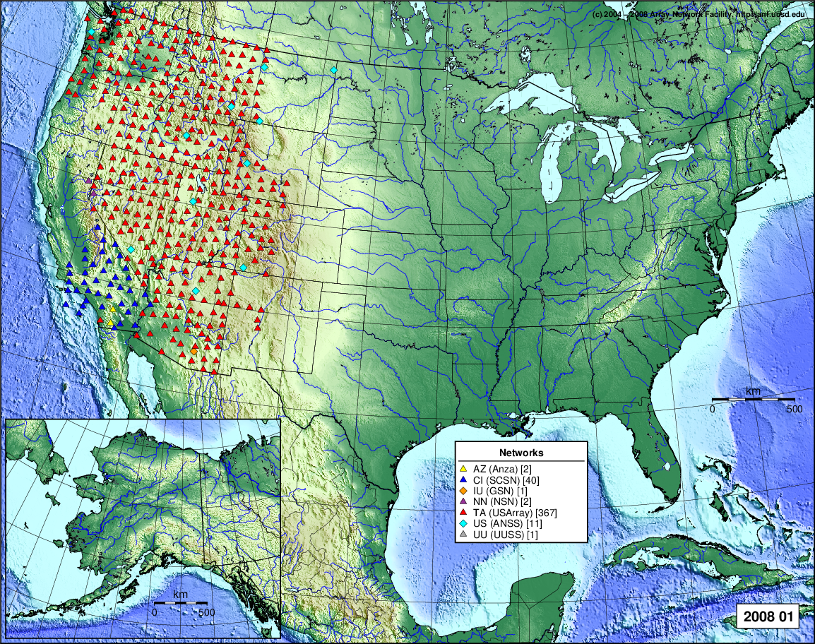
- 2008 January: Seismic [ cumulative | rolling ] Inframet [ cumulative | rolling ]
2007
- 2007 December: Seismic [ cumulative | rolling ]
- 2007 November: Seismic [ cumulative | rolling ]
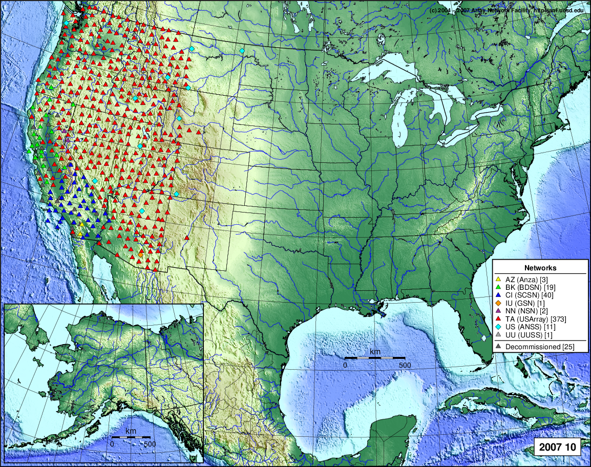
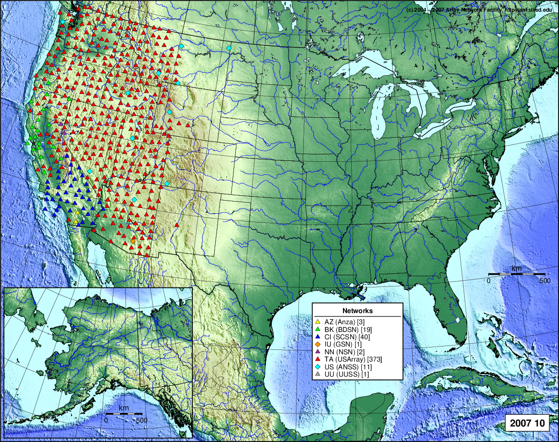
- 2007 October: Seismic [ cumulative | rolling ]
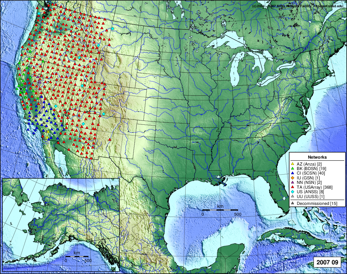
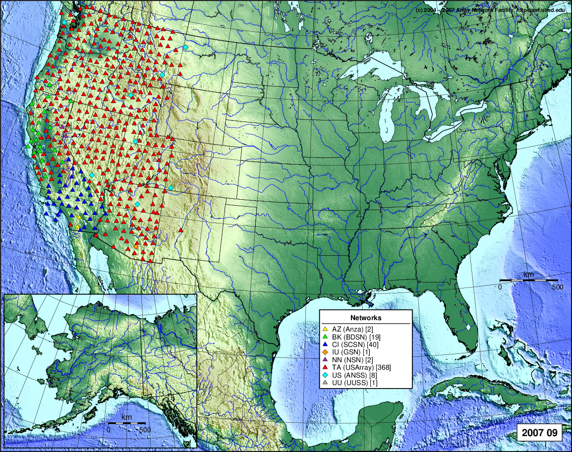
- 2007 September: Seismic [ cumulative | rolling ]
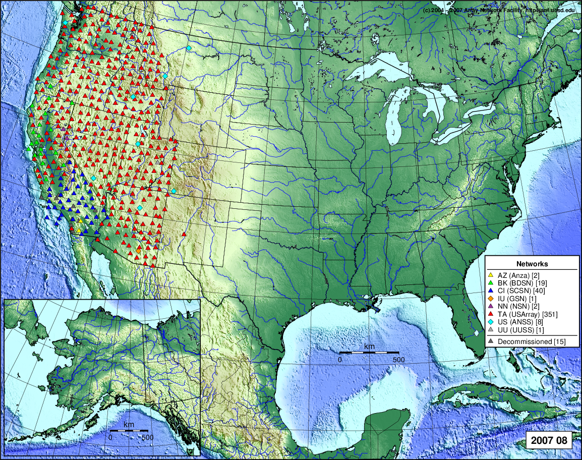
- 2007 August: Seismic [ cumulative | rolling ]
- 2007 July: Seismic [ cumulative | rolling ]
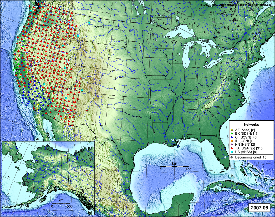
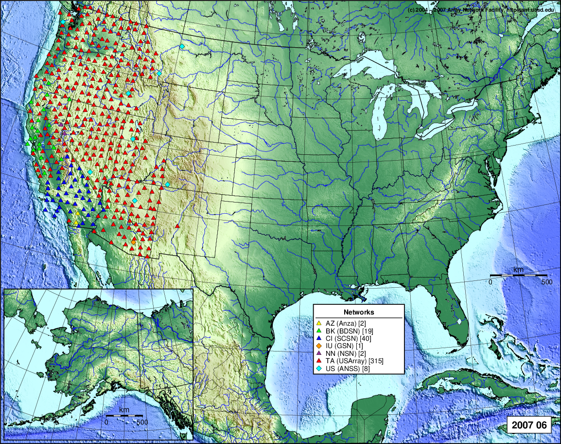
- 2007 June: Seismic [ cumulative | rolling ]
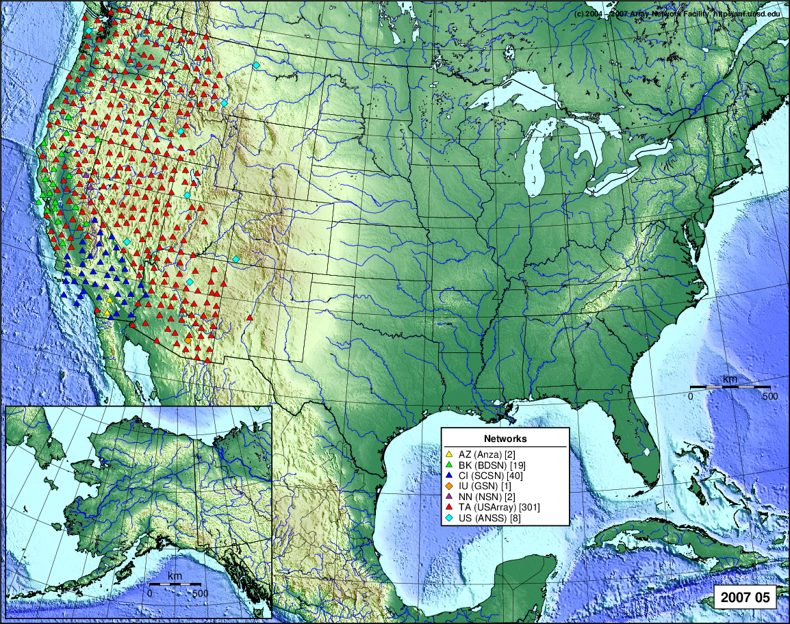
- 2007 May: Seismic [ cumulative | rolling ]
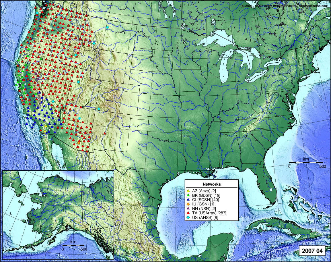
- 2007 April: Seismic [ cumulative | rolling ]
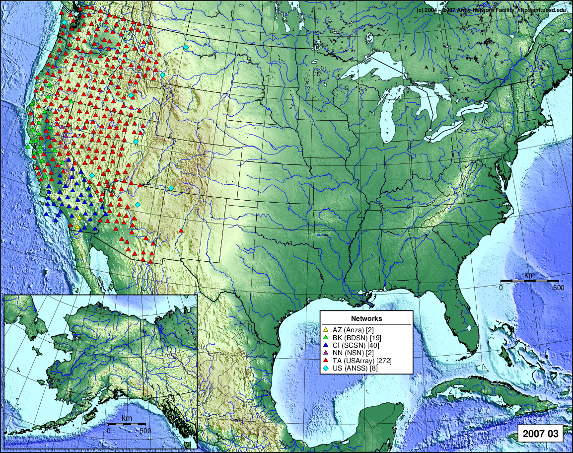
- 2007 March: Seismic [ cumulative | rolling ]
- 2007 February: Seismic [ cumulative | rolling ]
- 2007 January: Seismic [ cumulative | rolling ]
2006
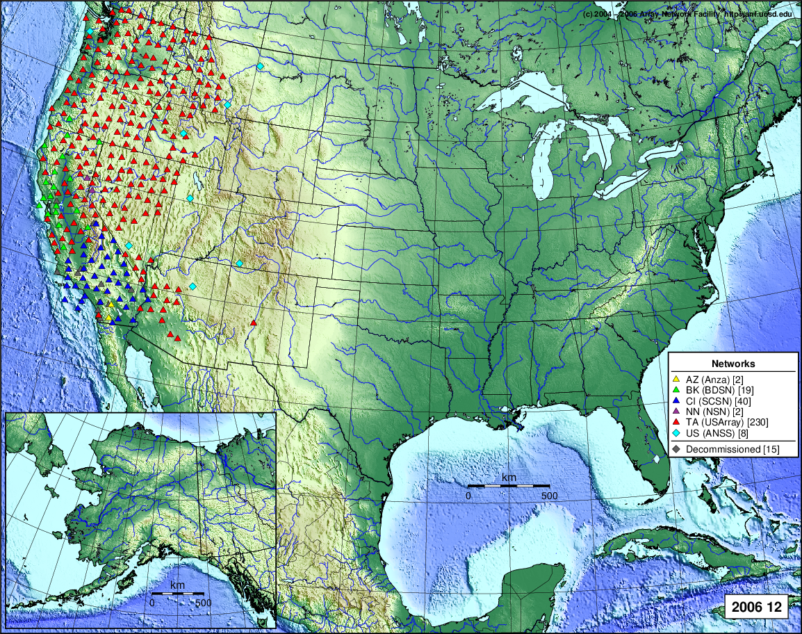
- 2006 December: Seismic [ cumulative | rolling ]
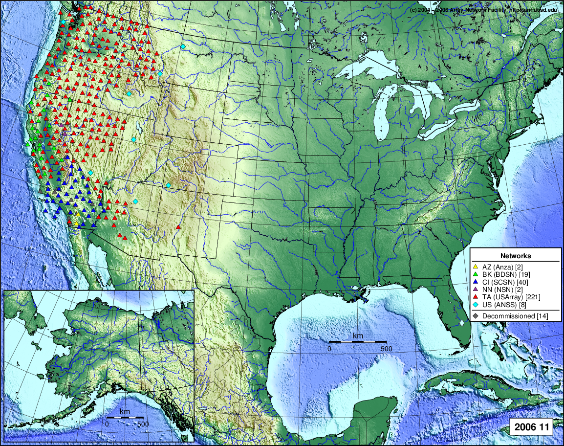
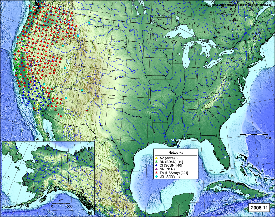
- 2006 November: Seismic [ cumulative | rolling ]
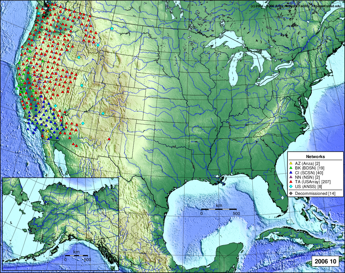
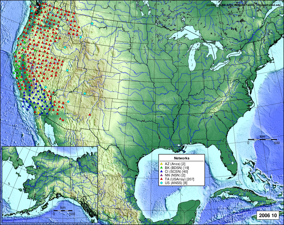
- 2006 October: Seismic [ cumulative | rolling ]
- 2006 September: Seismic [ cumulative | rolling ]
- 2006 August: Seismic [ cumulative | rolling ]
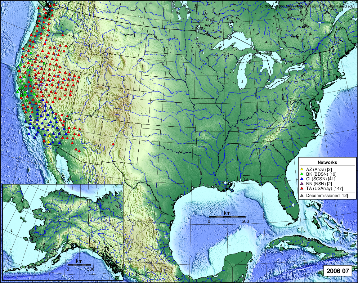
- 2006 July: Seismic [ cumulative | rolling ]
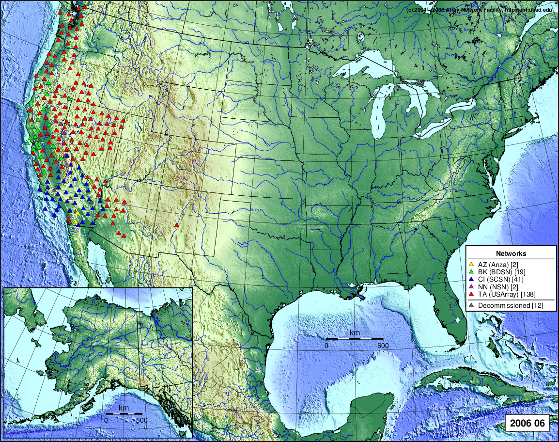
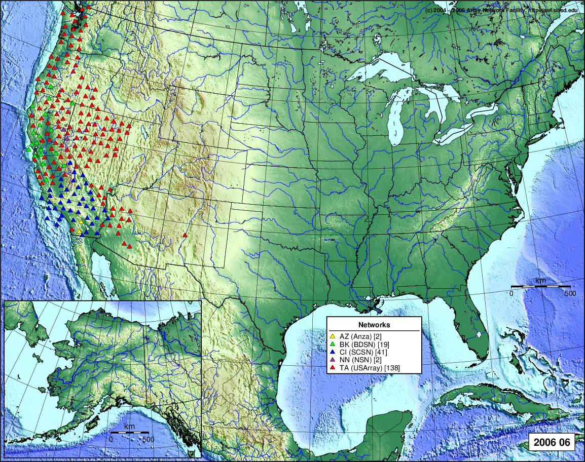
- 2006 June: Seismic [ cumulative | rolling ]
- 2006 May: Seismic [ cumulative | rolling ]
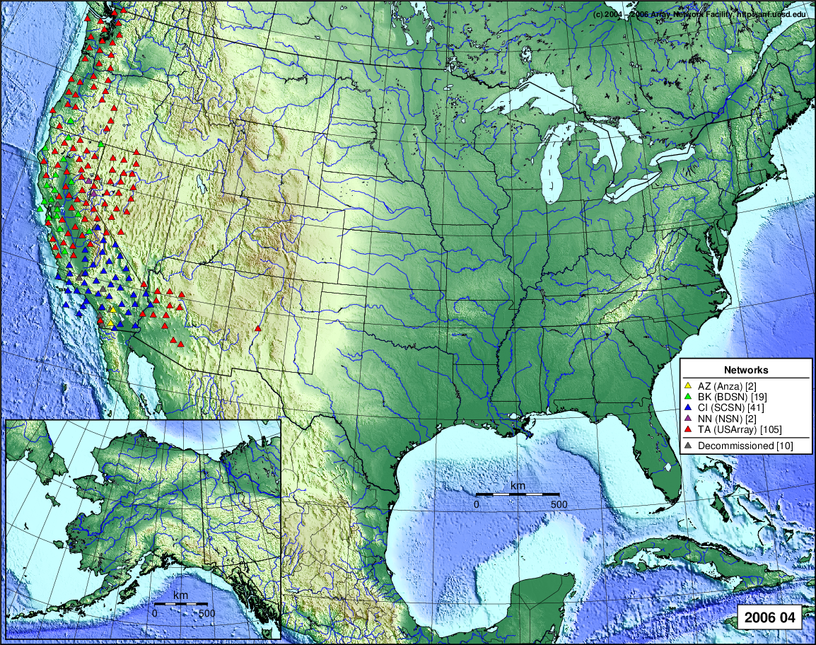
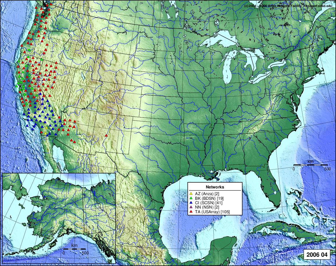
- 2006 April: Seismic [ cumulative | rolling ]
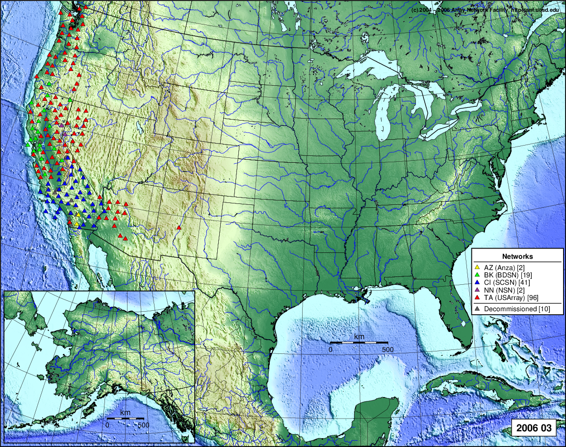
- 2006 March: Seismic [ cumulative | rolling ]
- 2006 February: Seismic [ cumulative | rolling ]
- 2006 January: Seismic [ cumulative | rolling ]
2005
- 2005 December: Seismic [ cumulative | rolling ]
- 2005 November: Seismic [ cumulative | rolling ]
- 2005 October: Seismic [ cumulative | rolling ]
- 2005 September: Seismic [ cumulative | rolling ]
- 2005 August: Seismic [ cumulative | rolling ]
- 2005 July: Seismic [ cumulative | rolling ]
- 2005 June: Seismic [ cumulative | rolling ]
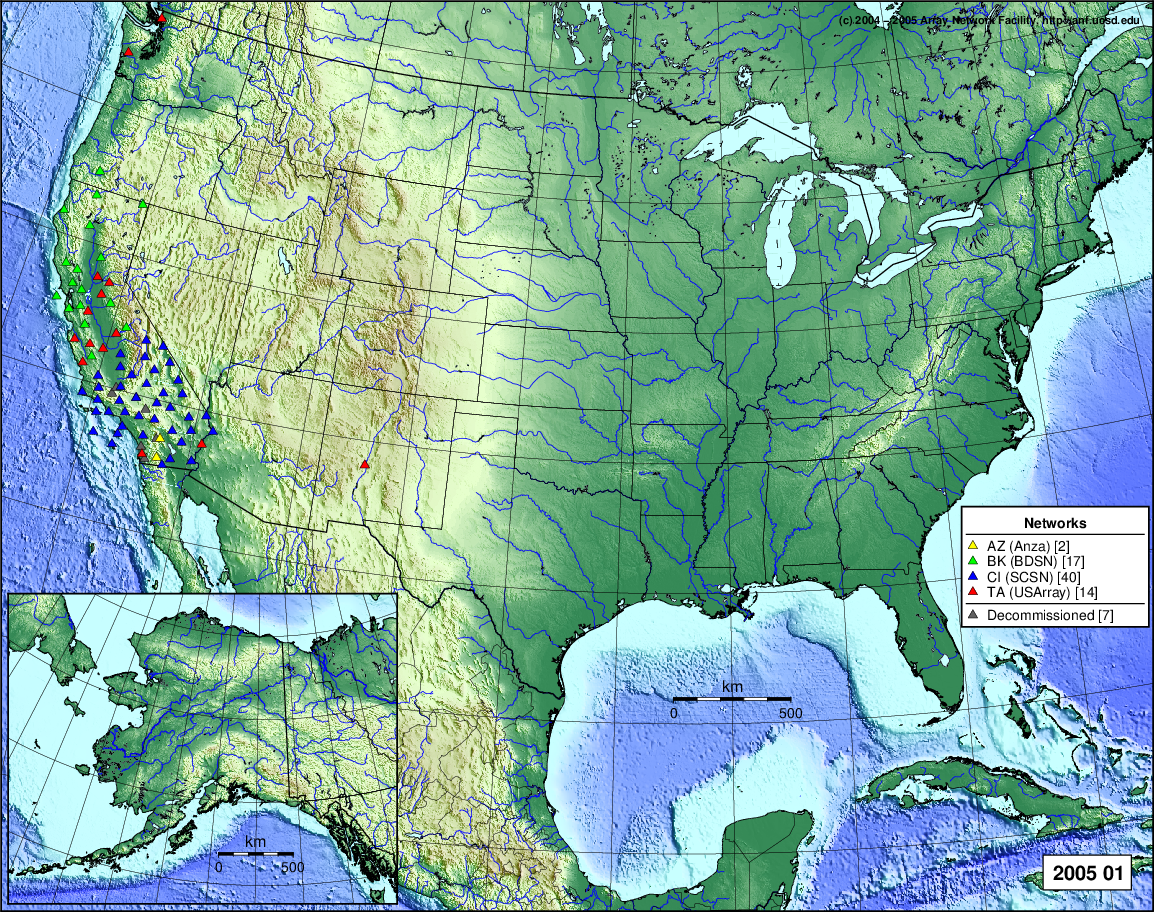
- 2005 May: Seismic [ cumulative | rolling ]
- 2005 April: Seismic [ cumulative | rolling ]
- 2005 March: Seismic [ cumulative | rolling ]
- 2005 February: Seismic [ cumulative | rolling ]
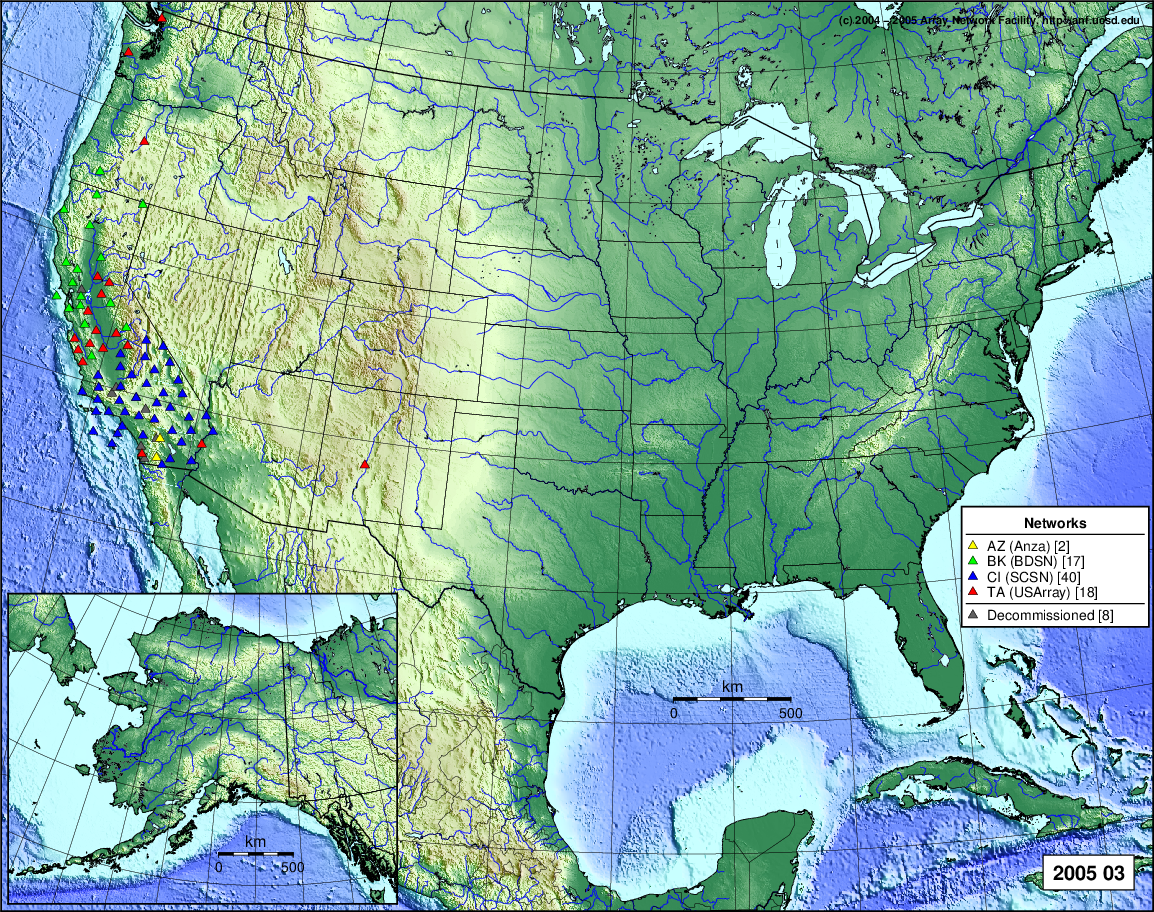
- 2005 January: Seismic [ cumulative | rolling ]
2004
- 2004 December: Seismic [ cumulative | rolling ]
- 2004 November: Seismic [ cumulative | rolling ]
- 2004 October: Seismic [ cumulative | rolling ]
- 2004 September: Seismic [ cumulative | rolling ]
- 2004 August: Seismic [ cumulative | rolling ]
- 2004 July: Seismic [ cumulative | rolling ]
- 2004 June: Seismic [ cumulative | rolling ]
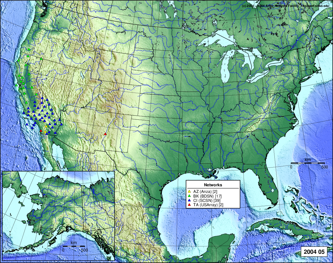
- 2004 May: Seismic [ cumulative | rolling ]
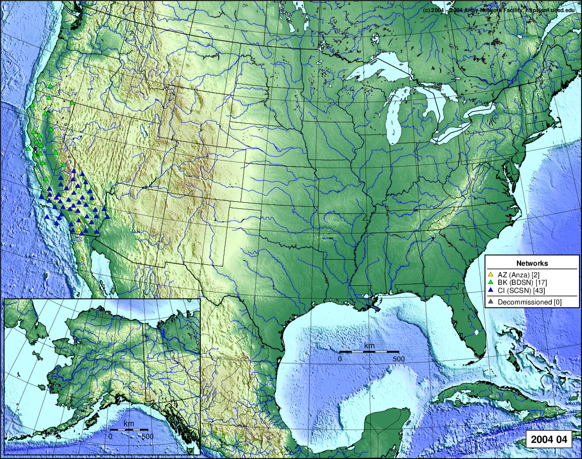
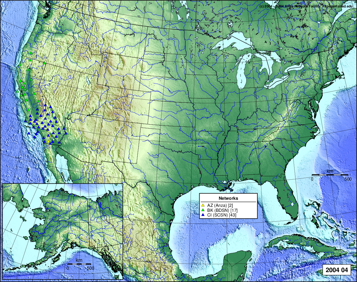
- 2004 April: Seismic [ cumulative | rolling ]