About The ANF
The Array Network Facility component of the EarthScope USArray project is charged with ensuring all the real–time data and metadata collected from the Transportable and Flexible Arrays (TA) is transmitted, checked for quality, archived, and accessible online for researchers and the general public. For the majority of the experiment, 2004 through mid-2020, analysts evaluated event detections and produced a fully reviewed bulletin of events which are available for download. We also have ensured near real–time delivery of the data and metadata to the permanent archive located at the IRIS Data Management Center (DMC) in Seattle, Washington.
Stations
The USArray project deployed a series of portable broadband seismic stations across the continental United States over the years 2004 – 2015. The stations were deployed for approximately two years with the deployment start in 2004 on the western side of the United States. The network migrated eastwards, reusing components from previously deployed stations. You can view a map of currently deployed stations or see the monthly temporal evolution of the network. All but a few stray stations were either adopted by other agencies or removed by 2018.
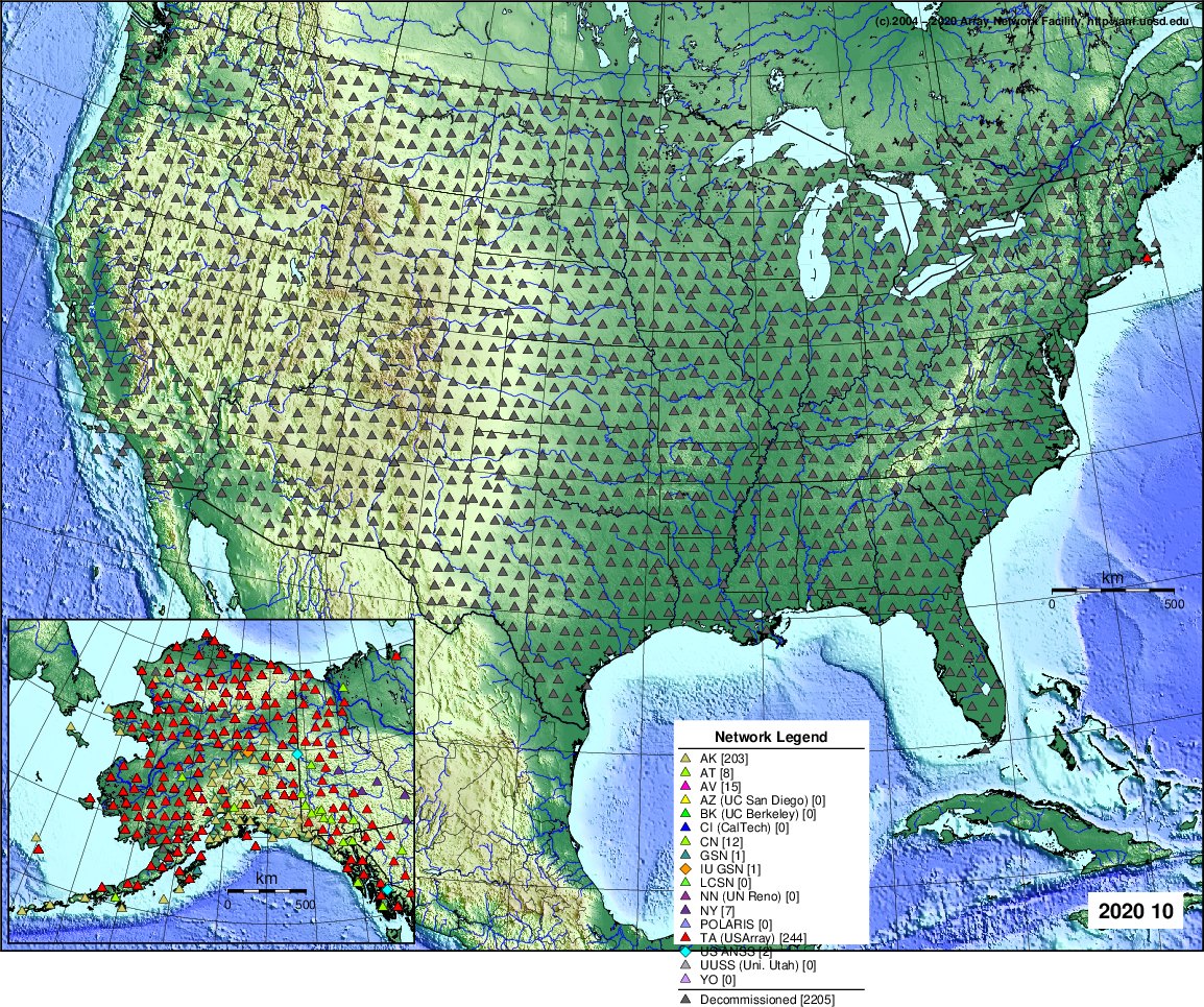
Figure 1a) Map showing all stations ever deployed or included in the USArray Transportable Array as of October 2020. All stations were not deployed at the same time. (Click image to see larger version)
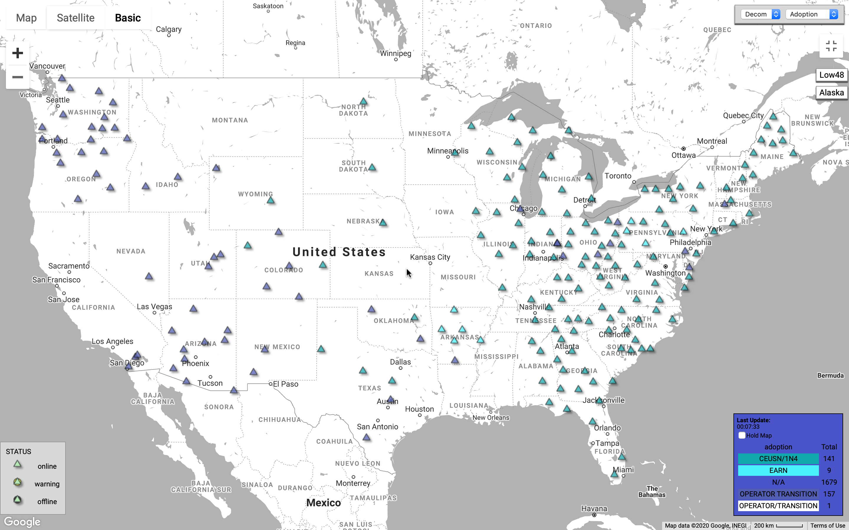
Figure 1b) Map showing adopted stations from the Alaska USArray Transportable Array as of November 2020. (Click image to see larger version)
Starting in 2014, stations were deployed in Alaska with operations planned to continue until 2020. You can view a map of the status of currently deployed stations. Many stations were “adopted” (equipment and operational transfer [Fig 2b below]) by the AEC (Alaska Earthquake Center) or the AVO (Alaska Volcano Observatory) but full removal of the remaining stations planned for 2020 has been delayed due to the COVID-19 pandemic travel and operations restrictions.
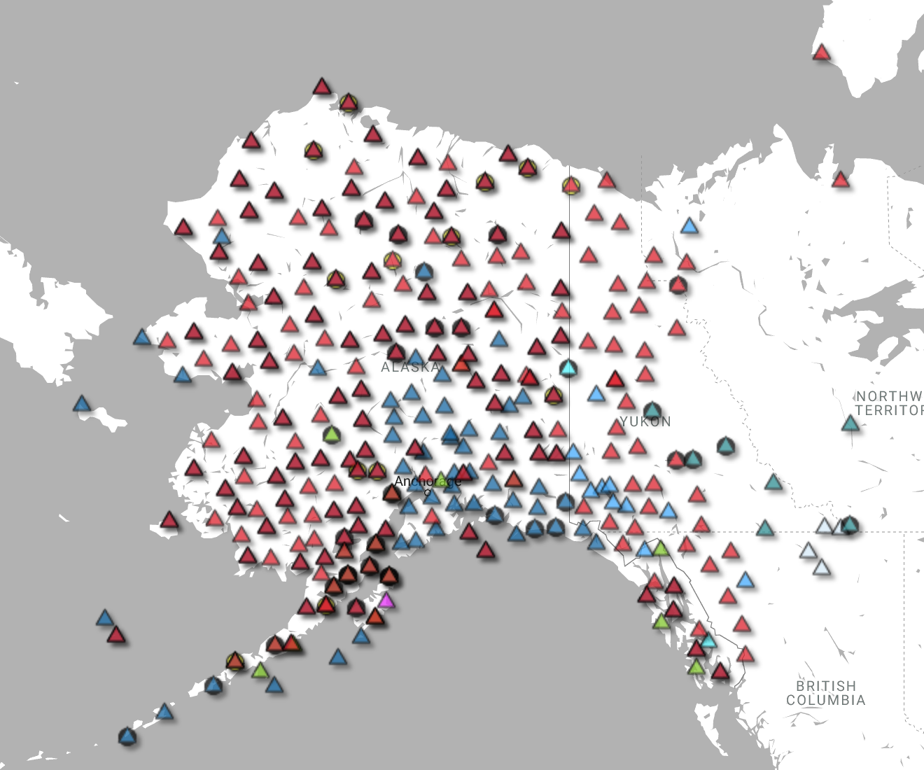
Figure 2a). Map showing full deployment of stations from the Alaska USArray Transportable Array as of November 2020. (Click image to see larger version)
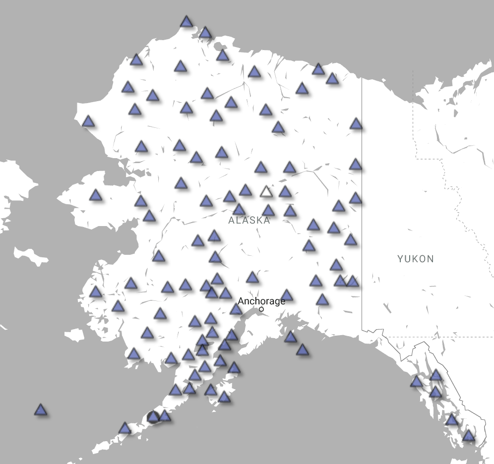
Figure 2b) Map showing adopted stations from the Alaska USArray Transportable Array as of November 2020. (Click image to see larger version)
Vault Design
The vault design evolved as the network moved eastwards. In the US Lower 48, it consisted of a broadband sensor (such as a Streckeisen STS-2 or a Nanometrics Trillium), assorted other instrumentation (such as infrasound and meterological sensors), a Quanterra Q330 digitizer, solar panels and backup battery to provide power, a bilge pump in case of water leaks, a Vault Interface Enclosure (VIE), foam insulation, and a communications link to transfer data in near time (such as a cellular phone connection or VSAT) to the ANF. Below is a schematic diagram of the vault design.
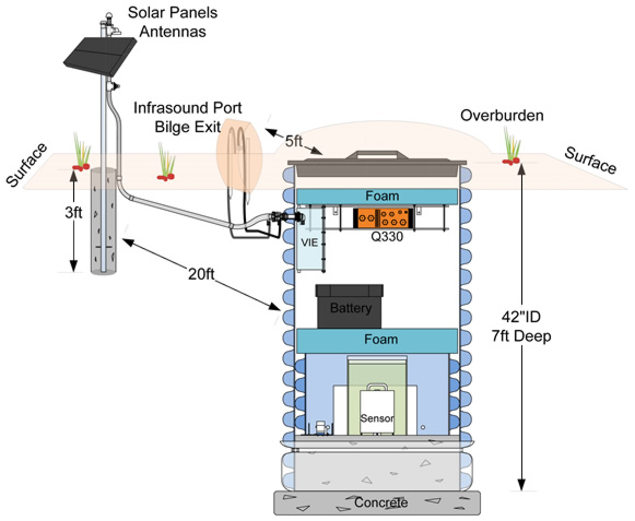
Figure 2. Schematic Transportable Array station vault cross
section, version 2.
(Click image to see larger version)

Figure 3. Schematic Alaska Transportable Array station vault cross
section.
(Click image to see larger version)
Online Diagnostic Tools
We have developed a series of online tools to help station engineers, analysts, researchers and the public determine the quality and status of the data returned from the deployed stations.
Subprojects
- Central and Eastern United States Network (CEUSN)
- The Cascadia subproject
- The Chile broadband network
- The Greenland Ice Sheet Monitoring Network (GLISN)
More information
Realtime archiving of the data is through the IRIS DMC
The ANF component of the USArray experiment is funded by the National Science Foundation.